

<< Our Photo Pages >> Chiaráin stones - Holed Stone in Ireland (Republic of) in Co. Galway
Submitted by KaiHofmann on Tuesday, 25 September 2012 Page Views: 3086
Neolithic and Bronze AgeSite Name: Chiaráin stonesCountry: Ireland (Republic of) County: Co. Galway Type: Holed Stone
Nearest Town: Kilronan
Latitude: 53.131944N Longitude: 9.684909W
Condition:
| 5 | Perfect |
| 4 | Almost Perfect |
| 3 | Reasonable but with some damage |
| 2 | Ruined but still recognisable as an ancient site |
| 1 | Pretty much destroyed, possibly visible as crop marks |
| 0 | No data. |
| -1 | Completely destroyed |
| 5 | Superb |
| 4 | Good |
| 3 | Ordinary |
| 2 | Not Good |
| 1 | Awful |
| 0 | No data. |
| 5 | Can be driven to, probably with disabled access |
| 4 | Short walk on a footpath |
| 3 | Requiring a bit more of a walk |
| 2 | A long walk |
| 1 | In the middle of nowhere, a nightmare to find |
| 0 | No data. |
| 5 | co-ordinates taken by GPS or official recorded co-ordinates |
| 4 | co-ordinates scaled from a detailed map |
| 3 | co-ordinates scaled from a bad map |
| 2 | co-ordinates of the nearest village |
| 1 | co-ordinates of the nearest town |
| 0 | no data |
Internal Links:
External Links:
")
Two standing stones, one with a sword/cross engraving and one holed stone with an ancient cross engraving in front and behind of the early christina church Teampall Chiaráin.
You may be viewing yesterday's version of this page. To see the most up to date information please register for a free account.
")
")
")
")
Do not use the above information on other web sites or publications without permission of the contributor.
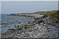
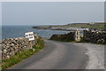
Nearby Images from Geograph Britain and Ireland:
©2021(licence)
©2008(licence)
©2021(licence)
©2014(licence)
©2014(licence)
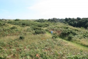
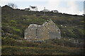
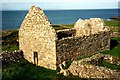
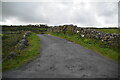
The above images may not be of the site on this page, they are loaded from Geograph.
Please Submit an Image of this site or go out and take one for us!
Click here to see more info for this site
Nearby sites
Click here to view sites on an interactive map of the areaKey: Red: member's photo, Blue: 3rd party photo, Yellow: other image, Green: no photo - please go there and take one, Grey: site destroyed
Download sites to:
KML (Google Earth)
GPX (GPS waypoints)
CSV (Garmin/Navman)
CSV (Excel)
To unlock full downloads you need to sign up as a Contributory Member. Otherwise downloads are limited to 50 sites.
Turn off the page maps and other distractions
Nearby sites listing. In the following links * = Image available
1.1km WSW 240° Dun Eochla* Stone Fort or Dun (L863098)
1.2km WSW 244° Dún Eochla wedge tomb* Wedge Tomb (L8620409853)
2.3km WSW 257° Oghil Wedge Tomb* Wedge Tomb (L84980988)
3.0km S 184° Dun Ducathair* Stone Fort or Dun (L870073)
4.6km W 268° Dún Aengus Inishmore Island Promontory Fort / Cliff Castle
4.8km W 270° Ogham stone at Kilmurvy* Standing Stone (Menhir) (L8241410412)
5.1km WNW 282° Clochan na Carraige* Ancient Village or Settlement (L823115)
5.6km W 263° Dun Aengus* Stone Fort or Dun (L817098)
6.1km W 279° Dun Eoghanachta* Stone Fort or Dun (L812114)
6.4km WNW 285° High Cross (Teampall Bhreacain)* Ancient Cross
6.4km WNW 284° Na Seacht dTeampaill* Early Christian Sculptured Stone
6.8km W 277° Clochan Chambered Cairn
8.7km SE 129° Dún Chonchúir* Stone Fort or Dun
13.5km SE 125° O'Brien stone fort Stone Fort or Dun
15.0km NNE 19° Oorid Standing Stones (L924245)
22.3km NNW 342° Lough Scannaimh* Crannog
22.8km ESE 120° Teergonean* Court Tomb (R068985)
26.4km E 93° Fanmore Midden* Ancient Village or Settlement
26.5km SE 139° St. Brigid's Holy Well* Holy Well or Sacred Spring (R044900)
28.8km E 86° Caherdoonerish Ring Fort* Stone Fort or Dun
31.2km E 99° Derrynavaha* Wedge Tomb (M181048)
31.6km ESE 114° Boghill Centre Modern Stone Circle etc
32.3km E 98° Faunarooska Wedge Tomb* Wedge Tomb
33.3km SE 136° Calluragh South* Burial Chamber or Dolmen (R101860)
33.9km ESE 106° Cahermacnaughten Stone Fort or Dun (M197001)
View more nearby sites and additional images


 We would like to know more about this location. Please feel free to add a brief description and any relevant information in your own language.
 Wir möchten mehr über diese Stätte erfahren. Bitte zögern Sie nicht, eine kurze Beschreibung und relevante Informationen in Deutsch hinzuzufügen.
 Nous aimerions en savoir encore un peu sur les lieux. S'il vous plaît n'hesitez pas à ajouter une courte description et tous les renseignements pertinents dans votre propre langue.
 Quisieramos informarnos un poco más de las lugares. No dude en añadir una breve descripción y otros datos relevantes en su propio idioma.