


<< Our Photo Pages >> Scartaglin - Stone Circle in Ireland (Republic of) in Co. Kerry
Submitted by frogcottage42 on Sunday, 14 July 2002 Page Views: 8627
Neolithic and Bronze AgeSite Name: ScartaglinCountry: Ireland (Republic of)
NOTE: This site is 11.142 km away from the location you searched for.
County: Co. Kerry Type: Stone Circle
Map Ref: R05050479
Discovery Map Number: D72
Latitude: 52.187219N Longitude: 9.38905W
Condition:
| 5 | Perfect |
| 4 | Almost Perfect |
| 3 | Reasonable but with some damage |
| 2 | Ruined but still recognisable as an ancient site |
| 1 | Pretty much destroyed, possibly visible as crop marks |
| 0 | No data. |
| -1 | Completely destroyed |
| 5 | Superb |
| 4 | Good |
| 3 | Ordinary |
| 2 | Not Good |
| 1 | Awful |
| 0 | No data. |
| 5 | Can be driven to, probably with disabled access |
| 4 | Short walk on a footpath |
| 3 | Requiring a bit more of a walk |
| 2 | A long walk |
| 1 | In the middle of nowhere, a nightmare to find |
| 0 | No data. |
| 5 | co-ordinates taken by GPS or official recorded co-ordinates |
| 4 | co-ordinates scaled from a detailed map |
| 3 | co-ordinates scaled from a bad map |
| 2 | co-ordinates of the nearest village |
| 1 | co-ordinates of the nearest town |
| 0 | no data |
Internal Links:
External Links:
I have visited· I would like to visit
frogcottage42 has visited here
")
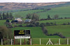
Situated in rough pasture on a plateau with open views to the South and South West there is no easy path to find it. GPS R 05053,04797 taken 22/5/2010
You may be viewing yesterday's version of this page. To see the most up to date information please register for a free account.
")
")
Do not use the above information on other web sites or publications without permission of the contributor.
Nearby Images from Flickr


The above images may not be of the site on this page, but were taken nearby. They are loaded from Flickr so please click on them for image credits.
Click here to see more info for this site
Nearby sites
Click here to view sites on an interactive map of the areaKey: Red: member's photo, Blue: 3rd party photo, Yellow: other image, Green: no photo - please go there and take one, Grey: site destroyed
Download sites to:
KML (Google Earth)
GPX (GPS waypoints)
CSV (Garmin/Navman)
CSV (Excel)
To unlock full downloads you need to sign up as a Contributory Member. Otherwise downloads are limited to 50 sites.
Turn off the page maps and other distractions
Nearby sites listing. In the following links * = Image available
4.7km SSE 149° Knockrower West Stone Row / Alignment
13.5km SE 137° Scrahanagullaun Stone Row / Alignment
13.9km E 94° Glenreagh* Stone Circle (R189035)
14.3km NE 47° Cloghvoula* Stone Row / Alignment (R158143)
14.8km NE 55° Knockaclarig* Stone Row / Alignment (R174130)
14.9km SSW 204° Park Standing Stone * Standing Stone (Menhir) (V98729131)
15.0km S 190° Ardaneanig Row* Stone Row / Alignment (W02139003)
15.1km SSW 199° Lissyviggeen* Stone Circle (V998906)
15.1km SSW 200° Lissyviggeen Standing Stones (V997906)
17.6km E 86° Knocknanagh E Stone Row / Alignment (R227057)
18.7km SSE 151° Cathair Crobh Dearg* Stone Fort or Dun (W1386388309)
18.7km SW 227° Fossa Stone * Standing Stone (Menhir) (V91169216)
18.8km N 3° Feavautia Stone Row / Alignment
20.0km SE 143° Awnaskirtawn Standing Stone* Standing Stone (Menhir) (W1686788620)
20.1km NE 37° Tooreenglanahee Stone Row / Alignment (R174207)
21.9km SW 230° Coomagort ogham stones* Standing Stones
22.6km SE 133° Gortavehy West Standing Stone* Standing Stone (Menhir) (W2119488946)
24.2km SE 132° Kippagh Row* Stone Row / Alignment
24.8km S 181° Derrybanane* Wedge Tomb (W0411580006)
25.1km SE 130° Kilmeedy W* Stone Circle (W23888814)
25.3km SE 130° Unidentified (W242882)* Standing Stone (Menhir) (W2423088228)
25.4km SE 129° Kilmeedy - eastern stone circle* Stone Circle
27.0km SE 134° Comeenatrush Lake Log Boat* Ancient Village or Settlement
27.1km SSW 208° Gertroe Stone Circle (V920810)
27.6km SSE 151° Slievereagh standing stone* Standing Stone (Menhir)
View more nearby sites and additional images


 We would like to know more about this location. Please feel free to add a brief description and any relevant information in your own language.
 Wir möchten mehr über diese Stätte erfahren. Bitte zögern Sie nicht, eine kurze Beschreibung und relevante Informationen in Deutsch hinzuzufügen.
 Nous aimerions en savoir encore un peu sur les lieux. S'il vous plaît n'hesitez pas à ajouter une courte description et tous les renseignements pertinents dans votre propre langue.
 Quisieramos informarnos un poco más de las lugares. No dude en añadir una breve descripción y otros datos relevantes en su propio idioma.