


<< Our Photo Pages >> Maughanasilly - Stone Row / Alignment in Ireland (Republic of) in Co. Cork
Submitted by Ebor on Tuesday, 27 December 2016 Page Views: 7322
Neolithic and Bronze AgeSite Name: Maughanasilly Alternative Name: Ahil MoreCountry: Ireland (Republic of) County: Co. Cork Type: Stone Row / Alignment
Nearest Town: Bantry Nearest Village: Maughanasilly
Map Ref: W0431958413
Discovery Map Number: D85
Latitude: 51.770422N Longitude: 9.38681W
Condition:
| 5 | Perfect |
| 4 | Almost Perfect |
| 3 | Reasonable but with some damage |
| 2 | Ruined but still recognisable as an ancient site |
| 1 | Pretty much destroyed, possibly visible as crop marks |
| 0 | No data. |
| -1 | Completely destroyed |
| 5 | Superb |
| 4 | Good |
| 3 | Ordinary |
| 2 | Not Good |
| 1 | Awful |
| 0 | No data. |
| 5 | Can be driven to, probably with disabled access |
| 4 | Short walk on a footpath |
| 3 | Requiring a bit more of a walk |
| 2 | A long walk |
| 1 | In the middle of nowhere, a nightmare to find |
| 0 | No data. |
| 5 | co-ordinates taken by GPS or official recorded co-ordinates |
| 4 | co-ordinates scaled from a detailed map |
| 3 | co-ordinates scaled from a bad map |
| 2 | co-ordinates of the nearest village |
| 1 | co-ordinates of the nearest town |
| 0 | no data |
Internal Links:
External Links:
I have visited· I would like to visit
RantonUFO rrmoser would like to visit
mark_a has visited here
")
Page originally by Tom Bullock
Note: Winter Solstice sunset alignment at Maughanasilly Stone Row Co.Cork.
You may be viewing yesterday's version of this page. To see the most up to date information please register for a free account.
")
")
")
Do not use the above information on other web sites or publications without permission of the contributor.
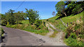
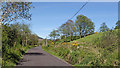
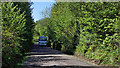
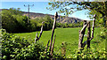
Nearby Images from Geograph Britain and Ireland:
©2018(licence)
©2018(licence)
©2018(licence)
©2018(licence)
©2011(licence)
The above images may not be of the site on this page, they are loaded from Geograph.
Please Submit an Image of this site or go out and take one for us!
Click here to see more info for this site
Nearby sites
Click here to view sites on an interactive map of the areaKey: Red: member's photo, Blue: 3rd party photo, Yellow: other image, Green: no photo - please go there and take one, Grey: site destroyed
Download sites to:
KML (Google Earth)
GPX (GPS waypoints)
CSV (Garmin/Navman)
CSV (Excel)
To unlock full downloads you need to sign up as a Contributory Member. Otherwise downloads are limited to 50 sites.
Turn off the page maps and other distractions
Nearby sites listing. In the following links * = Image available
1.1km NNE 13° Illane.* Stone Circle (W04595951)
1.2km SSW 202° Ahil More standing stone* Standing Stone (Menhir)
3.0km SSE 158° Kealkil* Stone Circle (W0538155588)
3.2km SSE 165° Breeney More* Stone Circle (W05085526)
3.4km SW 223° Trawnamaddree Stone Row / Alignment (W01975597)
3.8km N 5° Derrynafinchin* Stone Circle (W04756218)
4.1km ESE 107° Cahermuckee* Standing Stones (W08245714)
4.7km NE 52° Cappaboy Beg NW* Stone Circle (W0811961229)
4.8km SSE 168° Derryarkane Stone Circle (W05255374)
4.8km ESE 121° Maughanaclea Centre* Stone Circle (W08385588)
4.8km SE 143° Ardrah Stone Row* Stone Row / Alignment (W0710854517)
4.8km ESE 122° Maughanaclea* Stone Circle (W08355580)
5.1km ESE 114° Maughanclea SW* Stone Circle (W08945630)
5.2km S 189° Cappanaboul* Stone Circle (W0343753265)
5.4km ENE 69° Cappaboy Beg Stone Row / Alignment (W0944060275)
5.5km SE 131° Ardrah wedge tomb* Wedge Tomb
5.5km ENE 69° Cappaboy Beg* Stone Circle (W09556031)
5.6km SW 224° Dromkeal* Stone Circle (W00315445)
5.6km WSW 249° Mill Little Stone Row / Alignment (V98985653)
5.7km WSW 249° Mill Little* Stone Circle (V989565)
5.8km ENE 69° Cappaboy Beg SE* Stone Circle (W09786037)
5.8km SSW 207° Crossoge wedge tomb* Wedge Tomb
5.9km W 276° Cooleenlemane rock scribing* Cave or Rock Shelter
6.0km SE 131° Gortnacowly four poster* Standing Stones
6.4km ESE 106° Maughanclea NE* Stone Circle (W104565)
View more nearby sites and additional images


 We would like to know more about this location. Please feel free to add a brief description and any relevant information in your own language.
 Wir möchten mehr über diese Stätte erfahren. Bitte zögern Sie nicht, eine kurze Beschreibung und relevante Informationen in Deutsch hinzuzufügen.
 Nous aimerions en savoir encore un peu sur les lieux. S'il vous plaît n'hesitez pas à ajouter une courte description et tous les renseignements pertinents dans votre propre langue.
 Quisieramos informarnos un poco más de las lugares. No dude en añadir una breve descripción y otros datos relevantes en su propio idioma.