<< Our Photo Pages >> Castro de Leceia - Castro or Chafurdão in Portugal in Lisboa
Submitted by Bak_teria on Friday, 13 November 2015 Page Views: 3449
Iron Age and Later PrehistorySite Name: Castro de Leceia Alternative Name: Povoado Pré-Histórico de Leceia, Estação Eneolítica de Leceia, Estação Arqueológica de LeceiaCountry: Portugal
NOTE: This site is 4.235 km away from the location you searched for.
Distrito: Lisboa Type: Castro or Chafurdão
Nearest Town: Barcarena Nearest Village: Leceia
Latitude: 38.728087N Longitude: 9.281686W
Condition:
| 5 | Perfect |
| 4 | Almost Perfect |
| 3 | Reasonable but with some damage |
| 2 | Ruined but still recognisable as an ancient site |
| 1 | Pretty much destroyed, possibly visible as crop marks |
| 0 | No data. |
| -1 | Completely destroyed |
| 5 | Superb |
| 4 | Good |
| 3 | Ordinary |
| 2 | Not Good |
| 1 | Awful |
| 0 | No data. |
| 5 | Can be driven to, probably with disabled access |
| 4 | Short walk on a footpath |
| 3 | Requiring a bit more of a walk |
| 2 | A long walk |
| 1 | In the middle of nowhere, a nightmare to find |
| 0 | No data. |
| 5 | co-ordinates taken by GPS or official recorded co-ordinates |
| 4 | co-ordinates scaled from a detailed map |
| 3 | co-ordinates scaled from a bad map |
| 2 | co-ordinates of the nearest village |
| 1 | co-ordinates of the nearest town |
| 0 | no data |
Internal Links:
External Links:
I have visited· I would like to visit
Bak_teria visited on 14th Nov 2015 - their rating: Cond: 3 Amb: 4 Access: 5
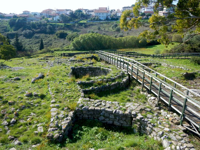
It was discovered and excavated in 1878 by Carlos Ribeiro, in 1914 by J. Leite de Vasconcellos, in 1920 by Álvaro de Bree, but was target of a new rushed intervention later at the early eighties due to the warning of a possible destruction. This archaeological interventions were made by Joaquina Fontes, João Cardoso, Carlos Tavares da Silva e Joaquina Soares and its archaeological study remain active until today. With the great help of the Municipality of Oeiras it has already been excavated 11.000 m2 of area and it corresponds of one of the most vast and important archaeological explorations of a prehistoric site known in Portugal and Spain. It was originally classified as IIP – Imóvel de Interesse Público (Estate of Public Interest) in the 25th of October, 1963 and nowadays is also considered a Special Protection Zone. You can rent a car in Portugal to visit this and the many other fascinating ancient sites and museums to be found there.
About the architecture
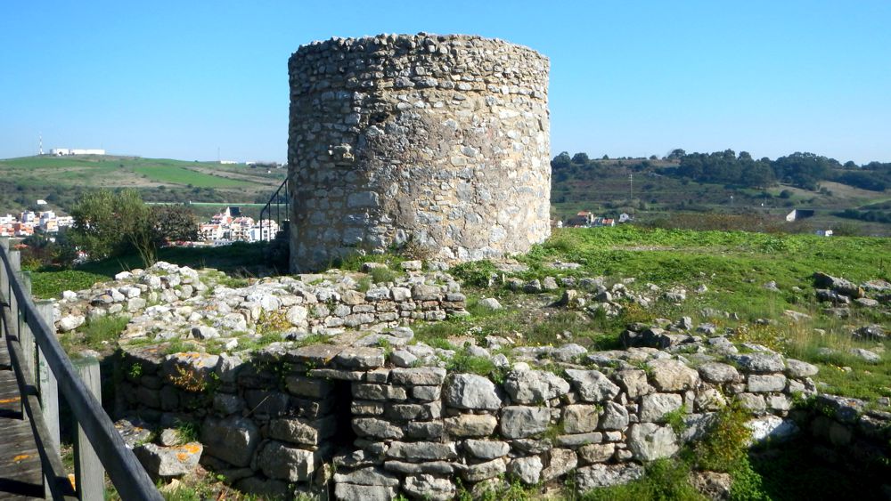
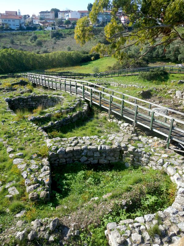
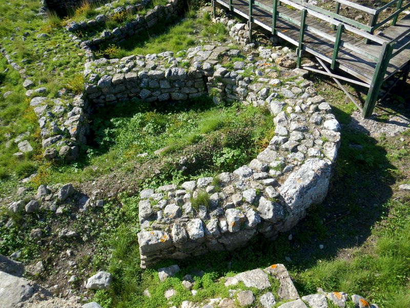
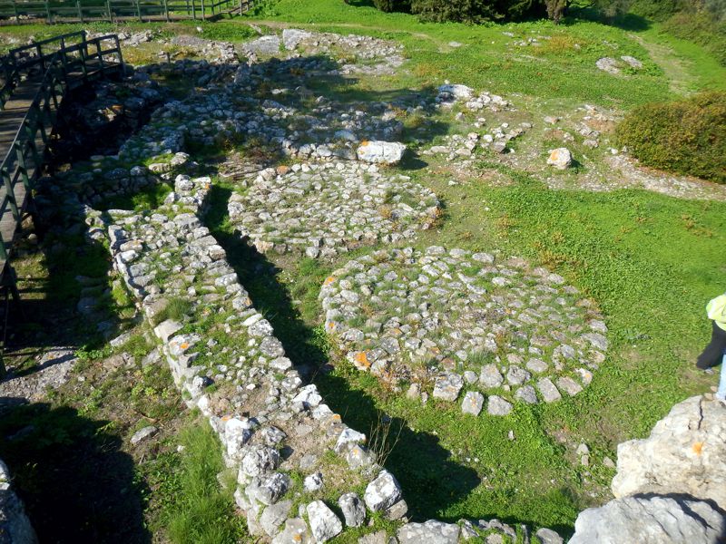
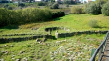
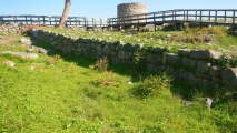
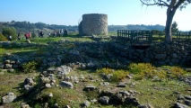
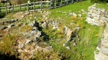
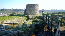
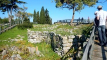
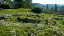
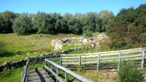
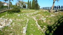
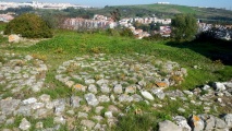
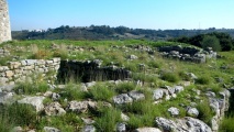
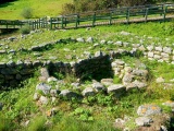
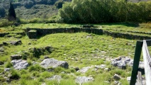
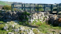
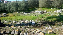
The defensive device is constituted by three arcuate walls, all of them provided with entrances articulated by winding paths crossing the whole defensive space. From the outside of the walls there are hollow and wide bastions of semicircular plant, which would be secondarily used as houses or warehouses. There is a hut of the bell beaker period built on the outside of the village. The fortification denounces only one construction phase, showing a pre-conception of the space that would be occupied in the early Chalcolithic period. With evidence of numerous arrangements and further reinforcements it declined 200 years later.
About the occupancy and the artifacts
There are various findings that corroborate with various times of occupancy. The use of this space goes from the final Neolithic period to the middle and final Chalcolithic periods, represented by the bell beaker ceramics, occupying the second half of the III millennium BC. With about 1000 years of use it has lived big remodelations in its defensive system, made of defensive walls and bastions organized in three lines, at about 2000 BC (in the Copper age first phase) and since then leading to its decline until the full Chalcolithic period. The cattle breeding is well documented by the finding of sheep, cow, goat and pig bones. The agriculture economy is proven by the finding of millstones and sickle elements in flint and hoes made of stone. The finding of copper fish hooks suggests the use of fishing lines.
About the location
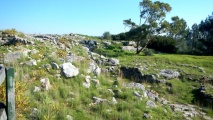
The building of this settlement was made in the usual defensive conditions of any known castro, located in a high place, taking advantage of a leaning rocky spur over the valley of the river of Barcarena, which dominated the landscape from over the top of the hill. It reveals the necessity of protecting the security of people and goods, probably arising from the accumulation of agricultural surplus production, result of a well established economy based in agricultural and cattle breeding. It is also known that people eated hunted animals like deers, wild boars, rabbits, and sometimes bears, horses and aurochs (extinct breed of wild bulls). Were also found the remains of molluscs probably catch by the coast line and also of copper fish hooks.
About the abandonment
A lot of theories can be made but the most probable reason for the decline of this settlement should be the accumulation of agricultural surplus production, probably desired by other communities and could be also the increasing complexity of the new societies, given the coexistence with other new emerging cultures in the region, that probably could have created social instability. This could be shown by the built improvements in the defensive structure over the centuries of its existence. The total abandonment in the final Chalcolithic is a more difficult problem to resolve. It can be pointed to a reorganization of the model of society in that period, with the demographic redistribution of the population who were probably leaving the high and fortified areas to live in other communities in the open areas.
About the access
Due to its fragility it's only possible to visit the site by appointment, there is no direct access to it. The municipality of Oeiras organizes guided visits but only to groups of 12 or more. More information here (info in portuguese). To know a little bit more about the story and visit the artifacts collection of the whole excavations of this site in 20 years of archaeological surveys, visit also the Fábrica da Pólvora exhibition.
Links and information sources (all texts written in Portuguese):
- DGPC
- Portal do Arqueólogo
You may be viewing yesterday's version of this page. To see the most up to date information please register for a free account.
These are just the first 25 photos of Castro de Leceia. If you log in with a free user account you will be able to see our entire collection.
Do not use the above information on other web sites or publications without permission of the contributor.
Click here to see more info for this site
Nearby sites
Click here to view sites on an interactive map of the areaKey: Red: member's photo, Blue: 3rd party photo, Yellow: other image, Green: no photo - please go there and take one, Grey: site destroyed
Download sites to:
KML (Google Earth)
GPX (GPS waypoints)
CSV (Garmin/Navman)
CSV (Excel)
To unlock full downloads you need to sign up as a Contributory Member. Otherwise downloads are limited to 50 sites.
Turn off the page maps and other distractions
Nearby sites listing. In the following links * = Image available
1.5km N 350° Fábrica da Pólvora de Barcarena* Museum
4.7km NNE 18° Anta do Monte Abraão* Burial Chamber or Dolmen
4.8km NNE 15° Anta da Estria* Burial Chamber or Dolmen
5.1km N 355° Anta da Agualva* Burial Chamber or Dolmen
5.2km NNE 15° Anta do Senhor da Serra* Burial Chamber or Dolmen
6.0km NNE 33° Necrópole de Carenque* Rock Cut Tomb
7.3km ESE 118° Museu Nacional de Arqueologia* Museum
8.6km WSW 254° Grutas Artificiais de Alapraia* Rock Cut Tomb
10.3km NNE 32° Anta das Pedras Grandes* Burial Chamber or Dolmen
11.6km E 98° Museo Geológico - Lisboa* Museum
11.7km NW 313° Sintra Menhir* Standing Stone (Menhir)
11.7km NW 308° Castelo dos Mouros, Sintra* Cave or Rock Shelter
12.5km WSW 256° Grutas do Poço Velho Cave or Rock Shelter
14.8km WNW 290° Tholos do Monge* Chambered Tomb
15.8km W 269° Villa Romana Casais Velhos Ancient Village or Settlement
16.8km WNW 289° Anta de Adrenunes* Burial Chamber or Dolmen
17.1km ENE 74° Humming Stone Lisbon (Summstein) Modern Stone Circle etc
17.6km NNE 23° Anta do Alto da Toupeira* Burial Chamber or Dolmen
17.8km NNE 22° Gruta de Salemas* Cave or Rock Shelter
18.4km NNE 18° Anta de Carcavelos* Burial Chamber or Dolmen
19.6km NNE 30° Anta de Casaínhos* Burial Chamber or Dolmen
19.6km NNW 337° Conjunto Megalítico de Barreira* Standing Stones
24.6km NNE 15° Tholos da Tituaria* Chambered Tomb
25.2km NE 43° Dólmen de Monte Serves* Burial Chamber or Dolmen
34.9km ESE 121° Grutas da Quinta do Anjo* Rock Cut Tomb
View more nearby sites and additional images





 We would like to know more about this location. Please feel free to add a brief description and any relevant information in your own language.
 Wir möchten mehr über diese Stätte erfahren. Bitte zögern Sie nicht, eine kurze Beschreibung und relevante Informationen in Deutsch hinzuzufügen.
 Nous aimerions en savoir encore un peu sur les lieux. S'il vous plaît n'hesitez pas à ajouter une courte description et tous les renseignements pertinents dans votre propre langue.
 Quisieramos informarnos un poco más de las lugares. No dude en añadir una breve descripción y otros datos relevantes en su propio idioma.