


<< Text Pages >> Castro de Lourido - Castro or Chafurdão in Spain in Galicia
Submitted by TheCaptain on Wednesday, 08 September 2010 Page Views: 1500
Iron Age and Later PrehistorySite Name: Castro de LouridoCountry: Spain Region: Galicia Type: Castro or Chafurdão
Nearest Town: La Coruña
Latitude: 43.084095N Longitude: 9.223232W
Condition:
| 5 | Perfect |
| 4 | Almost Perfect |
| 3 | Reasonable but with some damage |
| 2 | Ruined but still recognisable as an ancient site |
| 1 | Pretty much destroyed, possibly visible as crop marks |
| 0 | No data. |
| -1 | Completely destroyed |
| 5 | Superb |
| 4 | Good |
| 3 | Ordinary |
| 2 | Not Good |
| 1 | Awful |
| 0 | No data. |
| 5 | Can be driven to, probably with disabled access |
| 4 | Short walk on a footpath |
| 3 | Requiring a bit more of a walk |
| 2 | A long walk |
| 1 | In the middle of nowhere, a nightmare to find |
| 0 | No data. |
| 5 | co-ordinates taken by GPS or official recorded co-ordinates |
| 4 | co-ordinates scaled from a detailed map |
| 3 | co-ordinates scaled from a bad map |
| 2 | co-ordinates of the nearest village |
| 1 | co-ordinates of the nearest town |
| 0 | no data |
Be the first person to rate this site - see the 'Contribute!' box in the right hand menu.
Internal Links:
External Links:
Castro in Galicia
Castro de Lourido is a Castro in the community of Lousame, Province of La Coruña, region of Galicia
You may be viewing yesterday's version of this page. To see the most up to date information please register for a free account.
Do not use the above information on other web sites or publications without permission of the contributor.
Nearby Images from Flickr
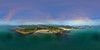
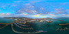
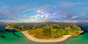
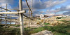
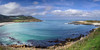
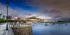
The above images may not be of the site on this page, but were taken nearby. They are loaded from Flickr so please click on them for image credits.
Click here to see more info for this site
Nearby sites
Click here to view sites on an interactive map of the areaKey: Red: member's photo, Blue: 3rd party photo, Yellow: other image, Green: no photo - please go there and take one, Grey: site destroyed
Download sites to:
KML (Google Earth)
GPX (GPS waypoints)
CSV (Garmin/Navman)
CSV (Excel)
To unlock full downloads you need to sign up as a Contributory Member. Otherwise downloads are limited to 50 sites.
Turn off the page maps and other distractions
Nearby sites listing. In the following links * = Image available
1.5km SE 127° O Castro (Serantes) Castro or Chafurdão
4.1km SSW 197° Castro de O Castriño (Morquintián) Castro or Chafurdão
7.1km NNE 33° Castro de Camariñas Castro or Chafurdão
7.3km SSW 195° Castro de Monte do Vao Castro or Chafurdão
7.4km NNE 26° Castro de Mourín Castro or Chafurdão
9.8km SSE 165° Mámoa de Pedras Negras Burial Chamber or Dolmen
10.3km E 100° Petróglifo de Boallo* Rock Art
10.7km ENE 61° Castro do Croado Castro or Chafurdão
11.3km S 187° Castro de Canosa Castro or Chafurdão
11.3km ESE 108° Petróglifos do Pedrouso Rock Art
11.4km ESE 120° Castro de Berdeogas Castro or Chafurdão
11.8km ESE 110° Casota Dos Mouros Dolmen* Burial Chamber or Dolmen
12.1km E 95° Mámoa da Arquiña de Vilaseco Round Barrow(s)
12.7km SE 137° Castro de Regoelle Castro or Chafurdão
12.9km E 96° Dolmen de Vilaseco Burial Chamber or Dolmen
13.0km ENE 64° Mina de Aquela Banda Cist
13.2km ENE 70° A Mina de Folías Dolmen Burial Chamber or Dolmen
13.2km SE 137° Castro de Ferrio Castro or Chafurdão
13.6km E 101° Castro do Sino Castro or Chafurdão
13.8km E 92° Arca de Ogas Burial Chamber or Dolmen
14.0km ENE 60° A Mina De Recesindes* Burial Chamber or Dolmen
14.4km ENE 65° Castro Buxán Castro or Chafurdão
14.5km SE 138° Castro de Fragoso Castro or Chafurdão
14.8km E 84° Castro das Barreiras Castro or Chafurdão
15.1km SE 137° Petróglifo de Pedra Ancha Rock Art
View more nearby sites and additional images


 We would like to know more about this location. Please feel free to add a brief description and any relevant information in your own language.
 Wir möchten mehr über diese Stätte erfahren. Bitte zögern Sie nicht, eine kurze Beschreibung und relevante Informationen in Deutsch hinzuzufügen.
 Nous aimerions en savoir encore un peu sur les lieux. S'il vous plaît n'hesitez pas à ajouter une courte description et tous les renseignements pertinents dans votre propre langue.
 Quisieramos informarnos un poco más de las lugares. No dude en añadir una breve descripción y otros datos relevantes en su propio idioma.