


<< Our Photo Pages >> Ballykinvarga - Stone Fort or Dun in Ireland (Republic of) in Co. Clare
Submitted by Anthony_Weir on Sunday, 13 October 2002 Page Views:
Multi-periodSite Name: BallykinvargaCountry: Ireland (Republic of)
NOTE: This site is 1.877 km away from the location you searched for.
County: Co. Clare Type: Stone Fort or Dun
Nearest Village: Kilfenora
Map Ref: R201946
Discovery Map Number: D51
Latitude: 52.996477N Longitude: 9.190719W
Condition:
| 5 | Perfect |
| 4 | Almost Perfect |
| 3 | Reasonable but with some damage |
| 2 | Ruined but still recognisable as an ancient site |
| 1 | Pretty much destroyed, possibly visible as crop marks |
| 0 | No data. |
| -1 | Completely destroyed |
| 5 | Superb |
| 4 | Good |
| 3 | Ordinary |
| 2 | Not Good |
| 1 | Awful |
| 0 | No data. |
| 5 | Can be driven to, probably with disabled access |
| 4 | Short walk on a footpath |
| 3 | Requiring a bit more of a walk |
| 2 | A long walk |
| 1 | In the middle of nowhere, a nightmare to find |
| 0 | No data. |
| 5 | co-ordinates taken by GPS or official recorded co-ordinates |
| 4 | co-ordinates scaled from a detailed map |
| 3 | co-ordinates scaled from a bad map |
| 2 | co-ordinates of the nearest village |
| 1 | co-ordinates of the nearest town |
| 0 | no data |
Internal Links:
External Links:
I have visited· I would like to visit
rrmoser would like to visit
jeffrep visited on 19th Apr 2008 - their rating: Cond: 3 Amb: 4 Access: 3
optimistic20814 visited - their rating: Cond: 3 Amb: 4 Access: 3 I had to climb a wall and cross a field or two to get to this. It's on private property, but the field was unoccupied when I found it.
Average ratings for this site from all visit loggers: Condition: 3 Ambience: 4 Access: 3
")
A fine and large stone fort measuring 49 x 39 metres internally, and built of large limestone blocks, it has a fine chevaux-de-frise of closely-spaced upright stones to impede attack, including a larger standing-stone (part of a destroyed megalith ?). The wall, surviving up to 4.5 meters high is typically built in vertical layers so that it is as much as 6 meters thick in parts. Remains of huts can be seen built against the wall inside. Grid reference taken from Archaeologist Carleton Jones excellent book, The Burren and the Aran Islands: Exploring the Archaeology.
You may be viewing yesterday's version of this page. To see the most up to date information please register for a free account.
")
")
Do not use the above information on other web sites or publications without permission of the contributor.
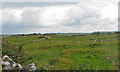
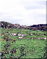
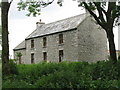
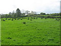
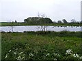
Nearby Images from Geograph Britain and Ireland:
©2008(licence)
©2011(licence)
©2008(licence)
©2009(licence)
©2009(licence)
The above images may not be of the site on this page, they are loaded from Geograph.
Please Submit an Image of this site or go out and take one for us!
Click here to see more info for this site
Nearby sites
Click here to view sites on an interactive map of the areaKey: Red: member's photo, Blue: 3rd party photo, Yellow: other image, Green: no photo - please go there and take one, Grey: site destroyed
Download sites to:
KML (Google Earth)
GPX (GPS waypoints)
CSV (Garmin/Navman)
CSV (Excel)
To unlock full downloads you need to sign up as a Contributory Member. Otherwise downloads are limited to 50 sites.
Turn off the page maps and other distractions
Nearby sites listing. In the following links * = Image available
3.4km SSE 153° Ballyganner South* Wedge Tomb (R216915)
3.8km NE 49° Iskancullin* Wedge Tomb (R230970)
4.7km NNE 11° Lissylisheen* Wedge Tomb (R211992)
4.7km WNW 297° Boghill Centre Modern Stone Circle etc
5.0km NE 38° Poulawack Cairn* Cairn (R2323998520)
5.3km NE 38° Poulawack Rath and Souterrain* Souterrain (Fogou, Earth House)
5.5km N 355° Cahermacnaughten Stone Fort or Dun (M197001)
5.7km NNE 16° Baur South Cairn* Cairn
5.7km NNE 15° Baur South* Wedge Tomb (M217001)
5.7km E 101° Parknabinnia 1* Wedge Tomb (R25749341)
5.9km ESE 102° Parknabinnia 4* Wedge Tomb (R25889326)
5.9km ESE 102° Parknabinnia Capstone Factory* Ancient Mine, Quarry or other Industry (R259933)
6.0km E 99° Parknabinnia Court Tomb* Court Tomb (R2602193585)
6.0km NE 35° Caherconnell* Stone Fort or Dun (R236995)
6.1km ESE 101° Parknabinnia 2* Wedge Tomb (R26069331)
6.3km NNE 19° Baur North* Wedge Tomb (M223005)
6.4km E 98° Parknabinnia* Wedge Tomb (R26489357)
6.5km NNE 11° Poulnabrucky* Wedge Tomb (M215010)
6.7km NNE 30° Poulnabrone* Portal Tomb (M2359500356)
6.8km E 94° Commons North 1* Wedge Tomb (R269940)
6.8km E 94° Commons North 2* Wedge Tomb (R269940)
7.1km NE 53° Meggagh* Wedge Tomb (R258988)
7.4km E 80° Creevagh* Wedge Tomb (R274958)
7.6km ESE 112° Killinaboy Church Early Christian Sculptured Stone (R27139158)
8.1km NNE 20° Gleninsheen 1* Wedge Tomb (M230022)
View more nearby sites and additional images


 We would like to know more about this location. Please feel free to add a brief description and any relevant information in your own language.
 Wir möchten mehr über diese Stätte erfahren. Bitte zögern Sie nicht, eine kurze Beschreibung und relevante Informationen in Deutsch hinzuzufügen.
 Nous aimerions en savoir encore un peu sur les lieux. S'il vous plaît n'hesitez pas à ajouter une courte description et tous les renseignements pertinents dans votre propre langue.
 Quisieramos informarnos un poco más de las lugares. No dude en añadir una breve descripción y otros datos relevantes en su propio idioma.