 with our Megalithic Portal iPhone app")


<< Our Photo Pages >> Caherkirky boulder burials + standing stone - Burial Chamber or Dolmen in Ireland (Republic of) in Co. Cork
Submitted by GaelicLaird on Thursday, 20 July 2023 Page Views: 331
Neolithic and Bronze AgeSite Name: Caherkirky boulder burials + standing stoneCountry: Ireland (Republic of)
NOTE: This site is 3.695 km away from the location you searched for.
County: Co. Cork Type: Burial Chamber or Dolmen
Nearest Town: Clonakilty Nearest Village: Rossmore
Latitude: 51.681125N Longitude: 8.99552W
Condition:
| 5 | Perfect |
| 4 | Almost Perfect |
| 3 | Reasonable but with some damage |
| 2 | Ruined but still recognisable as an ancient site |
| 1 | Pretty much destroyed, possibly visible as crop marks |
| 0 | No data. |
| -1 | Completely destroyed |
| 5 | Superb |
| 4 | Good |
| 3 | Ordinary |
| 2 | Not Good |
| 1 | Awful |
| 0 | No data. |
| 5 | Can be driven to, probably with disabled access |
| 4 | Short walk on a footpath |
| 3 | Requiring a bit more of a walk |
| 2 | A long walk |
| 1 | In the middle of nowhere, a nightmare to find |
| 0 | No data. |
| 5 | co-ordinates taken by GPS or official recorded co-ordinates |
| 4 | co-ordinates scaled from a detailed map |
| 3 | co-ordinates scaled from a bad map |
| 2 | co-ordinates of the nearest village |
| 1 | co-ordinates of the nearest town |
| 0 | no data |
Internal Links:
External Links:
")
This site is located in flat pasture near the headwaters of the Ihernagh river and comprises of one standing stone and two boulder burials.
Standing stone (site no CO121-018003-) is a large slab (H 2.7m; 1.9m x 0.5m) which narrows towards the base; long axis NE-SW. The two boulder-burials (CO121-018001- and CO121-018002-) lie immediately to SW approx. 5m apart.
The larger boulder burial (site no CO121-018001-) lies to the west with a cover stone approx. 2.4m x 2.2m; T 1m and rests above three support stones. It’s upper surface slopes downwards to W.
The eastern boulder burial (site no CO121-018002-) lies very close to the standing stone and has one support stone visible beneath cover-stone (1.7m x 1.3m; T 0.8m). There is at least one cupmark on the cover stone of the eastern boulder burial.
The above description is derived from the published 'Archaeological Inventory of County Cork. Volume 1: West Cork' (Dublin: Stationery Office, 1992).
You may be viewing yesterday's version of this page. To see the most up to date information please register for a free account.
")
")
")
Do not use the above information on other web sites or publications without permission of the contributor.
Nearby Images from Geograph Britain and Ireland:
©2016(licence)
©2012(licence)
©2012(licence)
©2016(licence)
©2016(licence)
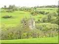
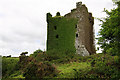
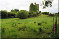
The above images may not be of the site on this page, they are loaded from Geograph.
Please Submit an Image of this site or go out and take one for us!
Click here to see more info for this site
Nearby sites
Click here to view sites on an interactive map of the areaKey: Red: member's photo, Blue: 3rd party photo, Yellow: other image, Green: no photo - please go there and take one, Grey: site destroyed
Download sites to:
KML (Google Earth)
GPX (GPS waypoints)
CSV (Garmin/Navman)
CSV (Excel)
To unlock full downloads you need to sign up as a Contributory Member. Otherwise downloads are limited to 50 sites.
Turn off the page maps and other distractions
Nearby sites listing. In the following links * = Image available
2.7km SSW 207° Knocks NW* Stone Circle
3.3km SSW 193° The Knocks* Standing Stones (W30394482)
3.4km SSW 213° Knockawaddra Stone Row / Alignment (W293452)
3.8km SSE 165° Knockatlowig stone row* Stone Row / Alignment
3.8km SSW 192° Na Cnoic standing stone* Standing Stone (Menhir)
3.8km SSW 193° Knocks SE* Stone Circle
4.2km ENE 75° Forge Cross Roads boulder burials and ringfort* Burial Chamber or Dolmen
4.5km WSW 241° Knockawaddra SE* Standing Stones
4.5km W 259° Lettergorman NE* Stone Circle
4.6km WSW 243° Knockawaddra Stone Row* Stone Row / Alignment
4.9km SSE 153° Ahagilla* Stone Circle (W334436)
5.0km SE 126° Letter Cromlechs* Chambered Tomb
5.4km SW 227° Glanbrack five stone circle and stone pair* Stone Circle
5.5km WSW 243° Lettergorman SW* Stone Circle
5.8km SSW 207° Sarue standing stone pair* Standing Stones
6.2km SW 231° Maulatanvally* Stone Circle
6.2km SSE 149° Ballvackey* Stone Circle
6.8km SW 230° Carrigagrenane NE Stone Circle
7.2km WNW 304° Ballyhalwick Stone Row / Alignment (W25215211)
7.2km W 261° Kippagh Stone Circle (W240470)
7.5km SW 229° Carrigagrenane SW Stone Circle
7.8km NNW 340° Toom stones Standing Stones
7.9km SSW 201° Counsellors Stone Fort Stone Fort or Dun
8.0km S 186° Coolcraheen Stone* Standing Stone (Menhir)
8.3km S 191° Caherbeg Dun* Stone Fort or Dun
View more nearby sites and additional images


 We would like to know more about this location. Please feel free to add a brief description and any relevant information in your own language.
 Wir möchten mehr über diese Stätte erfahren. Bitte zögern Sie nicht, eine kurze Beschreibung und relevante Informationen in Deutsch hinzuzufügen.
 Nous aimerions en savoir encore un peu sur les lieux. S'il vous plaît n'hesitez pas à ajouter une courte description et tous les renseignements pertinents dans votre propre langue.
 Quisieramos informarnos un poco más de las lugares. No dude en añadir una breve descripción y otros datos relevantes en su propio idioma.