


<< Text Pages >> Mámoa de As Legüíñas - Round Barrow(s) in Spain in Galicia
Submitted by holger_rix on Friday, 11 December 2015 Page Views: 606
Neolithic and Bronze AgeSite Name: Mámoa de As LegüíñasCountry: Spain
NOTE: This site is 3.712 km away from the location you searched for.
Region: Galicia Type: Round Barrow(s)
Latitude: 42.889352N Longitude: 9.052918W
Condition:
| 5 | Perfect |
| 4 | Almost Perfect |
| 3 | Reasonable but with some damage |
| 2 | Ruined but still recognisable as an ancient site |
| 1 | Pretty much destroyed, possibly visible as crop marks |
| 0 | No data. |
| -1 | Completely destroyed |
| 5 | Superb |
| 4 | Good |
| 3 | Ordinary |
| 2 | Not Good |
| 1 | Awful |
| 0 | No data. |
| 5 | Can be driven to, probably with disabled access |
| 4 | Short walk on a footpath |
| 3 | Requiring a bit more of a walk |
| 2 | A long walk |
| 1 | In the middle of nowhere, a nightmare to find |
| 0 | No data. |
| 5 | co-ordinates taken by GPS or official recorded co-ordinates |
| 4 | co-ordinates scaled from a detailed map |
| 3 | co-ordinates scaled from a bad map |
| 2 | co-ordinates of the nearest village |
| 1 | co-ordinates of the nearest town |
| 0 | no data |
Be the first person to rate this site - see the 'Contribute!' box in the right hand menu.
Internal Links:
External Links:
Round Barrow(s) in Galicia
You may be viewing yesterday's version of this page. To see the most up to date information please register for a free account.
Do not use the above information on other web sites or publications without permission of the contributor.
Nearby Images from Flickr

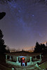
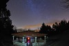
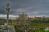
The above images may not be of the site on this page, but were taken nearby. They are loaded from Flickr so please click on them for image credits.
Click here to see more info for this site
Nearby sites
Click here to view sites on an interactive map of the areaKey: Red: member's photo, Blue: 3rd party photo, Yellow: other image, Green: no photo - please go there and take one, Grey: site destroyed
Download sites to:
KML (Google Earth)
GPX (GPS waypoints)
CSV (Garmin/Navman)
CSV (Excel)
To unlock full downloads you need to sign up as a Contributory Member. Otherwise downloads are limited to 50 sites.
Turn off the page maps and other distractions
Nearby sites listing. In the following links * = Image available
3.1km W 271° Mámoa da Cima da Arca Round Barrow(s)
4.6km SSW 197° Petróglifo do Outeiro de Prousos Magos Rock Art
5.2km NW 313° Castro de Os Castros (O Enxilde) Castro or Chafurdão
5.2km WNW 293° Ruinas do Monte Peñafiel Ancient Village or Settlement
5.8km NNW 335° Castro das Teixoeiras Castro or Chafurdão
5.8km SSW 195° Petróglifos das Camposas Rock Art
5.9km NW 321° Castro de Os Castriños Castro or Chafurdão
5.9km NNW 340° Castro de Castrelo (Mazaricos) Castro or Chafurdão
5.9km SSE 165° Castro de Riomao Castro or Chafurdão
6.2km W 261° Castro de O Pedrullo Castro or Chafurdão
6.2km SE 141° Pedrafita do Outeiro das Capas Standing Stone (Menhir)
7.5km ESE 102° Castro de Valadares Castro or Chafurdão
7.6km NNW 346° Castro de Os Castros (Río Xallas) Castro or Chafurdão
7.8km SSW 204° Petróglifo de Carnota Rock Art
8.0km ESE 122° Casiña dos Mouros Burial Chamber or Dolmen
8.0km SSW 197° Petróglifo da Laxe Escrita* Rock Art
8.4km N 0° Mámoas de Costa Olveiroa 1 Barrow Cemetery
8.5km N 3° Mámoas de Costa Olveiroa 2 Barrow Cemetery
8.6km ESE 120° Castro de Mirás Castro or Chafurdão
9.0km N 351° Pedra do Brazal* Natural Stone / Erratic / Other Natural Feature
9.2km N 352° Castro de Logoso Castro or Chafurdão
9.4km S 190° Cova da Bruxa Petróglifos* Rock Art
9.9km SSW 199° Petróglifos do Outeiro dos Corvos* Rock Art
10.0km NW 319° Mámoa da Pedra Vixía Round Barrow(s)
10.1km SSW 202° Castro de Mallou Castro or Chafurdão
View more nearby sites and additional images


 We would like to know more about this location. Please feel free to add a brief description and any relevant information in your own language.
 Wir möchten mehr über diese Stätte erfahren. Bitte zögern Sie nicht, eine kurze Beschreibung und relevante Informationen in Deutsch hinzuzufügen.
 Nous aimerions en savoir encore un peu sur les lieux. S'il vous plaît n'hesitez pas à ajouter une courte description et tous les renseignements pertinents dans votre propre langue.
 Quisieramos informarnos un poco más de las lugares. No dude en añadir una breve descripción y otros datos relevantes en su propio idioma.