


<< Text Pages >> Ka'k' Naab' saltworks - Ancient Mine, Quarry or other Industry in Belize
Submitted by bat400 on Tuesday, 12 October 2010 Page Views: 5918
Multi-periodSite Name: Ka'k' Naab' saltworks Alternative Name: Punta Ycacos Lagoon saltworksCountry: Belize
NOTE: This site is 59.646 km away from the location you searched for.
Type: Ancient Mine, Quarry or other Industry
Nearest Town: New Haven, Belize
Latitude: 16.267000N Longitude: 88.6W
Condition:
| 5 | Perfect |
| 4 | Almost Perfect |
| 3 | Reasonable but with some damage |
| 2 | Ruined but still recognisable as an ancient site |
| 1 | Pretty much destroyed, possibly visible as crop marks |
| 0 | No data. |
| -1 | Completely destroyed |
| 5 | Superb |
| 4 | Good |
| 3 | Ordinary |
| 2 | Not Good |
| 1 | Awful |
| 0 | No data. |
| 5 | Can be driven to, probably with disabled access |
| 4 | Short walk on a footpath |
| 3 | Requiring a bit more of a walk |
| 2 | A long walk |
| 1 | In the middle of nowhere, a nightmare to find |
| 0 | No data. |
| 5 | co-ordinates taken by GPS or official recorded co-ordinates |
| 4 | co-ordinates scaled from a detailed map |
| 3 | co-ordinates scaled from a bad map |
| 2 | co-ordinates of the nearest village |
| 1 | co-ordinates of the nearest town |
| 0 | no data |
Be the first person to rate this site - see the 'Contribute!' box in the right hand menu.
Internal Links:
External Links:
Ancient Industry in Belize.One of multiple saltworks dating to the Late Classic Period (~670AD-870AD). The sites were submerged as sea levels rose, but remains of distinctive pottery for boiling salt water, ceramic stands, and wooden posts from buildings have been found from survays in the shallow water.
Note: The location given is very general. Sources include: Finds in Belize document Late Classic Maya salt making and canoe transport, Heather McKillop, 2005.
Note: Was this the industry that supplied salt to the Mayan city states? Researchers receive grant. See comment.
You may be viewing yesterday's version of this page. To see the most up to date information please register for a free account.
Do not use the above information on other web sites or publications without permission of the contributor.
Nearby Images from Flickr
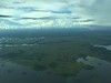
The above images may not be of the site on this page, but were taken nearby. They are loaded from Flickr so please click on them for image credits.
Click here to see more info for this site
Nearby sites
Click here to view sites on an interactive map of the areaKey: Red: member's photo, Blue: 3rd party photo, Yellow: other image, Green: no photo - please go there and take one, Grey: site destroyed
Download sites to:
KML (Google Earth)
GPX (GPS waypoints)
CSV (Garmin/Navman)
CSV (Excel)
To unlock full downloads you need to sign up as a Contributory Member. Otherwise downloads are limited to 50 sites.
Turn off the page maps and other distractions
Nearby sites listing. In the following links * = Image available
24.6km WNW 284° Nim Li Punit* Ancient Village or Settlement
38.0km NW 323° Quebrada de Oro Ancient Village or Settlement
38.4km W 273° Lubaantun* Ancient Village or Settlement
78.1km NW 315° Caracol Ancient Village or Settlement
106.5km NNW 332° Chaa Creek* Ancient Village or Settlement
108.1km NNW 328° Xunantunich* Ancient Village or Settlement
110.0km NNW 333° Cahal Pech Ancient Village or Settlement
117.9km NW 312° Holtun* Ancient Village or Settlement
118.1km N 351° Saturday Creek Ancient Village or Settlement
119.1km WNW 301° Chilonche Ancient Village or Settlement
119.4km NW 324° Naranjo* Ancient Village or Settlement
120.3km SSW 203° Quirigua* Ancient Village or Settlement
120.7km SSE 150° Palos Blancos Ancient Village or Settlement
123.5km NW 316° Yaxha* Ancient Village or Settlement
124.3km NNW 332° El Pilar* Ancient Village or Settlement
130.3km S 189° El Puente Ancient Village or Settlement
131.0km NNW 348° Cara Blanca Natural Stone / Erratic / Other Natural Feature
132.5km NW 320° Nakum* Ancient Village or Settlement
136.6km NNW 328° Holmul Ancient Village or Settlement
139.8km NW 304° Ixlú Ancient Village or Settlement
139.9km NNW 331° Cival Ancient Village or Settlement
152.7km NW 314° Tikal* Ancient Village or Settlement
156.1km WNW 298° Nojpetén* Ancient Village or Settlement
156.4km W 260° Cancuen* Ancient Village or Settlement
158.2km W 280° Ceibal* Ancient Village or Settlement
View more nearby sites and additional images


 We would like to know more about this location. Please feel free to add a brief description and any relevant information in your own language.
 Wir möchten mehr über diese Stätte erfahren. Bitte zögern Sie nicht, eine kurze Beschreibung und relevante Informationen in Deutsch hinzuzufügen.
 Nous aimerions en savoir encore un peu sur les lieux. S'il vous plaît n'hesitez pas à ajouter une courte description et tous les renseignements pertinents dans votre propre langue.
 Quisieramos informarnos un poco más de las lugares. No dude en añadir una breve descripción y otros datos relevantes en su propio idioma.