

<< Our Photo Pages >> Pinson Mounds - Mound 28 - Artificial Mound in United States in The South
Submitted by symbionspacesuit on Sunday, 14 February 2010 Page Views: 3248
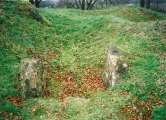
Pre-ColumbianSite Name: Pinson Mounds - Mound 28 Alternative Name: City of CiscoCountry: United States
NOTE: This site is 30.289 km away from the location you searched for.
Region: The South Type: Artificial Mound
Nearest Town: Jackson, TN Nearest Village: Pinson, TN
Latitude: 35.500517N Longitude: 88.673067W
Condition:
| 5 | Perfect |
| 4 | Almost Perfect |
| 3 | Reasonable but with some damage |
| 2 | Ruined but still recognisable as an ancient site |
| 1 | Pretty much destroyed, possibly visible as crop marks |
| 0 | No data. |
| -1 | Completely destroyed |
| 5 | Superb |
| 4 | Good |
| 3 | Ordinary |
| 2 | Not Good |
| 1 | Awful |
| 0 | No data. |
| 5 | Can be driven to, probably with disabled access |
| 4 | Short walk on a footpath |
| 3 | Requiring a bit more of a walk |
| 2 | A long walk |
| 1 | In the middle of nowhere, a nightmare to find |
| 0 | No data. |
| 5 | co-ordinates taken by GPS or official recorded co-ordinates |
| 4 | co-ordinates scaled from a detailed map |
| 3 | co-ordinates scaled from a bad map |
| 2 | co-ordinates of the nearest village |
| 1 | co-ordinates of the nearest town |
| 0 | no data |
Internal Links:
External Links:
I have visited· I would like to visit
davidmorgan visited on 23rd Aug 2017 - their rating: Cond: 3 Amb: 4 Access: 3
")
You may be viewing yesterday's version of this page. To see the most up to date information please register for a free account.
")
")
")
Do not use the above information on other web sites or publications without permission of the contributor.
Click here to see more info for this site
Nearby sites
Click here to view sites on an interactive map of the areaKey: Red: member's photo, Blue: 3rd party photo, Yellow: other image, Green: no photo - please go there and take one, Grey: site destroyed
Download sites to:
KML (Google Earth)
GPX (GPS waypoints)
CSV (Garmin/Navman)
CSV (Excel)
To unlock full downloads you need to sign up as a Contributory Member. Otherwise downloads are limited to 50 sites.
Turn off the page maps and other distractions
Nearby sites listing. In the following links * = Image available
546m S 170° Pinson Mounds - Eastern Citadel* Misc. Earthwork
682m SSE 162° Pinson Mounds - Mound 30* Artificial Mound
882m WSW 251° Pinson Mounds* Artificial Mound
1.0km WSW 237° Pinson Mounds - Sauls Mound* Artificial Mound
1.2km SW 234° Pinson Mounds - Other Sites Artificial Mound
1.9km W 266° Pinson Mounds - Ozier Mound* Artificial Mound
2.0km WSW 258° Pinson Mounds - Twin Mounds* Artificial Mound
50.8km SE 142° Shiloh Indian Mounds* Ancient Village or Settlement
104.0km NNE 14° Obion Mounds* Artificial Mound
107.1km SSE 152° Bear Creek* Ancient Village or Settlement
117.1km SSE 168° Pharr Mounds* Artificial Mound
118.7km W 276° Nodena Site* Ancient Village or Settlement
120.7km SE 131° Florence Mound* Artificial Mound
123.3km WNW 293° Chickasawba Mound* Artificial Mound
124.0km W 274° Hampson* Museum
127.4km SSW 196° Ingomar Mounds* Artificial Mound
128.2km NNW 339° Adams Site* Artificial Mound
133.9km WSW 252° Chickasaw Heritage Park* Artificial Mound
135.4km NNW 343° O'Bayum's Fort* Artificial Mound
140.9km WSW 250° Chucalissa Prehistoric Indian Village* Museum
141.9km NNW 339° Towosahgy Ancient Village or Settlement
144.8km NW 326° Lilbourn Mound Ancient Village or Settlement
148.9km WSW 247° Cheatham Mound* Artificial Mound
149.2km S 174° Mound Cemetary* Artificial Mound
151.0km WSW 248° Edgefield Mounds* Artificial Mound
View more nearby sites and additional images


 We would like to know more about this location. Please feel free to add a brief description and any relevant information in your own language.
 Wir möchten mehr über diese Stätte erfahren. Bitte zögern Sie nicht, eine kurze Beschreibung und relevante Informationen in Deutsch hinzuzufügen.
 Nous aimerions en savoir encore un peu sur les lieux. S'il vous plaît n'hesitez pas à ajouter une courte description et tous les renseignements pertinents dans votre propre langue.
 Quisieramos informarnos un poco más de las lugares. No dude en añadir una breve descripción y otros datos relevantes en su propio idioma.