


<< Our Photo Pages >> Angel Mounds Museum - Museum in United States in Great Lakes Midwest
Submitted by bat400 on Saturday, 24 June 2006 Page Views: 4914
MuseumsSite Name: Angel Mounds Museum Alternative Name: Angel Mounds Historical Site MuseumCountry: United States
NOTE: This site is 35.798 km away from the location you searched for.
Region: Great Lakes Midwest Type: Museum
Nearest Town: Evansville, Indiana Nearest Village: Newburgh, Indiana
Latitude: 37.943900N Longitude: 87.451W
Condition:
| 5 | Perfect |
| 4 | Almost Perfect |
| 3 | Reasonable but with some damage |
| 2 | Ruined but still recognisable as an ancient site |
| 1 | Pretty much destroyed, possibly visible as crop marks |
| 0 | No data. |
| -1 | Completely destroyed |
| 5 | Superb |
| 4 | Good |
| 3 | Ordinary |
| 2 | Not Good |
| 1 | Awful |
| 0 | No data. |
| 5 | Can be driven to, probably with disabled access |
| 4 | Short walk on a footpath |
| 3 | Requiring a bit more of a walk |
| 2 | A long walk |
| 1 | In the middle of nowhere, a nightmare to find |
| 0 | No data. |
| 5 | co-ordinates taken by GPS or official recorded co-ordinates |
| 4 | co-ordinates scaled from a detailed map |
| 3 | co-ordinates scaled from a bad map |
| 2 | co-ordinates of the nearest village |
| 1 | co-ordinates of the nearest town |
| 0 | no data |
Internal Links:
External Links:
I have visited· I would like to visit
bat400 has visited here
")
The Museum adjoins the Angel Mounds town site. It is directly opposite the location of the prehistoric stockade opening. The building has been designed to resemble a truncated pyramid - the classic shape of a Mississippian Mound.
The site and museum are owned by the Indiana Department of Natural Resources. It and the Angel Mounds Town site are open Tuesdays through Sundays. The website contains the times and directions. A nominal fee is charged.
The museum includes a short film on the site and multiple displays arranged topically to show the history and culture of the Mississippian people who built and maintained the town. The museum contains a large room with lifesize figures and buildings that reproduce portions of the town at its heyday. This "recreation" is mingled with displays of actual finds from the site, and explanitory information in posters and booklets describing the meaning of the physical evidence. (The website photos of these figures does not do them justice. The effect is more pleasing in person.)
There are some interesting displays on how the site was acquired for the state and how the main excavation was done in the 1930's and 40's under the direction of Glenn Black, a self taught archeologist. Black was one of the first archeologists to use magnetometer readings to search for underground structural information.
After viewing the museum you exit to a footbridge that crosses the slough and enters the town site itself.
You may be viewing yesterday's version of this page. To see the most up to date information please register for a free account.
")
Do not use the above information on other web sites or publications without permission of the contributor.
Nearby Images from Flickr
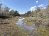
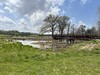
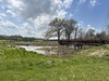
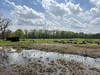
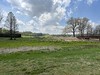
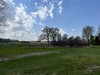
The above images may not be of the site on this page, but were taken nearby. They are loaded from Flickr so please click on them for image credits.
Click here to see more info for this site
Nearby sites
Click here to view sites on an interactive map of the areaKey: Red: member's photo, Blue: 3rd party photo, Yellow: other image, Green: no photo - please go there and take one, Grey: site destroyed
Download sites to:
KML (Google Earth)
GPX (GPS waypoints)
CSV (Garmin/Navman)
CSV (Excel)
To unlock full downloads you need to sign up as a Contributory Member. Otherwise downloads are limited to 50 sites.
Turn off the page maps and other distractions
Nearby sites listing. In the following links * = Image available
263m W 272° Angel Mounds* Ancient Village or Settlement
409m WSW 239° Angel Mounds - Mound A* Artificial Mound
495m NNE 23° Angel Mounds - Mound G* Artificial Mound
572m W 266° Angel Mounds - Mound E* Artificial Mound
862m WSW 240° Angel Mounds - Mound F* Pyramid / Mastaba
34.3km W 265° Mann Site Misc. Earthwork
42.8km W 263° GE. Mound Artificial Mound
44.6km WSW 252° Hovey Lake Village Ancient Village or Settlement
51.3km W 277° Wilson Mounds and Village Site* Artificial Mound
52.8km WSW 249° Slack Farm Ancient Village or Settlement
77.0km NNE 31° Glendale Ridge Archaeological Site Ancient Village or Settlement
78.6km WSW 250° Great Salt Spring Ancient Mine, Quarry or other Industry
79.2km N 356° Pyramid Mound* Barrow Cemetery
81.0km N 357° Indiana - Sugarloaf Mound* Barrow Cemetery
87.1km SSE 151° Indian Knoll* Barrow Cemetery
105.9km ENE 72° Wyandotte Cave* Ancient Mine, Quarry or other Industry
110.0km NE 52° Cox's Woods site Ancient Village or Settlement
117.9km SSE 156° Page Site, Kentucky* Artificial Mound
124.1km N 355° Merom Hillfort Ancient Village or Settlement
132.9km SW 224° Kincaid Mounds* Ancient Village or Settlement
140.8km SW 228° Rowlandton Mound Site* Artificial Mound
145.3km SE 125° Mammoth Cave Kentucky* Cave or Rock Shelter
157.5km WSW 257° Giant City Stone Fort Site* Hillfort
158.3km NNE 30° Glenn Black Laboratory* Museum
169.3km ENE 71° Moundbuilder's Fort Not Known (by us)
View more nearby sites and additional images


 We would like to know more about this location. Please feel free to add a brief description and any relevant information in your own language.
 Wir möchten mehr über diese Stätte erfahren. Bitte zögern Sie nicht, eine kurze Beschreibung und relevante Informationen in Deutsch hinzuzufügen.
 Nous aimerions en savoir encore un peu sur les lieux. S'il vous plaît n'hesitez pas à ajouter une courte description et tous les renseignements pertinents dans votre propre langue.
 Quisieramos informarnos un poco más de las lugares. No dude en añadir una breve descripción y otros datos relevantes en su propio idioma.