


<< Text Pages >> Blue Bluff - Rock Outcrop in United States in Great Lakes Midwest
Submitted by bat400 on Thursday, 08 June 2006 Page Views: 7202
Natural PlacesSite Name: Blue BluffCountry: United States Region: Great Lakes Midwest Type: Rock Outcrop
Nearest Town: Martinsville, IN Nearest Village: Centerton, IN
Latitude: 39.493500N Longitude: 86.397W
Condition:
| 5 | Perfect |
| 4 | Almost Perfect |
| 3 | Reasonable but with some damage |
| 2 | Ruined but still recognisable as an ancient site |
| 1 | Pretty much destroyed, possibly visible as crop marks |
| 0 | No data. |
| -1 | Completely destroyed |
| 5 | Superb |
| 4 | Good |
| 3 | Ordinary |
| 2 | Not Good |
| 1 | Awful |
| 0 | No data. |
| 5 | Can be driven to, probably with disabled access |
| 4 | Short walk on a footpath |
| 3 | Requiring a bit more of a walk |
| 2 | A long walk |
| 1 | In the middle of nowhere, a nightmare to find |
| 0 | No data. |
| 5 | co-ordinates taken by GPS or official recorded co-ordinates |
| 4 | co-ordinates scaled from a detailed map |
| 3 | co-ordinates scaled from a bad map |
| 2 | co-ordinates of the nearest village |
| 1 | co-ordinates of the nearest town |
| 0 | no data |
Internal Links:
External Links:
I have visited· I would like to visit
bat400 visited on 1st Sep 2006 - their rating: Cond: 4 Amb: 4 Access: 3
The immediate area around it is heavy wood with a wide variety of native plants (one a rare species.) The plot is owned and protected by the Central Indiana Land Trust.
The bluff is visible for miles along the flood plane of the river. More importantly it's noteworthy as you travel the river - there are few bluffs in the area. It was used by the historic Delaware Indians and European settlers as a meeting place and general guide to the area. (As in "I'll meet you at Blue Bluff two months from now and we'll set up a hunting camp.") It is highly likely that the landmark was known to the prehistoric Mississippian cultures that had their villages in the area. More recently (turn of the last century) there was a tourist camp (complete with cabins, dance pavilion, and dining area) at the foot of the bluff for visitors wishing to fish and boat on the river. The buildings are now completely gone, washed away in floods.
Blue Bluff Road crosses the river just west of the exposed rock outcropping and turns further west and then south around the foot of the forested portion of the bluff. A small green sign is posted on the road opposite what used to be the direct access into the preserve. Public access is not available at this time due to safety concerns.
More at the Central Indiana Land Trust web site.
You may be viewing yesterday's version of this page. To see the most up to date information please register for a free account.
Do not use the above information on other web sites or publications without permission of the contributor.
Nearby Images from Flickr
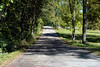


The above images may not be of the site on this page, but were taken nearby. They are loaded from Flickr so please click on them for image credits.
Click here to see more info for this site
Nearby sites
Click here to view sites on an interactive map of the areaKey: Red: member's photo, Blue: 3rd party photo, Yellow: other image, Green: no photo - please go there and take one, Grey: site destroyed
Download sites to:
KML (Google Earth)
GPX (GPS waypoints)
CSV (Garmin/Navman)
CSV (Excel)
To unlock full downloads you need to sign up as a Contributory Member. Otherwise downloads are limited to 50 sites.
Turn off the page maps and other distractions
Nearby sites listing. In the following links * = Image available
7.9km SSW 212° Bundy-Voyles Site* Ancient Village or Settlement
36.3km NNE 32° Indiana State Museum* Museum
37.6km SSW 197° Glenn Black Laboratory* Museum
80.0km NNE 28° Strawtown Enclosure* Ancient Village or Settlement
80.4km NNE 28° Castor Farm Ancient Village or Settlement
93.9km NE 44° Mounds State Park (Indiana) - Earthwork D* Misc. Earthwork
94.0km NE 44° Mounds (Indiana) - Fiddleback Mound* Misc. Earthwork
94.0km NE 45° Mounds (Indiana) - Earthwork B* Misc. Earthwork
94.0km NE 44° Mounds (Indiana) - Great Mound* Henge
94.3km NE 44° Mounds (Indiana)* Henge
94.9km NE 44° Mounds (Indiana) - Circle Mound* Misc. Earthwork
99.0km ENE 62° Chrysler Enclosure* Henge
104.1km ENE 59° New Castle Complex* Henge
105.6km S 182° Cox's Woods site Ancient Village or Settlement
110.0km NE 46° Yorktown Enclosure Misc. Earthwork
111.8km ENE 70° Cambridge City Henge Complex* Henge
111.9km WSW 245° Merom Hillfort Ancient Village or Settlement
118.2km SSW 206° Glendale Ridge Archaeological Site Ancient Village or Settlement
125.6km NE 54° Windsor Mound* Artificial Mound
132.4km SW 227° Indiana - Sugarloaf Mound* Barrow Cemetery
134.5km SW 226° Pyramid Mound* Barrow Cemetery
136.1km SSE 150° Moundbuilder's Fort Not Known (by us)
139.9km E 92° Reily Cemetery Mound* Artificial Mound
139.9km NW 305° Collins Site* Ancient Village or Settlement
140.0km ESE 111° River View Cemetery Mounds* Artificial Mound
View more nearby sites and additional images


 We would like to know more about this location. Please feel free to add a brief description and any relevant information in your own language.
 Wir möchten mehr über diese Stätte erfahren. Bitte zögern Sie nicht, eine kurze Beschreibung und relevante Informationen in Deutsch hinzuzufügen.
 Nous aimerions en savoir encore un peu sur les lieux. S'il vous plaît n'hesitez pas à ajouter une courte description et tous les renseignements pertinents dans votre propre langue.
 Quisieramos informarnos un poco más de las lugares. No dude en añadir una breve descripción y otros datos relevantes en su propio idioma.