 with our Megalithic Portal iPhone app")


<< Other Photo Pages >> Chaguitillo - Rock Art in Nicaragua
Submitted by davidmorgan on Thursday, 19 October 2017 Page Views: 1945
Rock ArtSite Name: Chaguitillo Alternative Name: Quebrada de ArrancabarbaCountry: Nicaragua
NOTE: This site is 17.817 km away from the location you searched for.
Type: Rock Art
Nearest Town: Matagalpa Nearest Village: Chagüitillo
Latitude: 12.885000N Longitude: 86.0778W
Condition:
| 5 | Perfect |
| 4 | Almost Perfect |
| 3 | Reasonable but with some damage |
| 2 | Ruined but still recognisable as an ancient site |
| 1 | Pretty much destroyed, possibly visible as crop marks |
| 0 | No data. |
| -1 | Completely destroyed |
| 5 | Superb |
| 4 | Good |
| 3 | Ordinary |
| 2 | Not Good |
| 1 | Awful |
| 0 | No data. |
| 5 | Can be driven to, probably with disabled access |
| 4 | Short walk on a footpath |
| 3 | Requiring a bit more of a walk |
| 2 | A long walk |
| 1 | In the middle of nowhere, a nightmare to find |
| 0 | No data. |
| 5 | co-ordinates taken by GPS or official recorded co-ordinates |
| 4 | co-ordinates scaled from a detailed map |
| 3 | co-ordinates scaled from a bad map |
| 2 | co-ordinates of the nearest village |
| 1 | co-ordinates of the nearest town |
| 0 | no data |
Be the first person to rate this site - see the 'Contribute!' box in the right hand menu.
Internal Links:
External Links:
")
Petroglyphs carved into the rocky banks by a small river.
Photo source: Sébaco Municipality website
You may be viewing yesterday's version of this page. To see the most up to date information please register for a free account.
Do not use the above information on other web sites or publications without permission of the contributor.
Nearby Images from Flickr
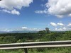
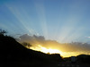
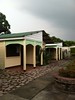
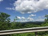
The above images may not be of the site on this page, but were taken nearby. They are loaded from Flickr so please click on them for image credits.
Click here to see more info for this site
Nearby sites
Click here to view sites on an interactive map of the areaKey: Red: member's photo, Blue: 3rd party photo, Yellow: other image, Green: no photo - please go there and take one, Grey: site destroyed
Download sites to:
KML (Google Earth)
GPX (GPS waypoints)
CSV (Garmin/Navman)
CSV (Excel)
To unlock full downloads you need to sign up as a Contributory Member. Otherwise downloads are limited to 50 sites.
Turn off the page maps and other distractions
Nearby sites listing. In the following links * = Image available
73.5km SW 216° Momotombito Island* Sculptured Stone
85.4km SSW 193° Managua Rock Art* Rock Art
85.4km SSW 193° Footprints of Acahualinca Museum* Museum
101.6km WSW 240° Subtiaba* Ancient Village or Settlement
102.2km S 182° Masaya Rock Art* Rock Art
106.8km S 173° San Francisco Museum (Granada) Museum
113.0km S 182° Pensacola* Sculptured Stone
114.2km SE 140° Aguas Buenas* Misc. Earthwork
116.1km SE 138° Museo Arqueológico Gregorio Aguilar Barea* Museum
118.1km SSE 168° Jinotepe* Rock Art
125.4km S 169° Isla El Muerto* Rock Art
130.6km SSE 168° Zapatero Island* Sculptured Stone
134.2km S 181° Riachuelo Cave* Rock Art
156.0km NE 41° Cueva la Conga Rock Art
161.4km NNW 328° Unknown Stela Sculptured Stone
165.4km SSE 160° Ometepe Indigenous Cemetery* Ancient Village or Settlement
166.1km SSE 159° Ometepe* Rock Art
291.0km N 351° Puerto Escondido Ancient Village or Settlement
297.0km NNW 327° Pulhapanzak Ancient Village or Settlement
308.6km NNE 33° La Ciudad Blanca* Ancient Village or Settlement
342.5km SSE 149° Williamsberg Mounds* Artificial Mound
343.9km SE 145° Anita Grande* Artificial Mound
344.1km NW 322° Palos Blancos Ancient Village or Settlement
369.8km WNW 287° Joya de Ceren* Ancient Village or Settlement
372.5km WNW 286° San Andres* Ancient Village or Settlement
View more nearby sites and additional images


 We would like to know more about this location. Please feel free to add a brief description and any relevant information in your own language.
 Wir möchten mehr über diese Stätte erfahren. Bitte zögern Sie nicht, eine kurze Beschreibung und relevante Informationen in Deutsch hinzuzufügen.
 Nous aimerions en savoir encore un peu sur les lieux. S'il vous plaît n'hesitez pas à ajouter une courte description et tous les renseignements pertinents dans votre propre langue.
 Quisieramos informarnos un poco más de las lugares. No dude en añadir una breve descripción y otros datos relevantes en su propio idioma.