Featured: Explore Scotland (and everywhere else) with our Megalithic Portal iPhone app

Explore Scotland (and everywhere else) with our Megalithic Portal iPhone app

Random Image


Marayoor Muniyaras

Stonehenge Tea Towels - Worldwide delivery

 Stonehenge Tea Towels - Worldwide delivery

Who's Online

There are currently, 284 guests and 2 members online.

You are a guest. To join in, please register for free by clicking here

Sponsors

<< Our Photo Pages >> Mounds (Indiana) - Great Mound - Henge in United States in Great Lakes Midwest

Submitted by bat400 on Saturday, 26 August 2006  Page Views: 9673

Neolithic and Bronze AgeSite Name: Mounds (Indiana) - Great Mound
Country: United States Region: Great Lakes Midwest Type: Henge
Nearest Town: Anderson, Indiana
Latitude: 40.094400N  Longitude: 85.6226W
Condition:
5Perfect
4Almost Perfect
3Reasonable but with some damage
2Ruined but still recognisable as an ancient site
1Pretty much destroyed, possibly visible as crop marks
0No data.
-1Completely destroyed
4 Ambience:
5Superb
4Good
3Ordinary
2Not Good
1Awful
0No data.
4 Access:
5Can be driven to, probably with disabled access
4Short walk on a footpath
3Requiring a bit more of a walk
2A long walk
1In the middle of nowhere, a nightmare to find
0No data.
4 Accuracy:
5co-ordinates taken by GPS or official recorded co-ordinates
4co-ordinates scaled from a detailed map
3co-ordinates scaled from a bad map
2co-ordinates of the nearest village
1co-ordinates of the nearest town
0no data
4

Internal Links:
External Links:

I have visited· I would like to visit

stonetracker visited - their rating: Cond: 4 Amb: 5 Access: 3 Visited late Oct 2023. This earthwork remains relatively unchanged since the original description was written. See my comments for changes that have taken place and some clarifications.

bat400 have visited here
Mounds (Indiana) - Great Mound
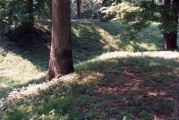
Mounds (Indiana) - Great Mound submitted by bat400 : Mounds - The Great Mound. View from the east with wild asters, the last flower of the season. The outer embankment wall prevents an outside viewer from seeing the central platform within. The exceptions are three dips in the embankment allowing a line of sight to the centers of three smaller earthwork enclosures surrounding the Great Mound. Photo: bat400 Oct 2006. (Vote or comment on this photo)
Artificial Mound in Mounds State Park, Madison County, Indiana.

Earthwork Enclosure.

Part of a Woodland ceremonial site, built by the Adena and also used by the Hopewell.

The Great Mound is actually an earthwork enclosure with a small mount on the central platform. The central mound is low, 30 feet in diameter and 4 feet high, surrounded by a large circular earthwork 384 feet in diameter. The circular enclosure is broken by a opening gateway to the south.

Excavations show that the original structure (250 BC) was a prepared circular floor of layers of clay and calcite powder (from burned limestone) in which a series of posts were sunk. Nearly 100 years later the ditch and embankment were created, while the central "platform" was still being augmented by added layers of material to the central mound. The site was later used for burials periodically between 50 - 900 AD.

There is no evidence of settlement sites in the immediate area. And a lack of "household" finds has been interpretted as the site being used for ceremonial activities. The identification of cultures in the Ohio Valley and associated watersheds is based on characteristics of artifacts. The Mounds area and other similar cememonial sites show both Adena and Hopewell characteristics. Hopewell culture may be an evolution of the earlier Adena among the same peoples, or a symptom of migration of peoples in the area.

During 1988 field school excavations by Ball State University, it was noticed that although observers outside the enclosure had no clear view of the interior from most directions, figures on the interior platform of the Great Mound had lines of sight to each of three smaller surrounding earthwork enclosures, through lower spots in the embankment. This discovery led to a hypothesis of possible astronomical alignments and a verification of several solar calendar alignments between the mounds themselves and the locations of the original posts on the central platform.

The Great Mound, as well as the entire site, lies on a bluff overlooking the White River. The location given is approximate. The entrance through the gateway into the center of the circular platform is now a raised boardwalk, suitable for handicapped and wheelchair access. This boardwalk ends in a large rectangular wooden viewing platform. The small mound on the central platform referenced in the description existed for some time but it is no longer visible above the surface. It is likely covered by feet of topsoil.

[Information from Mounds State Park information pamphlets, and "The Archaeology of Anderson Mounds, Mounds State Park, Anderson Indiana" by Donald Cochran and Beth McCord, 2001.]
You may be viewing yesterday's version of this page. To see the most up to date information please register for a free account.


Mounds (Indiana) - Great Mound
Mounds (Indiana) - Great Mound submitted by stonetracker : Diagram showing molds of wooden posts in the central platform. Post placement was seemingly haphazard and not well understood by archaeologists. However it is now believed that they were used as sighting devices aligning with dips in the enclosure wall and with parts of three smaller outer earthworks to observe solstice sunsets, equinox sunrise/sunsets, and the rising of certain stars. (1 comment - Vote or comment on this photo)

Mounds (Indiana) - Great Mound
Mounds (Indiana) - Great Mound submitted by stonetracker : A cross section of the central platform showing the location of its small mound (now covered with soil and not visible). Excavation findings included burials in a log tomb, a platform pipe, and cremation remains. These mound burials occurred well after the enclosure and platform were built. (1 comment - Vote or comment on this photo)

Mounds (Indiana) - Great Mound
Mounds (Indiana) - Great Mound submitted by stonetracker : Interpretation at the site as of 2023 (1 comment - Vote or comment on this photo)

Mounds (Indiana) - Great Mound
Mounds (Indiana) - Great Mound submitted by stonetracker : One side of the gateway showing the ditch. (1 comment - Vote or comment on this photo)

Mounds (Indiana) - Great Mound
Mounds (Indiana) - Great Mound submitted by stonetracker : First of several 2023 photos. There is now a boardwalk leading through the enclosure gateway to an observation deck on the central platform, (1 comment - Vote or comment on this photo)

Mounds (Indiana) - Great Mound
Mounds (Indiana) - Great Mound submitted by AKFisher : 1800s survey of earthworks at Anderson, Indiana. Portions of the site have been preserved in a state park. Photo courtesy Dr Greg Little, author of the Illustrated Encyclopedia of Native American Indian Mounds & Earthworks (2016). (1 comment)

Mounds (Indiana) - Great Mound
Mounds (Indiana) - Great Mound submitted by DocRock : View of the outer wall of the henge showing its undulating heights which facilitate viewing astronomical alignments.

Mounds (Indiana) - Great Mound
Mounds (Indiana) - Great Mound submitted by DocRock : View of the central platform showing the depth of the henge ditch and height of the outer wall of the henge to the left side of the henge gateway.

Mounds (Indiana) - Great Mound
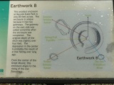
Mounds (Indiana) - Great Mound submitted by DocRock : State Park sign showing relationship of the Central Mound and the Fiddleback Mound and Earthwork B, etc., showing the astronomical alignments that were sighted not with alignment stones but by variations in the heights of the central henge wall and the outer earthworks. This was accidentally discovered during archaeological excavations at the sight when it was noted by variations in individual's ...

Mounds (Indiana) - Great Mound
Mounds (Indiana) - Great Mound submitted by DocRock : Park informational sign describing the construction of the gatewayed central henge and mound complex.

Mounds (Indiana) - Great Mound
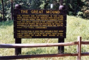
Mounds (Indiana) - Great Mound submitted by DocRock : Indiana State Park informational sign located at the entrance ramp into the platform enclosed in the circular henge at Mounds State Park, Anderson, Indiana.

Mounds (Indiana) - Great Mound
Mounds (Indiana) - Great Mound submitted by bat400 : Mounds State Park. Simplified topographic diagram of the Great Mound in the Visitors Center, shows alignments to the surrounding mounds and solar and stellar events. Photo: bat400 Oct 2006.

Mounds (Indiana) - Great Mound
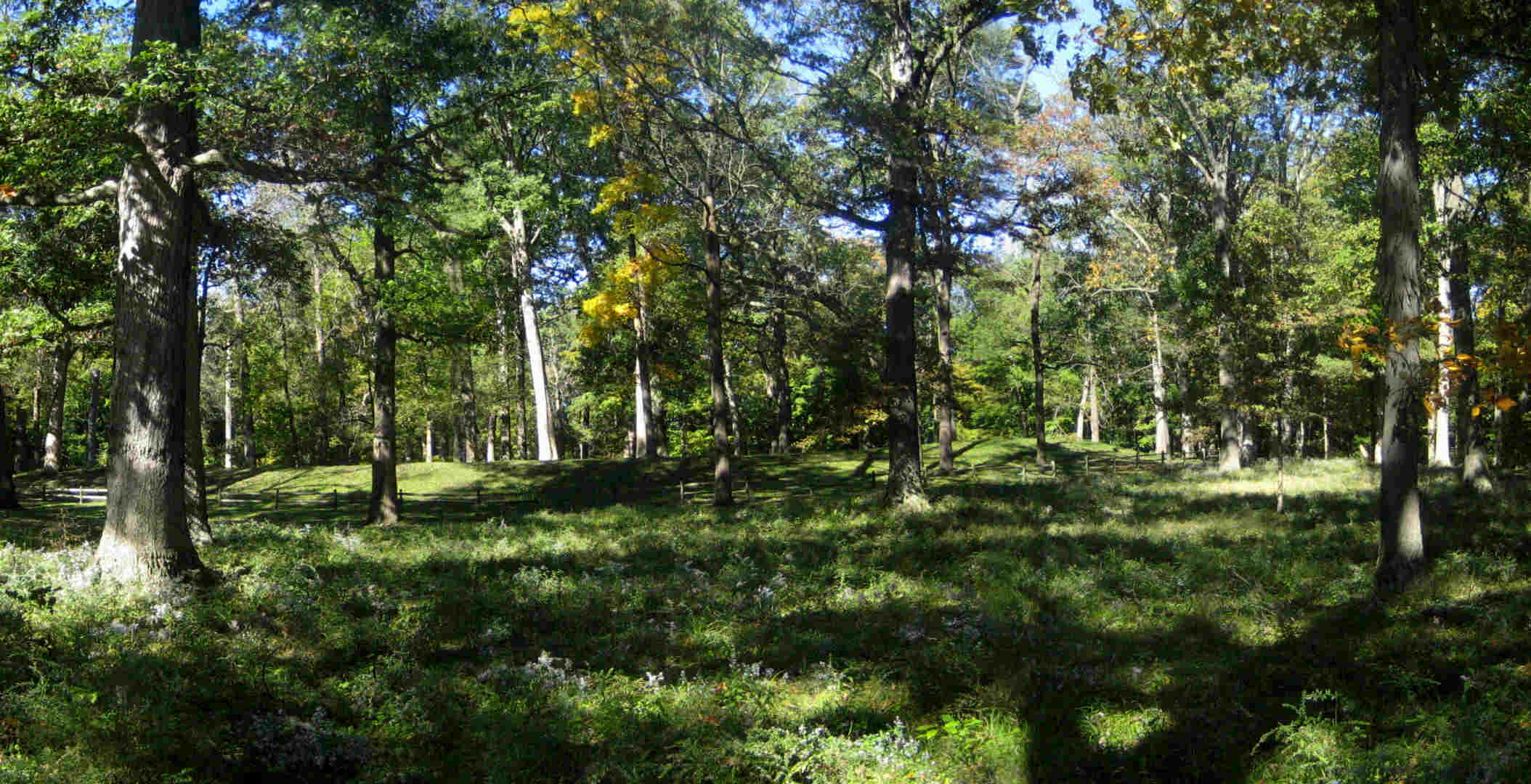
Mounds (Indiana) - Great Mound submitted by bat400 : Mounds - The Great Mound. Stitched photo taken from the southern entrance to the enclosure. Photo: bat400 Oct 2006.

Mounds (Indiana) - Great Mound
Mounds (Indiana) - Great Mound submitted by bat400 : Mounds - The Great Mound. The outer embankment is made from the spoil of the ditch that surrounds the central area. Photo: bat400 Oct 2006.

Do not use the above information on other web sites or publications without permission of the contributor.
Click here to see more info for this site

Nearby sites

Click here to view sites on an interactive map of the area

Key: Red: member's photo, Blue: 3rd party photo, Yellow: other image, Green: no photo - please go there and take one, Grey: site destroyed

Download sites to:
KML (Google Earth)
GPX (GPS waypoints)
CSV (Garmin/Navman)
CSV (Excel)

To unlock full downloads you need to sign up as a Contributory Member. Otherwise downloads are limited to 50 sites.


Turn off the page maps and other distractions

Nearby sites listing. In the following links * = Image available
 68m WNW 299° Mounds (Indiana) - Fiddleback Mound* Misc. Earthwork
 86m SE 142° Mounds (Indiana) - Earthwork B* Misc. Earthwork
 129m WSW 237° Mounds State Park (Indiana) - Earthwork D* Misc. Earthwork
 277m NE 53° Mounds (Indiana)* Henge
 994m NNE 18° Mounds (Indiana) - Circle Mound* Misc. Earthwork
 16.2km NE 54° Yorktown Enclosure Misc. Earthwork
 27.2km ESE 121° New Castle Complex* Henge
 28.1km W 278° Castor Farm Ancient Village or Settlement
 28.2km W 277° Strawtown Enclosure* Ancient Village or Settlement
 29.3km SE 134° Chrysler Enclosure* Henge
 36.0km E 79° Windsor Mound* Artificial Mound
 48.3km SE 127° Cambridge City Henge Complex* Henge
 59.0km SW 232° Indiana State Museum* Museum
 69.4km ESE 104° Whitehead Mound* Artificial Mound
 94.0km SW 225° Blue Bluff Rock Outcrop
 101.8km SW 224° Bundy-Voyles Site* Ancient Village or Settlement
 103.7km SE 135° Enyart Mound* Artificial Mound
 103.9km SE 135° Reily Cemetery Mound* Artificial Mound
 119.9km SE 132° Fortified Hill Works* Hillfort
 121.4km SE 137° Dunlap Works* Artificial Mound
 122.5km SE 128° Rentschler Park Hilltop Enclosure* Hillfort
 125.8km ESE 114° Miamisburg Mound* Artificial Mound
 125.9km ESE 109° Sunwatch* Ancient Village or Settlement
 127.9km ESE 108° Calvary Cemetery Hilltop Enclosure* Hillfort
 128.0km SE 145° Conrad Mound* Artificial Mound
View more nearby sites and additional images

<< Mounds (Indiana) - Fiddleback Mound

Beinn Ghobhlach Standing Stone >>

Please add your thoughts on this site

Newgrange and the Bend of the Boyne

Newgrange and the Bend of the Boyne

Sponsors

Auto-Translation (Google)

Translate from English into:

"Mounds (Indiana) - Great Mound" | Login/Create an Account | 6 News and Comments
  
Go back to top of page    Comments are owned by the poster. We aren't responsible for their content.
Re: Mounds (Indiana) - Great Mound by stonetracker on Tuesday, 24 October 2023
(User Info | Send a Message)
Video commentary Part 2 here:

photos.app.goo.gl/8SzYWCt1V7RQM5Zm8
[ Reply to This ]

Re: Mounds - Great Mound by stonetracker on Tuesday, 24 October 2023
(User Info | Send a Message)
Video commentary Part 1 here:

photos.app.goo.gl/i18KEmZymZgNAJ6R6
[ Reply to This ]

Re: Mounds - Great Mound by stonetracker on Monday, 23 October 2023
(User Info | Send a Message)
Changes/clarifications of note since the original description was posted:

* The entrance through the gateway into the center of the circular platform is now a raised boardwalk, suitable for handicapped and wheelchair access. This boardwalk ends in a large rectangular wooden viewing platform.

* The small mound on the central platform referenced in the description existed for some time but it is no longer visible above the surface. It is likely covered by feet of topsoil.

[ Reply to This ]

The Bronnenburg Family and the sites at Mound State Park by bat400 on Monday, 11 June 2012
(User Info | Send a Message)
In addition to the ancient mounds (henges) at the park, you will see the Bronnenburg farm house.

The Bronnenburgs settled this area in the earth 19th century (when the oxen pulling their wagon died nearby.) This house dates from the 1840s. They had title to 600 acres, and maintained the earthwork enclosures on their land free from farming and excavation. The property sold in 1897 to a private interurban company. The trolley stop they built here was developed as a tourist attraction, including restaurant, dance hall, amusement games and rides. Surprisingly even this development did not have a major impact of the earthworks and the financial disaster of the 1928 broke the company. The land was purchased by the state in 1930.
[ Reply to This ]

Re: Mounds - Great Mound by bat400 on Saturday, 29 December 2007
(User Info | Send a Message)
Revision of my May 2007 comment.

The "anonymous" commenter of 2 May 2007 is supplying an unsupported libel of researchers at Ball State University. The Cochran and McCord report (2001) of excavations at Mounds from late 1980's describe that the alignments to the winter and summer solstice were investigated following a 1988 identification that the lower walls of the Great Mound enclosure allowing sight lines to the alignment features. (This was later given greater credence by the excavation of earlier dated posthole marks at the center of the Great Mound, also indicating alignments - perhaps multiple ones.) I do not have any data of when any Ball State researcher first published or publicly announced the alignments, although there was a 1988 published report.

I've recently [May 2007] read Ervin Davis's 1996 Archaeology Notes on the web, where he implicates university researchers of publishing his previously found alignments. However, Davis names no names and gives only general dates (the 1980's) for when he discussed his findings with others. If "professors" did steal his work, I'm surprised that Davis did not name names, but without further information, we're in no position judge the validity of a prior claim.

Davis also seems to imply that Bradley Lepper's discussions of the Hopewell Road between Newark and the Mound City Group may have also been based on his [Davis's] work - although I may be reading too much into Davis' paper. The "Hopewell Road" was first described and speculated on by surveyors of mound sites going back to Squire and Davis and the Salsbury map; Lepper has only championed the idea and looked for more physical evidence. So perhaps I am misreading Davis's comment - perhaps it was only meant as a wry comment that he was ahead of his time.

The largest mound at the New Castle Site was destroyed to create a parking area and building site for a medical facility. This was prior to the excavations by Swartz in the 1970's, published in 1976. Can you [anonymous] supply any additional information for your statement that Ball State (or other another university) "destroyed the largest mound at new castle"? By this I am assuming that you mean the largest original mound on the far west of the complex. The largest mound excavated in the 1976's dig would appear to the the pandural mound on the north east side of the complex. It is still there; I visited there [fall 2006].

You are absolutely correct that there are many, many examples of university researchers completely leveling mounds in order to study them. However, a very great many of these examples in the United States are 50 years old or older - or, they are examples of salvage archaeology where the site was about to be destroyed for development. Very sad, and still going on.

If your condemnation of all university researchers includes any excavation at all as destruction, then yes - these sites are still being excavated. And such excavations continue to tell us more about pre-contact peoples.
[ Reply to This ]

Re: Mounds - Great Mound by Anonymous on Wednesday, 02 May 2007

It was discovered by Ervin Davis that the earthworks surrounding the large henge at Mounds State Park were aligned to the summer and winter solstice. Unforunatley, he made the mistake of going to Ball State University, where he told Donald Cochran who subsequently wrote a paper and took credit for the find, never mentioning Davis in his work.
Ball State University is the leader in the destruction of mound and earthworks in Indiana. They have desroyed the largest mound at new castle, Indiana that is aligned with another mound to the equinox.
The greatest threat to mounds and earthworks in the Ohio valley are the university grave robbers.
[ Reply to This ]

Your Name: Anonymous [ Register Now ]
Subject:


Add your comment or contribution to this page. Spam or offensive posts are deleted immediately, don't even bother

<<< What is five plus one as a number? (Please type the answer to this question in the little box on the left)
You can also embed videos and other things. For Youtube please copy and paste the 'embed code'.
For Google Street View please include Street View in the text.
Create a web link like this: <a href="https://www.megalithic.co.uk">This is a link</a>  

Allowed HTML is:
<p> <b> <i> <a> <img> <em> <br> <strong> <blockquote> <tt> <li> <ol> <ul> <object> <param> <embed> <iframe>

We would like to know more about this location. Please feel free to add a brief description and any relevant information in your own language.
Wir möchten mehr über diese Stätte erfahren. Bitte zögern Sie nicht, eine kurze Beschreibung und relevante Informationen in Deutsch hinzuzufügen.
Nous aimerions en savoir encore un peu sur les lieux. S'il vous plaît n'hesitez pas à ajouter une courte description et tous les renseignements pertinents dans votre propre langue.
Quisieramos informarnos un poco más de las lugares. No dude en añadir una breve descripción y otros datos relevantes en su propio idioma.