

<< Text Pages >> Grand Island - Ancient Village or Settlement in United States in Great Lakes Midwest
Submitted by bat400 on Saturday, 27 February 2010 Page Views: 5084
Multi-periodSite Name: Grand Island Alternative Name: Popper SiteCountry: United States
NOTE: This site is 64.106 km away from the location you searched for.
Region: Great Lakes Midwest Type: Ancient Village or Settlement
Nearest Town: Marquette, MI Nearest Village: Munsing, MI
Latitude: 46.472000N Longitude: 86.657W
Condition:
| 5 | Perfect |
| 4 | Almost Perfect |
| 3 | Reasonable but with some damage |
| 2 | Ruined but still recognisable as an ancient site |
| 1 | Pretty much destroyed, possibly visible as crop marks |
| 0 | No data. |
| -1 | Completely destroyed |
| 5 | Superb |
| 4 | Good |
| 3 | Ordinary |
| 2 | Not Good |
| 1 | Awful |
| 0 | No data. |
| 5 | Can be driven to, probably with disabled access |
| 4 | Short walk on a footpath |
| 3 | Requiring a bit more of a walk |
| 2 | A long walk |
| 1 | In the middle of nowhere, a nightmare to find |
| 0 | No data. |
| 5 | co-ordinates taken by GPS or official recorded co-ordinates |
| 4 | co-ordinates scaled from a detailed map |
| 3 | co-ordinates scaled from a bad map |
| 2 | co-ordinates of the nearest village |
| 1 | co-ordinates of the nearest town |
| 0 | no data |
Internal Links:
External Links:
Ancient Settlement in Alger County, Michigan.
Several Archaic and Paleo-Indian sites on Murray Bay have been excavated to determine dates of occupations (some as much as 5000 years old), settlement patterns, tool use, and hunting and gathering evidence.
Unless a field school is in progress there is little to see of the archaeology of Grand Island, but the National Recreation Area remains a beautiful location for hiking, camping, kayaking, and fishing.
The island is accessible by ferry. Bikes can be brought or rented on site. There is also a bus tour. Sights include the colored sandstone cliffs of the adjacent Pictured Rocks National Lakeshore.
You may be viewing yesterday's version of this page. To see the most up to date information please register for a free account.
Do not use the above information on other web sites or publications without permission of the contributor.
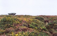
Nearby Images from Flickr
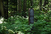
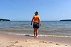
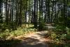
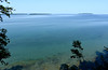
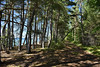
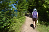
The above images may not be of the site on this page, but were taken nearby. They are loaded from Flickr so please click on them for image credits.
Click here to see more info for this site
Nearby sites
Click here to view sites on an interactive map of the areaKey: Red: member's photo, Blue: 3rd party photo, Yellow: other image, Green: no photo - please go there and take one, Grey: site destroyed
Download sites to:
KML (Google Earth)
GPX (GPS waypoints)
CSV (Garmin/Navman)
CSV (Excel)
To unlock full downloads you need to sign up as a Contributory Member. Otherwise downloads are limited to 50 sites.
Turn off the page maps and other distractions
Nearby sites listing. In the following links * = Image available
119.1km SE 132° Beaver Island Mound* Artificial Mound
120.5km SE 137° Beaver Island Stone Circle Stone Circle
153.1km SSW 201° Chambers Island Mounds* Artificial Mound
166.4km ESE 117° Old Fort Mackinac Mounds* Artificial Mound
205.2km SSE 156° Underwater Stone Circle nr Traverse City Stone Circle
227.4km ESE 118° Ocquecoc River Mound* Artificial Mound
251.3km NW 309° Triangle Island Mound, Isle Royale* Artificial Mound
351.6km SE 133° Ottawa Point Mound* Artificial Mound
354.2km SSW 200° Lizard Mound State Park* Artificial Mound
369.7km SW 227° Cranberry Creek Mound Group Artificial Mound
369.9km SSW 206° Nitschke Mounds State Park Artificial Mound
397.7km ESE 123° Alpena-Amberley Ridge Game Drives* Ancient Mine, Quarry or other Industry
400.1km S 169° Norton Mounds Barrow Cemetery
404.7km SSW 198° Cutler Mound Group* Artificial Mound
407.7km SW 217° Man Mound Park* Artificial Mound
416.4km SW 216° Devil's Lake Mounds* Artificial Mound
416.9km SSW 205° Aztalan State Park* Ancient Village or Settlement
416.9km SW 231° Fort McCoy Artificial Mound
424.4km SE 136° Sanilac Petroglyphs Historic State Park* Rock Art
427.1km SSW 193° Mound Cemetery (Racine) Barrow Cemetery
437.2km SSW 205° The Finch Site Ancient Village or Settlement
437.7km SSW 211° Forest Hill Cemetery* Artificial Mound
437.7km SSW 205° Lake Koshkonong Mounds* Artificial Mound
455.6km SW 215° Circle Sanctuary Nature Preserve* Modern Stone Circle etc
456.6km SW 215° Brighid's Spring at Circle Sanctuary* Holy Well or Sacred Spring
View more nearby sites and additional images


 We would like to know more about this location. Please feel free to add a brief description and any relevant information in your own language.
 Wir möchten mehr über diese Stätte erfahren. Bitte zögern Sie nicht, eine kurze Beschreibung und relevante Informationen in Deutsch hinzuzufügen.
 Nous aimerions en savoir encore un peu sur les lieux. S'il vous plaît n'hesitez pas à ajouter une courte description et tous les renseignements pertinents dans votre propre langue.
 Quisieramos informarnos un poco más de las lugares. No dude en añadir una breve descripción y otros datos relevantes en su propio idioma.