


<< Image Pages >> Ottawa Point Mound - Artificial Mound in United States in Great Lakes Midwest
Submitted by durhamnature on Wednesday, 20 February 2013 Page Views: 2788
Pre-ColumbianSite Name: Ottawa Point MoundCountry: United States
NOTE: This site is 26.718 km away from the location you searched for.
Region: Great Lakes Midwest Type: Artificial Mound
Nearest Town: Tawas City
Latitude: 44.250794N Longitude: 83.452535W
Condition:
| 5 | Perfect |
| 4 | Almost Perfect |
| 3 | Reasonable but with some damage |
| 2 | Ruined but still recognisable as an ancient site |
| 1 | Pretty much destroyed, possibly visible as crop marks |
| 0 | No data. |
| -1 | Completely destroyed |
| 5 | Superb |
| 4 | Good |
| 3 | Ordinary |
| 2 | Not Good |
| 1 | Awful |
| 0 | No data. |
| 5 | Can be driven to, probably with disabled access |
| 4 | Short walk on a footpath |
| 3 | Requiring a bit more of a walk |
| 2 | A long walk |
| 1 | In the middle of nowhere, a nightmare to find |
| 0 | No data. |
| 5 | co-ordinates taken by GPS or official recorded co-ordinates |
| 4 | co-ordinates scaled from a detailed map |
| 3 | co-ordinates scaled from a bad map |
| 2 | co-ordinates of the nearest village |
| 1 | co-ordinates of the nearest town |
| 0 | no data |
Internal Links:
External Links:
")
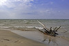
Indian mound on Ottawa Point, Lake Huron, Michigan.
This is a very striking and scenic location. It is now a popular walking and recreational area.
You may be viewing yesterday's version of this page. To see the most up to date information please register for a free account.
Do not use the above information on other web sites or publications without permission of the contributor.
Nearby Images from Flickr
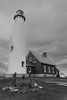
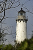
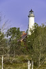
The above images may not be of the site on this page, but were taken nearby. They are loaded from Flickr so please click on them for image credits.
Click here to see more info for this site
Nearby sites
Click here to view sites on an interactive map of the areaKey: Red: member's photo, Blue: 3rd party photo, Yellow: other image, Green: no photo - please go there and take one, Grey: site destroyed
Download sites to:
KML (Google Earth)
GPX (GPS waypoints)
CSV (Garmin/Navman)
CSV (Excel)
To unlock full downloads you need to sign up as a Contributory Member. Otherwise downloads are limited to 50 sites.
Turn off the page maps and other distractions
Nearby sites listing. In the following links * = Image available
75.4km SSE 152° Sanilac Petroglyphs Historic State Park* Rock Art
82.7km ENE 74° Alpena-Amberley Ridge Game Drives* Ancient Mine, Quarry or other Industry
146.3km NNW 341° Ocquecoc River Mound* Artificial Mound
160.5km SSE 149° Mound at Head of St Clair River* Artificial Mound
169.3km SE 132° Davidson Ancient Village or Settlement
181.5km WNW 289° Underwater Stone Circle nr Traverse City Stone Circle
184.6km SSE 164° Riviere Au Vase Artificial Mound
198.3km NNW 330° Old Fort Mackinac Mounds* Artificial Mound
213.7km S 170° The Manitou Idol Sculptured Stone
218.8km S 172° Fort Wayne Mound Site Artificial Mound
219.2km S 173° Great Mound, River Rouge* Artificial Mound
231.5km NW 314° Beaver Island Stone Circle Stone Circle
232.6km NW 316° Beaver Island Mound* Artificial Mound
234.3km SW 232° Norton Mounds Barrow Cemetery
311.0km S 170° Danbury Site Ancient Village or Settlement
325.2km WNW 290° Chambers Island Mounds* Artificial Mound
346.4km ENE 78° Lewiston Mound State Park* Artificial Mound
351.6km NW 316° Grand Island Ancient Village or Settlement
375.5km SSE 157° Paleo Crossing Ancient Village or Settlement
385.8km WSW 259° Lizard Mound State Park* Artificial Mound
390.7km WSW 246° Mound Cemetery (Racine) Barrow Cemetery
396.2km SW 223° Goodall Site* Barrow Cemetery
396.7km E 85° Jacob's Island Mound Barrow Cemetery
408.7km WSW 252° Cutler Mound Group* Artificial Mound
410.6km SSE 156° Nobles Pond* Ancient Village or Settlement
View more nearby sites and additional images


 We would like to know more about this location. Please feel free to add a brief description and any relevant information in your own language.
 Wir möchten mehr über diese Stätte erfahren. Bitte zögern Sie nicht, eine kurze Beschreibung und relevante Informationen in Deutsch hinzuzufügen.
 Nous aimerions en savoir encore un peu sur les lieux. S'il vous plaît n'hesitez pas à ajouter une courte description et tous les renseignements pertinents dans votre propre langue.
 Quisieramos informarnos un poco más de las lugares. No dude en añadir una breve descripción y otros datos relevantes en su propio idioma.