


<< Our Photo Pages >> Fort Ancient - Moorehead Circle - Timber Circle in United States in Great Lakes Midwest
Submitted by bat400 on Wednesday, 02 January 2013 Page Views: 8374
Neolithic and Bronze AgeSite Name: Fort Ancient - Moorehead Circle Alternative Name: Moorehead Circle WoodhengeCountry: United States Region: Great Lakes Midwest Type: Timber Circle
Nearest Town: Lebanon, Ohio Nearest Village: Oregonia, Ohio
Latitude: 39.406800N Longitude: 84.0909W
Condition:
| 5 | Perfect |
| 4 | Almost Perfect |
| 3 | Reasonable but with some damage |
| 2 | Ruined but still recognisable as an ancient site |
| 1 | Pretty much destroyed, possibly visible as crop marks |
| 0 | No data. |
| -1 | Completely destroyed |
| 5 | Superb |
| 4 | Good |
| 3 | Ordinary |
| 2 | Not Good |
| 1 | Awful |
| 0 | No data. |
| 5 | Can be driven to, probably with disabled access |
| 4 | Short walk on a footpath |
| 3 | Requiring a bit more of a walk |
| 2 | A long walk |
| 1 | In the middle of nowhere, a nightmare to find |
| 0 | No data. |
| 5 | co-ordinates taken by GPS or official recorded co-ordinates |
| 4 | co-ordinates scaled from a detailed map |
| 3 | co-ordinates scaled from a bad map |
| 2 | co-ordinates of the nearest village |
| 1 | co-ordinates of the nearest town |
| 0 | no data |
Internal Links:
External Links:
I have visited· I would like to visit
bat400 has visited here
")
The complex site, has a triple circle of post holes with a central, rectangular pit filled with red, burned soil, 2.5-foot-deep pit that was 15 feet long by 13 feet wide.
Moorehead Circle has been the focus of yearly excavations led by Robert Riordan, an anthropology professor at Wright State University. The feature was named by Riordan in honor of pioneering archaeologist Warren K. Moorehead.
[Information from The Ohio Archaeology Blog, National Geographic, and other sources.]
Note: Richard Riordan describes Moorehead Circle Woodhenge as Hopewell "Ceremonial Machine." See comments from reports by Bradley Lepper.
You may be viewing yesterday's version of this page. To see the most up to date information please register for a free account.
")
")
Do not use the above information on other web sites or publications without permission of the contributor.
Nearby Images from Flickr

The above images may not be of the site on this page, but were taken nearby. They are loaded from Flickr so please click on them for image credits.
Click here to see more info for this site
Nearby sites
Click here to view sites on an interactive map of the areaKey: Red: member's photo, Blue: 3rd party photo, Yellow: other image, Green: no photo - please go there and take one, Grey: site destroyed
Download sites to:
KML (Google Earth)
GPX (GPS waypoints)
CSV (Garmin/Navman)
CSV (Excel)
To unlock full downloads you need to sign up as a Contributory Member. Otherwise downloads are limited to 50 sites.
Turn off the page maps and other distractions
Nearby sites listing. In the following links * = Image available
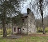
80m ENE 74° Fort Ancient* Hillfort
14.4km ENE 66° Hillside Haven Mound* Artificial Mound
24.0km NE 49° Keiter Mound* Artificial Mound
29.5km NNW 327° Miamisburg Mound* Artificial Mound
30.7km SSW 213° Millford Earthworks Circle Diverging Lines* Hill Figure or Geoglyph
33.0km ESE 109° Ratcliffe Mound Artificial Mound
34.2km WSW 242° Mathew Mound* Artificial Mound
34.5km W 272° Rentschler Park Hilltop Enclosure* Hillfort
36.5km NNW 341° Sunwatch* Ancient Village or Settlement
36.9km NNW 345° Calvary Cemetery Hilltop Enclosure* Hillfort
37.0km SW 230° Benham Mound* Artificial Mound
38.5km SW 216° Odd Fellows' Cemetery Mound* Artificial Mound
39.5km SE 143° Fort Salem Misc. Earthwork
40.5km SW 229° Norwood Mound* Artificial Mound
41.5km N 1° Wright-Patterson Air Force Base Mounds Artificial Mound
43.2km N 0° Wright Brothers Memorial Group Artificial Mound
43.4km NNE 31° Pollock Works* Misc. Earthwork
43.4km W 264° Fortified Hill Works* Hillfort
43.5km NNE 32° Pollock Works Artificial Mound
43.7km NNE 31° Wiliamson Mound* Misc. Earthwork
47.8km NNE 22° Orators Mound Artificial Mound
50.1km WSW 256° Dunlap Works* Artificial Mound
54.3km NNE 15° Enon Mound* Artificial Mound
57.9km W 273° Enyart Mound* Artificial Mound
58.3km W 273° Reily Cemetery Mound* Artificial Mound
View more nearby sites and additional images


 We would like to know more about this location. Please feel free to add a brief description and any relevant information in your own language.
 Wir möchten mehr über diese Stätte erfahren. Bitte zögern Sie nicht, eine kurze Beschreibung und relevante Informationen in Deutsch hinzuzufügen.
 Nous aimerions en savoir encore un peu sur les lieux. S'il vous plaît n'hesitez pas à ajouter une courte description et tous les renseignements pertinents dans votre propre langue.
 Quisieramos informarnos un poco más de las lugares. No dude en añadir una breve descripción y otros datos relevantes en su propio idioma.