<< Other Photo Pages >> Keiter Mound - Artificial Mound in United States in Great Lakes Midwest
Submitted by AKFisher on Wednesday, 16 August 2023 Page Views: 114
Pre-ColumbianSite Name: Keiter Mound Alternative Name: 33-CN-15Country: United States
NOTE: This site is 12.793 km away from the location you searched for.
Region: Great Lakes Midwest Type: Artificial Mound
Nearest Town: Wilmington, OH
Latitude: 39.548500N Longitude: 83.87945W
Condition:
| 5 | Perfect |
| 4 | Almost Perfect |
| 3 | Reasonable but with some damage |
| 2 | Ruined but still recognisable as an ancient site |
| 1 | Pretty much destroyed, possibly visible as crop marks |
| 0 | No data. |
| -1 | Completely destroyed |
| 5 | Superb |
| 4 | Good |
| 3 | Ordinary |
| 2 | Not Good |
| 1 | Awful |
| 0 | No data. |
| 5 | Can be driven to, probably with disabled access |
| 4 | Short walk on a footpath |
| 3 | Requiring a bit more of a walk |
| 2 | A long walk |
| 1 | In the middle of nowhere, a nightmare to find |
| 0 | No data. |
| 5 | co-ordinates taken by GPS or official recorded co-ordinates |
| 4 | co-ordinates scaled from a detailed map |
| 3 | co-ordinates scaled from a bad map |
| 2 | co-ordinates of the nearest village |
| 1 | co-ordinates of the nearest town |
| 0 | no data |
Internal Links:
External Links:

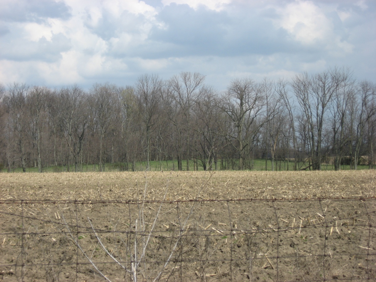
Due to its location, the Keiter Mound is believed to be a work of Hopewellian peoples. Unlike many Hopewell sites, such as the Newark Earthworks or Mound City, the Keiter Mound is isolated: no other mounds and no large geometric earthworks are located nearby. As such, it is likely to have been created by small groups of transient hunters who camped in the valley below. This identification is based on the mound's location and comparison with similar mounds: as the mound has never been substantially excavated, it likely holds the same grave goods as it did when it was constructed thousands of years ago.[4] The top is flat and slightly scarred, possibly from an early excavation, but for all practical purposes the mound is in pristine condition.[2] For this reason, it is a significant archaeological site: it is an unusually well preserved example of isolate Hopewell construction and might be able to yield important information about the Hopewell way of life.[4] In recognition of its archaeological significance, the Keiter Mound was listed on the National Register of Historic Places in 1975.[1]
References:
1. National Register Information System. National Register of Historic Places. National Park Service. March 13, 2009.
2. Koleszar, Stephen C. An Archaeological Survey of Southwestern Ohio. Columbus: Ohio Historical Society, 1970, 15.
3. 44 FR 7553
4. Owen, Lorrie K., ed. Dictionary of Ohio Historic Places. Vol. 2. St. Clair Shores: Somerset, 1999, 151.
Further reading and information: Wikipedia
Directions: From Wilmington, OH via US-68 N, 9 mi.
You may be viewing yesterday's version of this page. To see the most up to date information please register for a free account.
Do not use the above information on other web sites or publications without permission of the contributor.
Nearby Images from Flickr


The above images may not be of the site on this page, but were taken nearby. They are loaded from Flickr so please click on them for image credits.
Click here to see more info for this site
Nearby sites
Click here to view sites on an interactive map of the areaKey: Red: member's photo, Blue: 3rd party photo, Yellow: other image, Green: no photo - please go there and take one, Grey: site destroyed
Download sites to:
KML (Google Earth)
GPX (GPS waypoints)
CSV (Garmin/Navman)
CSV (Excel)
To unlock full downloads you need to sign up as a Contributory Member. Otherwise downloads are limited to 50 sites.
Turn off the page maps and other distractions
Nearby sites listing. In the following links * = Image available
11.2km SSW 206° Hillside Haven Mound* Artificial Mound
21.7km NNE 12° Pollock Works* Misc. Earthwork
21.8km NNE 13° Pollock Works Artificial Mound
22.2km NNE 11° Wiliamson Mound* Misc. Earthwork
24.0km SW 229° Fort Ancient* Hillfort
24.0km SW 229° Fort Ancient - Moorehead Circle* Timber Circle
28.6km N 359° Orators Mound Artificial Mound
29.8km SSE 154° Ratcliffe Mound Artificial Mound
30.9km NNW 326° Wright-Patterson Air Force Base Mounds Artificial Mound
32.8km NNW 327° Wright Brothers Memorial Group Artificial Mound
34.0km NW 306° Calvary Cemetery Hilltop Enclosure* Hillfort
35.4km WNW 285° Miamisburg Mound* Artificial Mound
35.5km WNW 302° Sunwatch* Ancient Village or Settlement
37.0km N 353° Enon Mound* Artificial Mound
47.5km S 173° Fort Salem Misc. Earthwork
54.2km SW 220° Millford Earthworks Circle Diverging Lines* Hill Figure or Geoglyph
54.5km WSW 255° Rentschler Park Hilltop Enclosure* Hillfort
57.9km WSW 237° Mathew Mound* Artificial Mound
61.0km SW 230° Benham Mound* Artificial Mound
61.5km ESE 105° Frankfort Works Mound* Ancient Village or Settlement
62.2km SW 221° Odd Fellows' Cemetery Mound* Artificial Mound
63.1km SE 140° Fort Hill* Hillfort
64.5km SW 229° Norwood Mound* Artificial Mound
64.6km WSW 252° Fortified Hill Works* Hillfort
66.4km ESE 121° Seip Mound* Artificial Mound
View more nearby sites and additional images


 We would like to know more about this location. Please feel free to add a brief description and any relevant information in your own language.
 Wir möchten mehr über diese Stätte erfahren. Bitte zögern Sie nicht, eine kurze Beschreibung und relevante Informationen in Deutsch hinzuzufügen.
 Nous aimerions en savoir encore un peu sur les lieux. S'il vous plaît n'hesitez pas à ajouter une courte description et tous les renseignements pertinents dans votre propre langue.
 Quisieramos informarnos un poco más de las lugares. No dude en añadir una breve descripción y otros datos relevantes en su propio idioma.