

<< Text Pages >> Biltmore Mound - Artificial Mound in United States in The South
Submitted by bat400 on Tuesday, 19 August 2008 Page Views: 9271
Pre-ColumbianSite Name: Biltmore MoundCountry: United States Region: The South Type: Artificial Mound
Nearest Town: Ashville, NC
Latitude: 35.540000N Longitude: 82.553W
Condition:
| 5 | Perfect |
| 4 | Almost Perfect |
| 3 | Reasonable but with some damage |
| 2 | Ruined but still recognisable as an ancient site |
| 1 | Pretty much destroyed, possibly visible as crop marks |
| 0 | No data. |
| -1 | Completely destroyed |
| 5 | Superb |
| 4 | Good |
| 3 | Ordinary |
| 2 | Not Good |
| 1 | Awful |
| 0 | No data. |
| 5 | Can be driven to, probably with disabled access |
| 4 | Short walk on a footpath |
| 3 | Requiring a bit more of a walk |
| 2 | A long walk |
| 1 | In the middle of nowhere, a nightmare to find |
| 0 | No data. |
| 5 | co-ordinates taken by GPS or official recorded co-ordinates |
| 4 | co-ordinates scaled from a detailed map |
| 3 | co-ordinates scaled from a bad map |
| 2 | co-ordinates of the nearest village |
| 1 | co-ordinates of the nearest town |
| 0 | no data |
Be the first person to rate this site - see the 'Contribute!' box in the right hand menu.
Internal Links:
External Links:
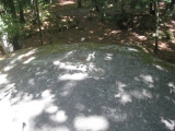
Artificial Mound in Buncombe County, North Carolina.
Woodland era mound (200-500AD) covering approximately 1000 sq feet in area, but much reduced from its original height. The mound is thought to have been built by the culture group known as the Connestee, contemporaries of the Hopewell culture centered in Ohio.
The location given is general for the historic Biltmore Estate. This mound is included on some tours of the grounds. Otherwise the site is not accessible.
You may be viewing yesterday's version of this page. To see the most up to date information please register for a free account.
Do not use the above information on other web sites or publications without permission of the contributor.
Nearby Images from Flickr

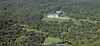
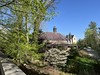

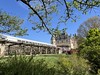
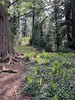
The above images may not be of the site on this page, but were taken nearby. They are loaded from Flickr so please click on them for image credits.
Click here to see more info for this site
Nearby sites
Click here to view sites on an interactive map of the areaKey: Red: member's photo, Blue: 3rd party photo, Yellow: other image, Green: no photo - please go there and take one, Grey: site destroyed
Download sites to:
KML (Google Earth)
GPX (GPS waypoints)
CSV (Garmin/Navman)
CSV (Excel)
To unlock full downloads you need to sign up as a Contributory Member. Otherwise downloads are limited to 50 sites.
Turn off the page maps and other distractions
Nearby sites listing. In the following links * = Image available
28.0km ESE 106° Chimney Rock (North Carolina)* Natural Stone / Erratic / Other Natural Feature
46.5km NNW 328° Hot Springs (North Carolina)* Holy Well or Sacred Spring
57.3km WSW 243° Judaculla Rock* Rock Art
69.3km W 265° Museum of the Cherokee Indian* Museum
69.9km SSW 193° South Carolina Rock Art Center* Rock Art
77.6km W 262° Kituwah* Ancient Village or Settlement
84.2km WSW 242° Nikwasi Mound* Artificial Mound
84.3km WSW 249° Cowee Mound Artificial Mound
88.8km NE 46° Split Rock / Sphinx Rock* Natural Stone / Erratic / Other Natural Feature
103.0km NE 50° The Blowing Rock* Natural Stone / Erratic / Other Natural Feature
115.9km WSW 259° Sculptured Stone near Robbinsville* Sculptured Stone
132.2km WNW 291° McClung Museum of Natural History and Culture* Museum
132.8km NNE 24° Cornelius Ancient Village or Settlement
133.1km WNW 290° University of Tennessee Agriculture Farm Mound* Barrow Cemetery
139.4km SW 227° Sautee-Nacoochee earthwork Ancient Village or Settlement
140.0km SW 227° Kenimer* Artificial Mound
140.4km WSW 239° Track Rock Gap Archaeological Area* Stone Row / Alignment
140.6km WSW 239° Track Rock* Rock Art
141.9km SW 228° Nacoochee* Barrow Cemetery
143.9km SW 231° Hickorynut Track Rock* Rock Art
145.4km NNW 329° Ely Mound* Artificial Mound
148.7km SSW 192° Georgia Guidestones* Modern Stone Circle etc
165.4km ESE 108° Big Rock, Charlotte NC Natural Stone / Erratic / Other Natural Feature
183.6km SSW 204° Sandy Creek terrace complex* Ancient Village or Settlement
209.6km NNW 329° Red Bird Petroglyphs Rock Art
View more nearby sites and additional images


 We would like to know more about this location. Please feel free to add a brief description and any relevant information in your own language.
 Wir möchten mehr über diese Stätte erfahren. Bitte zögern Sie nicht, eine kurze Beschreibung und relevante Informationen in Deutsch hinzuzufügen.
 Nous aimerions en savoir encore un peu sur les lieux. S'il vous plaît n'hesitez pas à ajouter une courte description et tous les renseignements pertinents dans votre propre langue.
 Quisieramos informarnos un poco más de las lugares. No dude en añadir una breve descripción y otros datos relevantes en su propio idioma.