


<< Image Pages >> Mill Cove Complex - Artificial Mound in United States in The South
Submitted by AKFisher on Sunday, 30 July 2023 Page Views: 449
Pre-ColumbianSite Name: Mill Cove Complex Alternative Name: Shields Mound, Grant MoundCountry: United States
NOTE: This site is 54.132 km away from the location you searched for.
Region: The South Type: Artificial Mound
Nearest Town: Jacksonville, FL
Latitude: 30.372870N Longitude: 81.569W
Condition:
| 5 | Perfect |
| 4 | Almost Perfect |
| 3 | Reasonable but with some damage |
| 2 | Ruined but still recognisable as an ancient site |
| 1 | Pretty much destroyed, possibly visible as crop marks |
| 0 | No data. |
| -1 | Completely destroyed |
| 5 | Superb |
| 4 | Good |
| 3 | Ordinary |
| 2 | Not Good |
| 1 | Awful |
| 0 | No data. |
| 5 | Can be driven to, probably with disabled access |
| 4 | Short walk on a footpath |
| 3 | Requiring a bit more of a walk |
| 2 | A long walk |
| 1 | In the middle of nowhere, a nightmare to find |
| 0 | No data. |
| 5 | co-ordinates taken by GPS or official recorded co-ordinates |
| 4 | co-ordinates scaled from a detailed map |
| 3 | co-ordinates scaled from a bad map |
| 2 | co-ordinates of the nearest village |
| 1 | co-ordinates of the nearest town |
| 0 | no data |
Be the first person to rate this site - see the 'Contribute!' box in the right hand menu.
Internal Links:
External Links:
")
From Wikipedia:
The Mill Cove Complex is a group of prehistoric archaeological sites located in Duval County, Florida built by people of the St. Johns culture approximately 900 to 1250 CE. The site encompasses two sand mounds, Grant Mound (8DU14) and the contemporaneous Shields Mound (8DU12) located 750 metres (0.47 mi) away, and an area in between the two which is full of St. Johns culture midden deposits.
Shields Mound
The mound is a mortuary structure first excavated in 1894 and 1895 by Clarence Bloomfield Moore. At the time Moore described the mound as being a slightly oblong shaped rectangular platform mound 65.2 metres (214 ft) in diameter and 5.5 metres (18 ft) in height with a summit measuring 40.5 metres (133 ft) by 35.1 metres (115 ft). There was a ramp running to the top on the north face that measured 38.2 metres (125 ft) in length by 26.7 metres (88 ft) wide. Later archaeological work in 1999-2002 determined that the mound is a burial mound and not a substructure platform mound with burials as Moore assumed. Moore found a number of exotic grave goods in the mound, including copper artifacts and several spatulate celts similar to ones found in Mississippian culture sites in other parts of the southeastern US and generally seen as elite status symbols.[1] He also found one copper plate similar to others he'd found when he excavated the Grant Mound and Mount Royal Mound, another nearby St. Johns culture sites.[2]
Grant Mound
In 1894 C. B. Moore described the mound as being a truncated cone mound 8.1 metres (27 ft) in height, with a base diameter of 65.8 metres (216 ft) a summit diameter of 7.3 metres (24 ft). When he excavated the mound he found a large number of graves and many artifacts, although all of the artifacts do not seem to be associated with burials as grave goods. The artifacts were of both local and nonlocal manufacture and included 147 polished stone celts, chipped stone tools, soapstone smoking pipes, shell drinking cups of the type used for the black drink ritual, bone pins, pottery and a variety of items made from or covered with copper. The copper items included embossed plaques, beads, two bi-conical ear spools and two long-nosed god maskettes.[1] Both the copper covered earspools and long-nosed god maskettes are rare items that have associations with the Cahokia site in western Illinois and the Southeastern Ceremonial Complex.[2]
References:
Ashley, Keith H. "Introducing Shield Mound (8DU12) and the Mill Cove Complex" (PDF). The Florida Anthropologist.
Ashley, Keith H. (2002). "On the periphery of the Early Mississippian world : Looking within and beyond Northeastern Florida" (PDF). Southeastern Archaeology. 2 (2).
Further reading and information:
https://en.wikipedia.org/wiki/Mill_Cove_Complex
https://www.unf.edu/~kashley/Other%20Files/2005-introMillC0ve.pdf
Directions: from Jacksonville via FL-115S, 8.4 mi.
You may be viewing yesterday's version of this page. To see the most up to date information please register for a free account.
Do not use the above information on other web sites or publications without permission of the contributor.
Nearby Images from Flickr
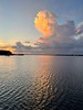
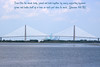


The above images may not be of the site on this page, but were taken nearby. They are loaded from Flickr so please click on them for image credits.
Click here to see more info for this site
Nearby sites
Click here to view sites on an interactive map of the areaKey: Red: member's photo, Blue: 3rd party photo, Yellow: other image, Green: no photo - please go there and take one, Grey: site destroyed
Download sites to:
KML (Google Earth)
GPX (GPS waypoints)
CSV (Garmin/Navman)
CSV (Excel)
To unlock full downloads you need to sign up as a Contributory Member. Otherwise downloads are limited to 50 sites.
Turn off the page maps and other distractions
Nearby sites listing. In the following links * = Image available
104.5km S 185° Mount Royal Site* Artificial Mound
122.3km SSE 158° Nocoroco* Ancient Village or Settlement
124.2km SSE 158° Strickland Mound Complex Barrow Cemetery
128.8km NNE 14° Sapelo Island Shell Ring Complex Ancient Village or Settlement
131.3km SSE 158° Ormond Burial Mound* Barrow Cemetery
152.1km SSE 157° Green Mound Artificial Mound
156.6km S 172° Hontoon Island State Park* Artificial Mound
162.2km SSE 157° Old Fort Mound Artificial Mound
164.7km NNE 15° Ossabaw Artificial Mound
175.7km SSE 156° Turtle Mound* Artificial Mound
177.9km S 169° Indian Mound Village Site* Artificial Mound
180.1km SSE 156° Castle Windy Artificial Mound
181.4km SSE 157° Snyder's Mound* Ancient Mine, Quarry or other Industry
182.6km NNE 16° Skidaway Shell Mound Ancient Village or Settlement
190.6km SSW 212° Crystal River Archaeological State Park* Barrow Cemetery
215.6km SSE 161° Windover (Florida)* Barrow Cemetery
232.8km W 275° Letchworth - Love Mounds Archaeological State Park* Artificial Mound
234.2km SSE 160° Brevard Museum of History and Natural Sciences* Museum
254.8km W 274° Velda Mound* Artificial Mound
259.4km SSW 206° Oelsner Indian Mound* Artificial Mound
263.5km W 274° Lake Jackson Mounds Archaeological State Park* Artificial Mound
276.2km NNE 27° Fig Island* Ring Cairn
277.6km SSE 163° Three Forks Marsh Artificial Mound
284.0km SSW 203° Safety Harbor Mound* Artificial Mound
298.4km SSW 200° Weedon Island Preserve* Barrow Cemetery
View more nearby sites and additional images


 We would like to know more about this location. Please feel free to add a brief description and any relevant information in your own language.
 Wir möchten mehr über diese Stätte erfahren. Bitte zögern Sie nicht, eine kurze Beschreibung und relevante Informationen in Deutsch hinzuzufügen.
 Nous aimerions en savoir encore un peu sur les lieux. S'il vous plaît n'hesitez pas à ajouter une courte description et tous les renseignements pertinents dans votre propre langue.
 Quisieramos informarnos un poco más de las lugares. No dude en añadir una breve descripción y otros datos relevantes en su propio idioma.