 with our Megalithic Portal iPhone app")


<< Other Photo Pages >> Snyder's Mound - Ancient Mine, Quarry or other Industry in United States in The South
Submitted by bat400 on Friday, 06 May 2011 Page Views: 3395
Multi-periodSite Name: Snyder's Mound Alternative Name: Oak Hill Mound, Seminole Rest MoundCountry: United States
NOTE: This site is 1.864 km away from the location you searched for.
Region: The South Type: Ancient Mine, Quarry or other Industry
Nearest Village: Oak Hill, FL
Latitude: 28.870300N Longitude: 80.8373W
Condition:
| 5 | Perfect |
| 4 | Almost Perfect |
| 3 | Reasonable but with some damage |
| 2 | Ruined but still recognisable as an ancient site |
| 1 | Pretty much destroyed, possibly visible as crop marks |
| 0 | No data. |
| -1 | Completely destroyed |
| 5 | Superb |
| 4 | Good |
| 3 | Ordinary |
| 2 | Not Good |
| 1 | Awful |
| 0 | No data. |
| 5 | Can be driven to, probably with disabled access |
| 4 | Short walk on a footpath |
| 3 | Requiring a bit more of a walk |
| 2 | A long walk |
| 1 | In the middle of nowhere, a nightmare to find |
| 0 | No data. |
| 5 | co-ordinates taken by GPS or official recorded co-ordinates |
| 4 | co-ordinates scaled from a detailed map |
| 3 | co-ordinates scaled from a bad map |
| 2 | co-ordinates of the nearest village |
| 1 | co-ordinates of the nearest town |
| 0 | no data |
Internal Links:
External Links:
I have visited· I would like to visit
bat400 visited on 1st Sep 2009 - their rating: Cond: 3 Amb: 4 Access: 5 See my description in the site listing. I visited very early in the morning, before any tours of the Instone house, so I am unsure if the docents or rangers provide much information about the mound or original Indian village.
")
As with many Florida mounds, early European settlers found Synder's, 13 feet high and 740 by 340 feet, to be one of the few locations high enough above the water table to build. The Instone house was built on the mound in ~1880, but the entire property was owned by the Synder family during most of the 20th century. Because the family did not further develop the property until they donated it, the mound is one of the largest undisturbed mounds in Florida. The property, Seminole Rest, is now owned and managed by the National Park Service as part of the Canaveral National Seashore. A wheelchair accessible path circles the base of the mound and leads to the house.
You may be viewing yesterday's version of this page. To see the most up to date information please register for a free account.
")
Do not use the above information on other web sites or publications without permission of the contributor.
Nearby Images from Flickr


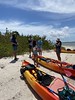
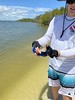

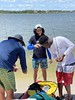
The above images may not be of the site on this page, but were taken nearby. They are loaded from Flickr so please click on them for image credits.
Click here to see more info for this site
Nearby sites
Click here to view sites on an interactive map of the areaKey: Red: member's photo, Blue: 3rd party photo, Yellow: other image, Green: no photo - please go there and take one, Grey: site destroyed
Download sites to:
KML (Google Earth)
GPX (GPS waypoints)
CSV (Garmin/Navman)
CSV (Excel)
To unlock full downloads you need to sign up as a Contributory Member. Otherwise downloads are limited to 50 sites.
Turn off the page maps and other distractions
Nearby sites listing. In the following links * = Image available
3.9km NE 47° Castle Windy Artificial Mound
6.8km N 8° Turtle Mound* Artificial Mound
19.3km NNW 335° Old Fort Mound Artificial Mound
29.4km NNW 338° Green Mound Artificial Mound
36.7km S 181° Windover (Florida)* Barrow Cemetery
37.5km WSW 259° Indian Mound Village Site* Artificial Mound
50.2km NNW 335° Ormond Burial Mound* Barrow Cemetery
51.9km WNW 283° Hontoon Island State Park* Artificial Mound
54.1km S 172° Brevard Museum of History and Natural Sciences* Museum
57.3km NNW 335° Strickland Mound Complex Barrow Cemetery
59.2km NNW 336° Nocoroco* Ancient Village or Settlement
99.3km S 175° Three Forks Marsh Artificial Mound
101.7km NW 308° Mount Royal Site* Artificial Mound
143.6km SSE 162° Vero Beach* Ancient Village or Settlement
172.6km W 272° Crystal River Archaeological State Park* Barrow Cemetery
181.4km NNW 337° Mill Cove Complex* Artificial Mound
196.7km WSW 251° Oelsner Indian Mound* Artificial Mound
203.8km WSW 242° Safety Harbor Mound* Artificial Mound
203.9km SW 223° Portavant Mound Site Artificial Mound
207.2km WSW 237° Weedon Island Preserve* Barrow Cemetery
213.9km S 179° Lake Okeechobee* Ancient Village or Settlement
215.2km S 189° Fort Center Archaeological Site* Artificial Mound
224.5km S 171° Big Mound City Misc. Earthwork
225.0km SW 230° Madira Bickel Mound State Archaeological Site* Artificial Mound
227.0km SSE 161° Jupiter Inlet Mound* Artificial Mound
View more nearby sites and additional images


 We would like to know more about this location. Please feel free to add a brief description and any relevant information in your own language.
 Wir möchten mehr über diese Stätte erfahren. Bitte zögern Sie nicht, eine kurze Beschreibung und relevante Informationen in Deutsch hinzuzufügen.
 Nous aimerions en savoir encore un peu sur les lieux. S'il vous plaît n'hesitez pas à ajouter une courte description et tous les renseignements pertinents dans votre propre langue.
 Quisieramos informarnos un poco más de las lugares. No dude en añadir una breve descripción y otros datos relevantes en su propio idioma.