


<< Our Photo Pages >> Jupiter Inlet Mound - Artificial Mound in United States in The South
Submitted by bat400 on Friday, 06 May 2011 Page Views: 3700
Pre-ColumbianSite Name: Jupiter Inlet MoundCountry: United States
NOTE: This site is 36.2 km away from the location you searched for.
Region: The South Type: Artificial Mound
Nearest Town: West Palm Beach Nearest Village: Jupiter, FL
Latitude: 26.943100N Longitude: 80.0757W
Condition:
| 5 | Perfect |
| 4 | Almost Perfect |
| 3 | Reasonable but with some damage |
| 2 | Ruined but still recognisable as an ancient site |
| 1 | Pretty much destroyed, possibly visible as crop marks |
| 0 | No data. |
| -1 | Completely destroyed |
| 5 | Superb |
| 4 | Good |
| 3 | Ordinary |
| 2 | Not Good |
| 1 | Awful |
| 0 | No data. |
| 5 | Can be driven to, probably with disabled access |
| 4 | Short walk on a footpath |
| 3 | Requiring a bit more of a walk |
| 2 | A long walk |
| 1 | In the middle of nowhere, a nightmare to find |
| 0 | No data. |
| 5 | co-ordinates taken by GPS or official recorded co-ordinates |
| 4 | co-ordinates scaled from a detailed map |
| 3 | co-ordinates scaled from a bad map |
| 2 | co-ordinates of the nearest village |
| 1 | co-ordinates of the nearest town |
| 0 | no data |
Internal Links:
External Links:
I have visited· I would like to visit
bat400 has visited here
")
A large shell mound with a historic house built on it. Part of a National Register of Historic Places site.
You may be viewing yesterday's version of this page. To see the most up to date information please register for a free account.
")
")
Do not use the above information on other web sites or publications without permission of the contributor.
Nearby Images from Flickr
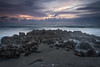
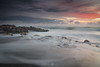
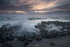

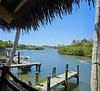
The above images may not be of the site on this page, but were taken nearby. They are loaded from Flickr so please click on them for image credits.
Click here to see more info for this site
Nearby sites
Click here to view sites on an interactive map of the areaKey: Red: member's photo, Blue: 3rd party photo, Yellow: other image, Green: no photo - please go there and take one, Grey: site destroyed
Download sites to:
KML (Google Earth)
GPX (GPS waypoints)
CSV (Garmin/Navman)
CSV (Excel)
To unlock full downloads you need to sign up as a Contributory Member. Otherwise downloads are limited to 50 sites.
Turn off the page maps and other distractions
Nearby sites listing. In the following links * = Image available
40.6km W 260° Big Mound City Misc. Earthwork
70.5km W 271° Lake Okeechobee* Ancient Village or Settlement
83.5km NNW 338° Vero Beach* Ancient Village or Settlement
96.3km WSW 243° Big (Tony's) Circle Mounds Artificial Mound
107.4km W 271° Fort Center Archaeological Site* Artificial Mound
115.7km S 184° Arch Creek Middens, Florida* Ancient Village or Settlement
121.7km S 185° El Portal Burial Mound* Artificial Mound
122.6km W 264° Ortona Prehistoric Village Artificial Mound
131.0km S 185° Miami Circle Rock Art
133.4km NNW 330° Three Forks Marsh Artificial Mound
153.1km SSE 149° Bimini Road Natural Stone / Erratic / Other Natural Feature
164.6km SSW 193° Coral Castle* Modern Stone Circle etc
174.2km NNW 337° Brevard Museum of History and Natural Sciences* Museum
187.0km WSW 252° Mound Key Archaeological State Park Artificial Mound
193.0km NNW 337° Windover (Florida)* Barrow Cemetery
194.3km WSW 243° Naples Canal Not Known (by us)
204.4km S 189° Key Largo Rock Mound Ancient Temple
208.3km W 262° Pineland* Ancient Village or Settlement
214.2km W 274° Little Salt Spring Natural Stone / Erratic / Other Natural Feature
225.5km WNW 287° Portavant Mound Site Artificial Mound
227.0km NNW 341° Snyder's Mound* Ancient Mine, Quarry or other Industry
228.6km NNW 342° Castle Windy Artificial Mound
233.0km NNW 342° Turtle Mound* Artificial Mound
235.2km NNW 332° Indian Mound Village Site* Artificial Mound
241.7km W 277° Spanish Point Shell Midden* Artificial Mound
View more nearby sites and additional images


 We would like to know more about this location. Please feel free to add a brief description and any relevant information in your own language.
 Wir möchten mehr über diese Stätte erfahren. Bitte zögern Sie nicht, eine kurze Beschreibung und relevante Informationen in Deutsch hinzuzufügen.
 Nous aimerions en savoir encore un peu sur les lieux. S'il vous plaît n'hesitez pas à ajouter une courte description et tous les renseignements pertinents dans votre propre langue.
 Quisieramos informarnos un poco más de las lugares. No dude en añadir una breve descripción y otros datos relevantes en su propio idioma.