


<< Image Pages >> St Berchert's Cross Slab (Tullylease) - Early Christian Sculptured Stone in Ireland (Republic of) in Co. Cork
Submitted by Sunny100 on Monday, 18 October 2010 Page Views: 8658
Early Medieval (Dark Age)Site Name: St Berchert's Cross Slab (Tullylease) Alternative Name: St Berechtir's Tomb Stone, The Tullylease CrossCountry: Ireland (Republic of)
NOTE: This site is 0.304 km away from the location you searched for.
County: Co. Cork Type: Early Christian Sculptured Stone
Nearest Town: Charleville Nearest Village: Tullylease
Map Ref: R360184
Latitude: 52.313969N Longitude: 8.939171W
Condition:
| 5 | Perfect |
| 4 | Almost Perfect |
| 3 | Reasonable but with some damage |
| 2 | Ruined but still recognisable as an ancient site |
| 1 | Pretty much destroyed, possibly visible as crop marks |
| 0 | No data. |
| -1 | Completely destroyed |
| 5 | Superb |
| 4 | Good |
| 3 | Ordinary |
| 2 | Not Good |
| 1 | Awful |
| 0 | No data. |
| 5 | Can be driven to, probably with disabled access |
| 4 | Short walk on a footpath |
| 3 | Requiring a bit more of a walk |
| 2 | A long walk |
| 1 | In the middle of nowhere, a nightmare to find |
| 0 | No data. |
| 5 | co-ordinates taken by GPS or official recorded co-ordinates |
| 4 | co-ordinates scaled from a detailed map |
| 3 | co-ordinates scaled from a bad map |
| 2 | co-ordinates of the nearest village |
| 1 | co-ordinates of the nearest town |
| 0 | no data |
Internal Links:
External Links:
 (PID:67882)")
The grid reference is for the village centre. Tullylease monastic site near Cahernagh dates from the 6th century but today only a ruined church remains along with a 6th-9th century carved cross-slab or gravestone of the local saint, Berechert.
He was an Englishman who fled to Ireland. According to the legend, he was a Saxon prince who was a follower of Colman, bishop of Lindisfarne. But when the bishop was overthrown by St Wilfrid at the Synod of Whitby in 664 AD, Berchert fled the country. There was, apparently, a clash between the Celtic and Roman churches. Berchert settled at Tullylease in Ireland where he founded a monastery. Various dates are given for his death...615, 700 and 839 CE.
In the ruins of St Berchert's church stands the saint's gravestone. This has a richly sculptured cross made up of key patterning and, interlaced knotwork in the central circle. A smaller central circle symbolizes 'the ever present God' There is an inscription recalling BERACHTUINE with a prayer asking us to remember him, and also some Greek letters included in the inscription. It is said that the slab marked the saint's grave.
You may be viewing yesterday's version of this page. To see the most up to date information please register for a free account.
Do not use the above information on other web sites or publications without permission of the contributor.
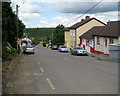
Nearby Images from Geograph Britain and Ireland:
©2009(licence)
The above images may not be of the site on this page, they are loaded from Geograph.
Please Submit an Image of this site or go out and take one for us!
Click here to see more info for this site
Nearby sites
Click here to view sites on an interactive map of the areaKey: Red: member's photo, Blue: 3rd party photo, Yellow: other image, Green: no photo - please go there and take one, Grey: site destroyed
Download sites to:
KML (Google Earth)
GPX (GPS waypoints)
CSV (Garmin/Navman)
CSV (Excel)
To unlock full downloads you need to sign up as a Contributory Member. Otherwise downloads are limited to 50 sites.
Turn off the page maps and other distractions
Nearby sites listing. In the following links * = Image available
15.7km NE 37° Graig (Co. Limerick) Stone Row / Alignment (R457308)
16.6km SSE 167° Gurteenard Standing Stones
18.4km SW 226° Knocknanagh E Stone Row / Alignment (R227057)
18.7km W 276° Tooreenglanahee Stone Row / Alignment (R174207)
19.3km WSW 253° Knockaclarig* Stone Row / Alignment (R174130)
20.1km SE 128° Kilmaclenine* Burial Chamber or Dolmen
20.4km SE 131° Knockaunvaddreen Stone Circle
20.4km SE 131° Knockane Stone Circle Stone Circle (R513048)
20.5km WSW 258° Cloghvoula* Stone Row / Alignment (R158143)
22.6km SW 228° Glenreagh* Stone Circle (R189035)
27.8km SSE 156° Gneeves* Stone Row / Alignment (W469928)
28.1km SSE 165° Nadanuller More burial ground* Marker Stone
28.3km S 188° Glenleigh circle Stone Circle
28.4km S 186° Glenleigh Stone Row / Alignment
28.7km SSE 155° Lackendarragh Standing Stone* Standing Stone (Menhir)
29.6km SSE 156° Garrane Stone Row* Stone Row / Alignment (W478912)
29.8km W 279° Feavautia Stone Row / Alignment
30.0km SSE 156° Garrane standing stones (pair)* Standing Stones
31.0km S 186° Brook Park E Stone Circle (W325876)
31.2km S 189° Tullig Stone Circle Stone Circle (W30958760)
31.4km S 186° Tullig east standing stone* Standing Stone (Menhir)
31.5km S 187° Tullig Stone Row* Stone Row / Alignment (W318872)
31.9km S 191° Lackdotia stone Standing Stone (Menhir)
31.9km SSE 157° Glandine* Standing Stones (W481888)
31.9km SSW 200° Kilmeedy - eastern stone circle* Stone Circle
View more nearby sites and additional images


 We would like to know more about this location. Please feel free to add a brief description and any relevant information in your own language.
 Wir möchten mehr über diese Stätte erfahren. Bitte zögern Sie nicht, eine kurze Beschreibung und relevante Informationen in Deutsch hinzuzufügen.
 Nous aimerions en savoir encore un peu sur les lieux. S'il vous plaît n'hesitez pas à ajouter une courte description et tous les renseignements pertinents dans votre propre langue.
 Quisieramos informarnos un poco más de las lugares. No dude en añadir una breve descripción y otros datos relevantes en su propio idioma.