

<< Text Pages >> Castro de Pico do Castro - Castro or Chafurdão in Spain in Galicia
Submitted by holger_rix on Saturday, 12 December 2015 Page Views: 619
Iron Age and Later PrehistorySite Name: Castro de Pico do Castro Alternative Name: Castro de O CastroCountry: Spain Region: Galicia Type: Castro or Chafurdão
Nearest Village: Zas
Latitude: 43.090915N Longitude: 8.918555W
Condition:
| 5 | Perfect |
| 4 | Almost Perfect |
| 3 | Reasonable but with some damage |
| 2 | Ruined but still recognisable as an ancient site |
| 1 | Pretty much destroyed, possibly visible as crop marks |
| 0 | No data. |
| -1 | Completely destroyed |
| 5 | Superb |
| 4 | Good |
| 3 | Ordinary |
| 2 | Not Good |
| 1 | Awful |
| 0 | No data. |
| 5 | Can be driven to, probably with disabled access |
| 4 | Short walk on a footpath |
| 3 | Requiring a bit more of a walk |
| 2 | A long walk |
| 1 | In the middle of nowhere, a nightmare to find |
| 0 | No data. |
| 5 | co-ordinates taken by GPS or official recorded co-ordinates |
| 4 | co-ordinates scaled from a detailed map |
| 3 | co-ordinates scaled from a bad map |
| 2 | co-ordinates of the nearest village |
| 1 | co-ordinates of the nearest town |
| 0 | no data |
Be the first person to rate this site - see the 'Contribute!' box in the right hand menu.
Internal Links:
External Links:
Castro or Chafurdão in Galicia
You may be viewing yesterday's version of this page. To see the most up to date information please register for a free account.
Do not use the above information on other web sites or publications without permission of the contributor.
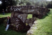
Nearby Images from Flickr
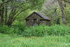
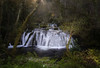
The above images may not be of the site on this page, but were taken nearby. They are loaded from Flickr so please click on them for image credits.
Click here to see more info for this site
Nearby sites
Click here to view sites on an interactive map of the areaKey: Red: member's photo, Blue: 3rd party photo, Yellow: other image, Green: no photo - please go there and take one, Grey: site destroyed
Download sites to:
KML (Google Earth)
GPX (GPS waypoints)
CSV (Garmin/Navman)
CSV (Excel)
To unlock full downloads you need to sign up as a Contributory Member. Otherwise downloads are limited to 50 sites.
Turn off the page maps and other distractions
Nearby sites listing. In the following links * = Image available
3.0km SSE 164° Castro da Atalaia Castro or Chafurdão
4.4km NW 315° Mámoa de Saconde Round Barrow(s)
4.9km WSW 257° Pedra Moura de Carneo* Burial Chamber or Dolmen
5.0km NE 40° Castro de Vilaestévez Castro or Chafurdão
5.4km W 268° Pedra Coberta Dolmen* Burial Chamber or Dolmen
5.7km NW 321° Castro de O Castro (Oróns) Castro or Chafurdão
6.0km WSW 245° Pedra de Lebre* Burial Chamber or Dolmen
6.3km NNW 341° Pedra Vixía Dolmen Burial Chamber or Dolmen
6.8km WNW 286° Castro de O Castro (Vimianzo) Castro or Chafurdão
7.1km SW 225° Arca da Piosa* Burial Chamber or Dolmen
7.2km SSW 206° Arca da Piosa Dolmen (As Laxas) Burial Chamber or Dolmen
7.7km WSW 251° Bico dos Xentís Castro or Chafurdão
8.5km WNW 285° Prado Garrido Dolmen Burial Chamber or Dolmen
8.9km W 279° Castro de Trasouteiro Castro or Chafurdão
9.1km NNE 22° Castro do Anido Castro or Chafurdão
9.3km S 182° Castro de Brandomil Castro or Chafurdão
9.8km SSW 199° Mámoa Os Currais Round Barrow(s)
10.1km W 275° Castro das Barreiras Castro or Chafurdão
10.2km SW 234° Arca do Rabós Burial Chamber or Dolmen
10.2km SW 235° Mámoa da Necrópole do Rabós 1 Round Barrow(s)
10.9km SW 217° Anta na Gándara de Baíñas Burial Chamber or Dolmen
11.0km W 264° Arca de Ogas Burial Chamber or Dolmen
11.0km WSW 245° Castro do Altiño de Padreiro Castro or Chafurdão
11.2km NW 320° A Fornela Dos Mouros Dolmen* Burial Chamber or Dolmen
11.2km SW 224° Castro de A Croa (A Bouza) Castro or Chafurdão
View more nearby sites and additional images


 We would like to know more about this location. Please feel free to add a brief description and any relevant information in your own language.
 Wir möchten mehr über diese Stätte erfahren. Bitte zögern Sie nicht, eine kurze Beschreibung und relevante Informationen in Deutsch hinzuzufügen.
 Nous aimerions en savoir encore un peu sur les lieux. S'il vous plaît n'hesitez pas à ajouter une courte description et tous les renseignements pertinents dans votre propre langue.
 Quisieramos informarnos un poco más de las lugares. No dude en añadir una breve descripción y otros datos relevantes en su propio idioma.