


<< Text Pages >> Castro de San Fins - Castro or Chafurdão in Spain in Galicia
Submitted by TheCaptain on Wednesday, 08 September 2010 Page Views: 1479
Iron Age and Later PrehistorySite Name: Castro de San FinsCountry: Spain
NOTE: This site is 1.856 km away from the location you searched for.
Region: Galicia Type: Castro or Chafurdão
Nearest Town: La Coruña Nearest Village: Cabana de Bergantiños
Latitude: 43.205575N Longitude: 8.921328W
Condition:
| 5 | Perfect |
| 4 | Almost Perfect |
| 3 | Reasonable but with some damage |
| 2 | Ruined but still recognisable as an ancient site |
| 1 | Pretty much destroyed, possibly visible as crop marks |
| 0 | No data. |
| -1 | Completely destroyed |
| 5 | Superb |
| 4 | Good |
| 3 | Ordinary |
| 2 | Not Good |
| 1 | Awful |
| 0 | No data. |
| 5 | Can be driven to, probably with disabled access |
| 4 | Short walk on a footpath |
| 3 | Requiring a bit more of a walk |
| 2 | A long walk |
| 1 | In the middle of nowhere, a nightmare to find |
| 0 | No data. |
| 5 | co-ordinates taken by GPS or official recorded co-ordinates |
| 4 | co-ordinates scaled from a detailed map |
| 3 | co-ordinates scaled from a bad map |
| 2 | co-ordinates of the nearest village |
| 1 | co-ordinates of the nearest town |
| 0 | no data |
Be the first person to rate this site - see the 'Contribute!' box in the right hand menu.
Internal Links:
External Links:
Castro in Galicia
Castro de San Fins is a Castro in the community of Cabana de Bergantiños, Province of La Coruña, region of Galicia
You may be viewing yesterday's version of this page. To see the most up to date information please register for a free account.
Do not use the above information on other web sites or publications without permission of the contributor.
Nearby Images from Flickr
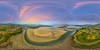
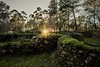
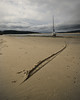
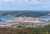


The above images may not be of the site on this page, but were taken nearby. They are loaded from Flickr so please click on them for image credits.
Click here to see more info for this site
Nearby sites
Click here to view sites on an interactive map of the areaKey: Red: member's photo, Blue: 3rd party photo, Yellow: other image, Green: no photo - please go there and take one, Grey: site destroyed
Download sites to:
KML (Google Earth)
GPX (GPS waypoints)
CSV (Garmin/Navman)
CSV (Excel)
To unlock full downloads you need to sign up as a Contributory Member. Otherwise downloads are limited to 50 sites.
Turn off the page maps and other distractions
Nearby sites listing. In the following links * = Image available
1.7km WNW 297° Castro de Tras da Agra Castro or Chafurdão
1.8km WSW 242° Castelo Ceda Hillfort
2.8km WSW 244° Castro de Borneiro* Castro or Chafurdão
3.1km NE 37° Castro de Monte Anllóns Castro or Chafurdão
3.8km N 6° Mámoa do Monte San Sebastián Round Barrow(s)
3.9km ENE 63° Castro de Beres Castro or Chafurdão
4.3km WSW 246° Dolmen de Dombate* Burial Chamber or Dolmen
5.4km NNE 17° Castro da Ponte da Balsa Castro or Chafurdão
5.6km SE 140° Castro do Anido Castro or Chafurdão
7.0km SSW 195° Pedra Vixía Dolmen Burial Chamber or Dolmen
7.6km NE 52° Castro de Tallo* Castro or Chafurdão
7.8km WNW 282° Castro de Petón do Castro Castro or Chafurdão
8.1km WSW 239° A Fornela Dos Mouros Dolmen* Burial Chamber or Dolmen
8.3km NNW 341° Petróglifo A Fieiteira Rock Art
8.4km NNE 26° Castro de Nemeño Castro or Chafurdão
9.0km SSW 202° Castro de O Castro (Oróns) Castro or Chafurdão
9.6km SSE 159° Castro de Vilaestévez Castro or Chafurdão
9.9km N 10° Castro de Niñóns Castro or Chafurdão
10.1km SSW 196° Mámoa de Saconde Round Barrow(s)
10.6km WSW 243° Penedos de Pasarela e Traba* Natural Stone / Erratic / Other Natural Feature
10.6km WSW 237° Mámoa da Gándara da Barca Burial Chamber or Dolmen
11.1km WSW 255° Castro de Mórdomo Castro or Chafurdão
11.9km NNE 19° Castro de O Castriño (Barizo) Castro or Chafurdão
12.6km SSW 210° Castro de O Castro (Vimianzo) Castro or Chafurdão
12.8km S 179° Castro de Pico do Castro Castro or Chafurdão
View more nearby sites and additional images


 We would like to know more about this location. Please feel free to add a brief description and any relevant information in your own language.
 Wir möchten mehr über diese Stätte erfahren. Bitte zögern Sie nicht, eine kurze Beschreibung und relevante Informationen in Deutsch hinzuzufügen.
 Nous aimerions en savoir encore un peu sur les lieux. S'il vous plaît n'hesitez pas à ajouter une courte description et tous les renseignements pertinents dans votre propre langue.
 Quisieramos informarnos un poco más de las lugares. No dude en añadir una breve descripción y otros datos relevantes en su propio idioma.