


<< Text Pages >> Castro e Torre de San Sadurniño - Castro or Chafurdão in Spain in Galicia
Submitted by holger_rix on Friday, 11 December 2015 Page Views: 454
Iron Age and Later PrehistorySite Name: Castro e Torre de San SadurniñoCountry: Spain
NOTE: This site is 3.795 km away from the location you searched for.
Region: Galicia Type: Castro or Chafurdão
Latitude: 42.507224N Longitude: 8.821385W
Condition:
| 5 | Perfect |
| 4 | Almost Perfect |
| 3 | Reasonable but with some damage |
| 2 | Ruined but still recognisable as an ancient site |
| 1 | Pretty much destroyed, possibly visible as crop marks |
| 0 | No data. |
| -1 | Completely destroyed |
| 5 | Superb |
| 4 | Good |
| 3 | Ordinary |
| 2 | Not Good |
| 1 | Awful |
| 0 | No data. |
| 5 | Can be driven to, probably with disabled access |
| 4 | Short walk on a footpath |
| 3 | Requiring a bit more of a walk |
| 2 | A long walk |
| 1 | In the middle of nowhere, a nightmare to find |
| 0 | No data. |
| 5 | co-ordinates taken by GPS or official recorded co-ordinates |
| 4 | co-ordinates scaled from a detailed map |
| 3 | co-ordinates scaled from a bad map |
| 2 | co-ordinates of the nearest village |
| 1 | co-ordinates of the nearest town |
| 0 | no data |
Be the first person to rate this site - see the 'Contribute!' box in the right hand menu.
Internal Links:
External Links:
Castro or Chafurdão in Galicia
You may be viewing yesterday's version of this page. To see the most up to date information please register for a free account.
Do not use the above information on other web sites or publications without permission of the contributor.
Nearby Images from Flickr
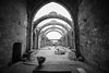
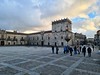

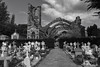
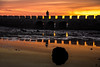
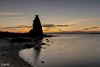
The above images may not be of the site on this page, but were taken nearby. They are loaded from Flickr so please click on them for image credits.
Click here to see more info for this site
Nearby sites
Click here to view sites on an interactive map of the areaKey: Red: member's photo, Blue: 3rd party photo, Yellow: other image, Green: no photo - please go there and take one, Grey: site destroyed
Download sites to:
KML (Google Earth)
GPX (GPS waypoints)
CSV (Garmin/Navman)
CSV (Excel)
To unlock full downloads you need to sign up as a Contributory Member. Otherwise downloads are limited to 50 sites.
Turn off the page maps and other distractions
Nearby sites listing. In the following links * = Image available
1.3km ENE 66° Castro da Pastora Castro or Chafurdão
2.6km NE 44° Castro de Pinal do Rei Castro or Chafurdão
2.7km S 180° Castro de A Revolta (Lourido) Castro or Chafurdão
3.0km SSE 160° Castro de Castrelo Castro or Chafurdão
3.7km ENE 59° Castro das Sete Pías Castro or Chafurdão
3.7km ENE 59° Petroglifo das Sete Pías Rock Art
4.1km S 173° Petroglifo do Monte Castelo (Sartaxes) Rock Art
5.4km SE 137° Castro de Vara Castro or Chafurdão
6.2km ESE 121° Castro de Gondes Castro or Chafurdão
6.3km NW 326° Castro do Campo dos Bufos Castro or Chafurdão
6.7km N 355° Castro de Vilanova de Arousa Castro or Chafurdão
6.7km SSE 164° Castro de Pena Aguda Castro or Chafurdão
6.9km SSE 148° Castro de Zapateiro Castro or Chafurdão
6.9km ENE 75° Castro de Monte de O Castro* Castro or Chafurdão
7.2km SE 125° Castro de Castiñeiras Castro or Chafurdão
7.5km WNW 301° Cistas do Xacemento de Tarais Cist
8.4km SSW 193° Castro de Noalla Castro or Chafurdão
9.2km SE 129° Outeiro do Cribo Petroglifo* Rock Art
9.6km WSW 250° Adro Vello Área Arqueológica Ancient Village or Settlement
9.6km SE 128° Casiña da Moura Dolmen* Burial Chamber or Dolmen
9.7km SSW 207° Castro de A Lanzada* Castro or Chafurdão
9.9km WSW 252° Castro de Carreiro Castro or Chafurdão
10.2km NE 49° Castro de Baión Castro or Chafurdão
10.3km NNE 24° Castro de Alobre* Castro or Chafurdão
11.1km SE 138° Petróglifos do Outeiro da Tartaruga* Rock Art
View more nearby sites and additional images


 We would like to know more about this location. Please feel free to add a brief description and any relevant information in your own language.
 Wir möchten mehr über diese Stätte erfahren. Bitte zögern Sie nicht, eine kurze Beschreibung und relevante Informationen in Deutsch hinzuzufügen.
 Nous aimerions en savoir encore un peu sur les lieux. S'il vous plaît n'hesitez pas à ajouter une courte description et tous les renseignements pertinents dans votre propre langue.
 Quisieramos informarnos un poco más de las lugares. No dude en añadir una breve descripción y otros datos relevantes en su propio idioma.