 with our Megalithic Portal iPhone app")


<< Text Pages >> Castro de Saa (A Guarda) - Castro or Chafurdão in Spain in Galicia
Submitted by TheCaptain on Wednesday, 08 September 2010 Page Views: 1761
Iron Age and Later PrehistorySite Name: Castro de Saa (A Guarda)Country: Spain
NOTE: This site is 0.788 km away from the location you searched for.
Region: Galicia Type: Castro or Chafurdão
Nearest Town: Pontevedra Nearest Village: A Guarda
Latitude: 41.888221N Longitude: 8.86189W
Condition:
| 5 | Perfect |
| 4 | Almost Perfect |
| 3 | Reasonable but with some damage |
| 2 | Ruined but still recognisable as an ancient site |
| 1 | Pretty much destroyed, possibly visible as crop marks |
| 0 | No data. |
| -1 | Completely destroyed |
| 5 | Superb |
| 4 | Good |
| 3 | Ordinary |
| 2 | Not Good |
| 1 | Awful |
| 0 | No data. |
| 5 | Can be driven to, probably with disabled access |
| 4 | Short walk on a footpath |
| 3 | Requiring a bit more of a walk |
| 2 | A long walk |
| 1 | In the middle of nowhere, a nightmare to find |
| 0 | No data. |
| 5 | co-ordinates taken by GPS or official recorded co-ordinates |
| 4 | co-ordinates scaled from a detailed map |
| 3 | co-ordinates scaled from a bad map |
| 2 | co-ordinates of the nearest village |
| 1 | co-ordinates of the nearest town |
| 0 | no data |
Be the first person to rate this site - see the 'Contribute!' box in the right hand menu.
Internal Links:
External Links:
Castro in Galicia
You may be viewing yesterday's version of this page. To see the most up to date information please register for a free account.
Do not use the above information on other web sites or publications without permission of the contributor.
Nearby Images from Flickr
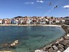
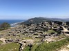


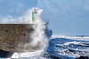
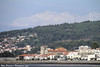
The above images may not be of the site on this page, but were taken nearby. They are loaded from Flickr so please click on them for image credits.
Click here to see more info for this site
Nearby sites
Click here to view sites on an interactive map of the areaKey: Red: member's photo, Blue: 3rd party photo, Yellow: other image, Green: no photo - please go there and take one, Grey: site destroyed
Download sites to:
KML (Google Earth)
GPX (GPS waypoints)
CSV (Garmin/Navman)
CSV (Excel)
To unlock full downloads you need to sign up as a Contributory Member. Otherwise downloads are limited to 50 sites.
Turn off the page maps and other distractions
Nearby sites listing. In the following links * = Image available
778m NW 308° Castro de Santa Tegra* Castro or Chafurdão
1.5km NNW 345° Castro de A Forca Castro or Chafurdão
1.5km SW 226° Pedra do Abellón Standing Stone (Menhir)
2.6km SE 137° Mamoa de Aspra Round Barrow(s)
3.2km SE 135° Castro do Coto da Pena Castro or Chafurdão
5.8km NNW 345° Petróglifo do Alto da Campana Rock Art
6.9km N 359° Petróglifo da Fonte do Home Rock Art
7.6km N 4° Petróglifo do Outeiro da Xiasta Rock Art
8.1km N 3° Petróglifo do Regueiro do Cabalo Rock Art
8.8km S 174° Anta da Barrosa* Burial Chamber or Dolmen
8.8km N 351° Castro de Xián Castro or Chafurdão
8.9km S 169° Dólmen de Vile Burial Chamber or Dolmen
10.4km NNE 19° Petróglifos de Barrio Novo Rock Art
11.3km S 177° Cividade de Âncora ou Castro da Cividade Castro or Chafurdão
13.5km N 357° Petróglifos da Pedreira Rock Art
13.9km N 357° Petróglifo do Río Vilar Rock Art
15.2km N 356° Petróglifo do Alto da Pousadela Rock Art
15.5km S 181° Castro da Corôa Castro or Chafurdão
16.8km NNE 12° Laberinto de Monte Lousado Petroglifo Rock Art
17.4km E 93° Castro de São Martinho Castro or Chafurdão
18.6km N 7° Pedra do Acordo Standing Stone (Menhir)
18.7km N 357° Petróglifos Pedra Lan Rock Art
18.9km E 81° Cividade do Cossourado Castro or Chafurdão
19.0km E 96° Castro do Coto de Ouro ou Alto da Cidade Castro or Chafurdão
19.6km S 173° Mamoa do Chão da Pica Round Barrow(s)
View more nearby sites and additional images


 We would like to know more about this location. Please feel free to add a brief description and any relevant information in your own language.
 Wir möchten mehr über diese Stätte erfahren. Bitte zögern Sie nicht, eine kurze Beschreibung und relevante Informationen in Deutsch hinzuzufügen.
 Nous aimerions en savoir encore un peu sur les lieux. S'il vous plaît n'hesitez pas à ajouter une courte description et tous les renseignements pertinents dans votre propre langue.
 Quisieramos informarnos un poco más de las lugares. No dude en añadir una breve descripción y otros datos relevantes en su propio idioma.