


<< Our Photo Pages >> Castros de Neixón - Castro or Chafurdão in Spain in Galicia
Submitted by holger_rix on Wednesday, 02 December 2015 Page Views: 530
Iron Age and Later PrehistorySite Name: Castros de NeixónCountry: Spain Region: Galicia Type: Castro or Chafurdão
Nearest Town: Boiro
Latitude: 42.663830N Longitude: 8.84256W
Condition:
| 5 | Perfect |
| 4 | Almost Perfect |
| 3 | Reasonable but with some damage |
| 2 | Ruined but still recognisable as an ancient site |
| 1 | Pretty much destroyed, possibly visible as crop marks |
| 0 | No data. |
| -1 | Completely destroyed |
| 5 | Superb |
| 4 | Good |
| 3 | Ordinary |
| 2 | Not Good |
| 1 | Awful |
| 0 | No data. |
| 5 | Can be driven to, probably with disabled access |
| 4 | Short walk on a footpath |
| 3 | Requiring a bit more of a walk |
| 2 | A long walk |
| 1 | In the middle of nowhere, a nightmare to find |
| 0 | No data. |
| 5 | co-ordinates taken by GPS or official recorded co-ordinates |
| 4 | co-ordinates scaled from a detailed map |
| 3 | co-ordinates scaled from a bad map |
| 2 | co-ordinates of the nearest village |
| 1 | co-ordinates of the nearest town |
| 0 | no data |
Be the first person to rate this site - see the 'Contribute!' box in the right hand menu.
Internal Links:
External Links:
")
You may be viewing yesterday's version of this page. To see the most up to date information please register for a free account.
")
")
")
Do not use the above information on other web sites or publications without permission of the contributor.
Nearby Images from Flickr
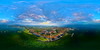
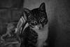
The above images may not be of the site on this page, but were taken nearby. They are loaded from Flickr so please click on them for image credits.
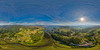
Click here to see more info for this site
Nearby sites
Click here to view sites on an interactive map of the areaKey: Red: member's photo, Blue: 3rd party photo, Yellow: other image, Green: no photo - please go there and take one, Grey: site destroyed
Download sites to:
KML (Google Earth)
GPX (GPS waypoints)
CSV (Garmin/Navman)
CSV (Excel)
To unlock full downloads you need to sign up as a Contributory Member. Otherwise downloads are limited to 50 sites.
Turn off the page maps and other distractions
Nearby sites listing. In the following links * = Image available
260m NNW 347° Centro Arqueolóxico do Barbanza* Museum
275m SE 140° Castro de Neixón Pequeno* Castro or Chafurdão
2.1km NNW 345° Mámoas da Amañecida Barrow Cemetery
2.7km SE 127° Castro do Castriño Castro or Chafurdão
2.9km WNW 290° Castro de Sandrenzo Castro or Chafurdão
3.8km N 358° Castro de Bealo Castro or Chafurdão
4.1km N 356° Laxe de Agueiro Petróglifos Rock Art
4.6km SE 130° Castro de Brión (Rianxo) Castro or Chafurdão
4.7km W 261° Castro de Runs Castro or Chafurdão
4.7km ESE 121° Petróglifo dos Mouchos* Rock Art
5.1km SSW 208° Castro de O Castriño Castro or Chafurdão
5.4km NW 310° Castro de Cures Castro or Chafurdão
5.6km E 82° Petróglifo da Foxa Vella* Rock Art
6.3km E 81° Dolmen de Os Campiños 1* Burial Chamber or Dolmen
6.4km E 80° Dolmen de Os Campiños 2* Burial Chamber or Dolmen
6.4km WNW 301° Castro do Coto da Moreira Castro or Chafurdão
6.8km SSW 213° Castro do Achadizo* Castro or Chafurdão
6.8km ENE 66° Mámoa do Couto de Burés* Burial Chamber or Dolmen
6.8km WNW 300° Túmulo Chan da Figueira Round Barrow(s)
7.3km WNW 303° Petroglifos de Fonte Sobreira Rock Art
7.4km NNE 12° Castelo de Fruíme Castro or Chafurdão
7.6km WNW 294° Túmulo de Sabuceda 5 Round Barrow(s)
7.6km WNW 294° Túmulo de Sabuceda 6 Round Barrow(s)
7.6km WNW 294° Túmulo de Sabuceda 4 Round Barrow(s)
7.6km WNW 294° Túmulo de Sabuceda 8 Round Barrow(s)
View more nearby sites and additional images


 We would like to know more about this location. Please feel free to add a brief description and any relevant information in your own language.
 Wir möchten mehr über diese Stätte erfahren. Bitte zögern Sie nicht, eine kurze Beschreibung und relevante Informationen in Deutsch hinzuzufügen.
 Nous aimerions en savoir encore un peu sur les lieux. S'il vous plaît n'hesitez pas à ajouter une courte description et tous les renseignements pertinents dans votre propre langue.
 Quisieramos informarnos un poco más de las lugares. No dude en añadir una breve descripción y otros datos relevantes en su propio idioma.