

<< Text Pages >> Petróglifo do Outeiro da Xiasta - Rock Art in Spain in Galicia
Submitted by holger_rix on Friday, 18 December 2015 Page Views: 535
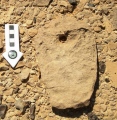
Rock ArtSite Name: Petróglifo do Outeiro da XiastaCountry: Spain
NOTE: This site is 3.466 km away from the location you searched for.
Region: Galicia Type: Rock Art
Latitude: 41.956700N Longitude: 8.85579W
Condition:
| 5 | Perfect |
| 4 | Almost Perfect |
| 3 | Reasonable but with some damage |
| 2 | Ruined but still recognisable as an ancient site |
| 1 | Pretty much destroyed, possibly visible as crop marks |
| 0 | No data. |
| -1 | Completely destroyed |
| 5 | Superb |
| 4 | Good |
| 3 | Ordinary |
| 2 | Not Good |
| 1 | Awful |
| 0 | No data. |
| 5 | Can be driven to, probably with disabled access |
| 4 | Short walk on a footpath |
| 3 | Requiring a bit more of a walk |
| 2 | A long walk |
| 1 | In the middle of nowhere, a nightmare to find |
| 0 | No data. |
| 5 | co-ordinates taken by GPS or official recorded co-ordinates |
| 4 | co-ordinates scaled from a detailed map |
| 3 | co-ordinates scaled from a bad map |
| 2 | co-ordinates of the nearest village |
| 1 | co-ordinates of the nearest town |
| 0 | no data |
Be the first person to rate this site - see the 'Contribute!' box in the right hand menu.
Internal Links:
External Links:
Rock Art in Galicia
You may be viewing yesterday's version of this page. To see the most up to date information please register for a free account.
Do not use the above information on other web sites or publications without permission of the contributor.
Nearby Images from Flickr
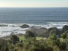
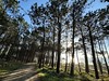
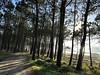
The above images may not be of the site on this page, but were taken nearby. They are loaded from Flickr so please click on them for image credits.
Click here to see more info for this site
Nearby sites
Click here to view sites on an interactive map of the areaKey: Red: member's photo, Blue: 3rd party photo, Yellow: other image, Green: no photo - please go there and take one, Grey: site destroyed
Download sites to:
KML (Google Earth)
GPX (GPS waypoints)
CSV (Garmin/Navman)
CSV (Excel)
To unlock full downloads you need to sign up as a Contributory Member. Otherwise downloads are limited to 50 sites.
Turn off the page maps and other distractions
Nearby sites listing. In the following links * = Image available
497m N 354° Petróglifo do Regueiro do Cabalo Rock Art
964m SW 218° Petróglifo da Fonte do Home Rock Art
2.1km WNW 300° Castro de Xián Castro or Chafurdão
2.9km SW 226° Petróglifo do Alto da Campana Rock Art
3.6km NE 52° Petróglifos de Barrio Novo Rock Art
6.0km NNW 348° Petróglifos da Pedreira Rock Art
6.2km S 188° Castro de A Forca Castro or Chafurdão
6.4km NNW 348° Petróglifo do Río Vilar Rock Art
7.2km S 189° Castro de Santa Tegra* Castro or Chafurdão
7.6km S 184° Castro de Saa (A Guarda) Castro or Chafurdão
7.7km NNW 349° Petróglifo do Alto da Pousadela Rock Art
8.8km S 190° Pedra do Abellón Standing Stone (Menhir)
9.3km NNE 19° Laberinto de Monte Lousado Petroglifo Rock Art
9.6km S 172° Mamoa de Aspra Round Barrow(s)
10.0km S 170° Castro do Coto da Pena Castro or Chafurdão
10.9km N 9° Pedra do Acordo Standing Stone (Menhir)
11.1km N 352° Petróglifos Pedra Lan Rock Art
12.5km NNE 24° Mámoa de Pinzás Round Barrow(s)
14.0km NNE 25° Chan do Portugués 2 Round Barrow(s)
14.1km NNE 25° Chan do Portugués 1 Round Barrow(s)
14.7km NNE 30° Mámoa dos Cotareles Burial Chamber or Dolmen
15.2km NE 43° Petroglifo de Real Seco Rock Art
15.3km NE 44° Monte Tetón Archaeological Eco Park* Rock Art
15.7km N 5° Petróglifos do Outeiro dos Lameiros* Rock Art
16.3km S 179° Anta da Barrosa* Burial Chamber or Dolmen
View more nearby sites and additional images


 We would like to know more about this location. Please feel free to add a brief description and any relevant information in your own language.
 Wir möchten mehr über diese Stätte erfahren. Bitte zögern Sie nicht, eine kurze Beschreibung und relevante Informationen in Deutsch hinzuzufügen.
 Nous aimerions en savoir encore un peu sur les lieux. S'il vous plaît n'hesitez pas à ajouter une courte description et tous les renseignements pertinents dans votre propre langue.
 Quisieramos informarnos un poco más de las lugares. No dude en añadir una breve descripción y otros datos relevantes en su propio idioma.