


<< Our Photo Pages >> Bracklaghboy - Standing Stone (Menhir) in Ireland (Republic of) in Co. Mayo
Submitted by Anthony_Weir on Sunday, 13 October 2002 Page Views:
Neolithic and Bronze AgeSite Name: Bracklaghboy Alternative Name: LisvaunCountry: Ireland (Republic of)
NOTE: This site is 6.225 km away from the location you searched for.
County: Co. Mayo Type: Standing Stone (Menhir)
Nearest Town: Ballyhaunis
Map Ref: M474807
Discovery Map Number: D32
Latitude: 53.773380N Longitude: 8.798519W
Condition:
| 5 | Perfect |
| 4 | Almost Perfect |
| 3 | Reasonable but with some damage |
| 2 | Ruined but still recognisable as an ancient site |
| 1 | Pretty much destroyed, possibly visible as crop marks |
| 0 | No data. |
| -1 | Completely destroyed |
| 5 | Superb |
| 4 | Good |
| 3 | Ordinary |
| 2 | Not Good |
| 1 | Awful |
| 0 | No data. |
| 5 | Can be driven to, probably with disabled access |
| 4 | Short walk on a footpath |
| 3 | Requiring a bit more of a walk |
| 2 | A long walk |
| 1 | In the middle of nowhere, a nightmare to find |
| 0 | No data. |
| 5 | co-ordinates taken by GPS or official recorded co-ordinates |
| 4 | co-ordinates scaled from a detailed map |
| 3 | co-ordinates scaled from a bad map |
| 2 | co-ordinates of the nearest village |
| 1 | co-ordinates of the nearest town |
| 0 | no data |
Internal Links:
External Links:
")
In the townland of Island, in the centre of a round mound to the E of a by-road, is a stone 1.8 metres high and leaning backwards, which has the worn inscription CUNALEGIAV……QUNACANOS
You may be viewing yesterday's version of this page. To see the most up to date information please register for a free account.
")
Do not use the above information on other web sites or publications without permission of the contributor.
Nearby Images from Geograph Britain and Ireland:
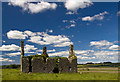
©2014(licence)
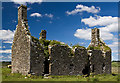
©2014(licence)
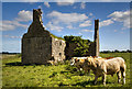
©2014(licence)
The above images may not be of the site on this page, they are loaded from Geograph.
Please Submit an Image of this site or go out and take one for us!
Click here to see more info for this site
Nearby sites
Click here to view sites on an interactive map of the areaKey: Red: member's photo, Blue: 3rd party photo, Yellow: other image, Green: no photo - please go there and take one, Grey: site destroyed
Download sites to:
KML (Google Earth)
GPX (GPS waypoints)
CSV (Garmin/Navman)
CSV (Excel)
To unlock full downloads you need to sign up as a Contributory Member. Otherwise downloads are limited to 50 sites.
Turn off the page maps and other distractions
Nearby sites listing. In the following links * = Image available
14.5km NNE 32° Kilcashel Stone Fort* Stone Fort or Dun
16.0km NNE 29° Kilmovee Ogham Stone* Sculptured Stone
26.5km SW 233° Carrowreagh* Stone Circle (M2665)
27.6km W 277° Belcarra Standing Stone* Standing Stone (Menhir)
27.7km ENE 76° Kilcorkey Stone* Standing Stone (Menhir)
28.0km NW 323° Lough Muck Stone Row* Stone Row / Alignment
29.0km ENE 76° Drummin Stones* Standing Stones
29.7km ENE 77° Standing stone near Rathcroghan* Standing Stone (Menhir)
30.9km SW 223° Cregduff* Henge
32.1km E 84° Rath na tDarbh* Round Barrow(s)
32.1km NE 43° Ballynakill (LoughRea) Stone Circle* Stone Circle (G696040)
32.2km E 85° Oweynagat* Cave or Rock Shelter
32.3km E 83° Ráth Mór* Artificial Mound
32.7km E 84° Rath Cruachan* Artificial Mound
32.7km E 84° Misgaun Maeve Stone Standing Stone (Menhir)
34.3km E 89° Ogulla Well Holy Well or Sacred Spring
35.5km E 93° Cloghfadnacarn Stone* Standing Stone (Menhir)
35.8km E 89° Cruachan Aí Heritage Centre* Museum
36.4km NE 53° Ballynanultagh* Portal Tomb (G76800237)
36.6km SW 232° Neale Stone* Standing Stone (Menhir)
38.8km NNW 335° Carrowcrom* Wedge Tomb
39.5km WSW 240° Inishowen Stone Circle (M128615)
39.5km SW 231° Cong East* Stone Circle
39.5km SW 231° Cong North* Stone Circle
39.6km SW 231° Cong Stone Circles Stone Circle
View more nearby sites and additional images


 We would like to know more about this location. Please feel free to add a brief description and any relevant information in your own language.
 Wir möchten mehr über diese Stätte erfahren. Bitte zögern Sie nicht, eine kurze Beschreibung und relevante Informationen in Deutsch hinzuzufügen.
 Nous aimerions en savoir encore un peu sur les lieux. S'il vous plaît n'hesitez pas à ajouter une courte description et tous les renseignements pertinents dans votre propre langue.
 Quisieramos informarnos un poco más de las lugares. No dude en añadir una breve descripción y otros datos relevantes en su propio idioma.