


<< Our Photo Pages >> Cividade de Terroso - Castro or Chafurdão in Portugal in Porto
Submitted by TheCaptain on Wednesday, 08 September 2010 Page Views: 3195
Iron Age and Later PrehistorySite Name: Cividade de TerrosoCountry: Portugal Distrito: Porto Type: Castro or Chafurdão
Nearest Town: Póvoa de Varzim Nearest Village: Terroso
Latitude: 41.412534N Longitude: 8.720991W
Condition:
| 5 | Perfect |
| 4 | Almost Perfect |
| 3 | Reasonable but with some damage |
| 2 | Ruined but still recognisable as an ancient site |
| 1 | Pretty much destroyed, possibly visible as crop marks |
| 0 | No data. |
| -1 | Completely destroyed |
| 5 | Superb |
| 4 | Good |
| 3 | Ordinary |
| 2 | Not Good |
| 1 | Awful |
| 0 | No data. |
| 5 | Can be driven to, probably with disabled access |
| 4 | Short walk on a footpath |
| 3 | Requiring a bit more of a walk |
| 2 | A long walk |
| 1 | In the middle of nowhere, a nightmare to find |
| 0 | No data. |
| 5 | co-ordinates taken by GPS or official recorded co-ordinates |
| 4 | co-ordinates scaled from a detailed map |
| 3 | co-ordinates scaled from a bad map |
| 2 | co-ordinates of the nearest village |
| 1 | co-ordinates of the nearest town |
| 0 | no data |
Internal Links:
External Links:
")
Cividade de Terroso is a Castro in the community of Terroso near the town of Póvoa de Varzim, District of Porto
You may be viewing yesterday's version of this page. To see the most up to date information please register for a free account.
")
")
")
")
Do not use the above information on other web sites or publications without permission of the contributor.
Nearby Images from Flickr
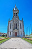
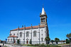
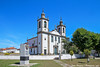
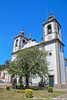
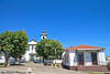
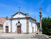
The above images may not be of the site on this page, but were taken nearby. They are loaded from Flickr so please click on them for image credits.
Click here to see more info for this site
Nearby sites
Click here to view sites on an interactive map of the areaKey: Red: member's photo, Blue: 3rd party photo, Yellow: other image, Green: no photo - please go there and take one, Grey: site destroyed
Download sites to:
KML (Google Earth)
GPX (GPS waypoints)
CSV (Garmin/Navman)
CSV (Excel)
To unlock full downloads you need to sign up as a Contributory Member. Otherwise downloads are limited to 50 sites.
Turn off the page maps and other distractions
Nearby sites listing. In the following links * = Image available
6.3km ESE 121° Cividade de Bagunte* Castro or Chafurdão
6.8km SSW 193° Aquaduct de Santa Clara Ancient Trackway
11.5km N 351° Outeiro dos Picotos Castro or Chafurdão
14.3km N 355° Castro do Sr. dos Desamparados Castro or Chafurdão
15.1km SE 145° Castro de Alvarelhos Castro or Chafurdão
15.3km NNE 33° Museu Arqueológico Paço dos Duques Museum
15.8km E 98° Castro de São Miguel-o-Anjo Castro or Chafurdão
16.4km NNW 348° Castro de São Lourenço* Castro or Chafurdão
17.1km N 352° Dolmen de Arribadas* Burial Chamber or Dolmen
17.3km ENE 72° Castro do Monte das Ermidas Castro or Chafurdão
17.7km NNW 347° Dólmen da Portelagem* Burial Chamber or Dolmen
18.3km NNW 346° Castro de Nossa Senhora da Paz Castro or Chafurdão
18.8km N 349° Mamoa 3 do Rápido* Burial Chamber or Dolmen
18.8km NNW 342° Menir de São Bartolomeu do Mar* Standing Stone (Menhir)
20.4km NNE 21° Castro de Monte Castro Castro or Chafurdão
21.3km N 350° Menir de São Paio de Antas* Standing Stone (Menhir)
21.4km NE 36° Monumento Castrejo de Santa Maria de Galegos Castro or Chafurdão
21.4km NNW 347° Cividade de Belinho Castro or Chafurdão
23.1km NNW 346° Monte do Castelo do Neiva Castro or Chafurdão
23.2km E 84° Castro das Eiras Castro or Chafurdão
23.8km ENE 73° Castro de Monte Redondo Castro or Chafurdão
23.9km S 171° Castro do Monte Castelo de Guifões ou Monte Castelo Castro or Chafurdão
25.0km E 94° Estação Arqueológica de Perrelos Ancient Village or Settlement
26.0km ESE 114° Castro do Monte Padrão Castro or Chafurdão
26.1km ENE 67° Mamoa de Lamas* Burial Chamber or Dolmen
View more nearby sites and additional images


 We would like to know more about this location. Please feel free to add a brief description and any relevant information in your own language.
 Wir möchten mehr über diese Stätte erfahren. Bitte zögern Sie nicht, eine kurze Beschreibung und relevante Informationen in Deutsch hinzuzufügen.
 Nous aimerions en savoir encore un peu sur les lieux. S'il vous plaît n'hesitez pas à ajouter une courte description et tous les renseignements pertinents dans votre propre langue.
 Quisieramos informarnos un poco más de las lugares. No dude en añadir una breve descripción y otros datos relevantes en su propio idioma.