


<< Text Pages >> Aquaduct de Santa Clara - Ancient Trackway in Portugal in Braga
Submitted by Maatje on Monday, 19 December 2022 Page Views: 455
Roman, Greek and ClassicalSite Name: Aquaduct de Santa Clara Alternative Name: Convento de Santa ClaraCountry: Portugal
NOTE: This site is 2.503 km away from the location you searched for.
Distrito: Braga Type: Ancient Trackway
Nearest Town: Vila do Conde
Latitude: 41.353391N Longitude: 8.739299W
Condition:
| 5 | Perfect |
| 4 | Almost Perfect |
| 3 | Reasonable but with some damage |
| 2 | Ruined but still recognisable as an ancient site |
| 1 | Pretty much destroyed, possibly visible as crop marks |
| 0 | No data. |
| -1 | Completely destroyed |
| 5 | Superb |
| 4 | Good |
| 3 | Ordinary |
| 2 | Not Good |
| 1 | Awful |
| 0 | No data. |
| 5 | Can be driven to, probably with disabled access |
| 4 | Short walk on a footpath |
| 3 | Requiring a bit more of a walk |
| 2 | A long walk |
| 1 | In the middle of nowhere, a nightmare to find |
| 0 | No data. |
| 5 | co-ordinates taken by GPS or official recorded co-ordinates |
| 4 | co-ordinates scaled from a detailed map |
| 3 | co-ordinates scaled from a bad map |
| 2 | co-ordinates of the nearest village |
| 1 | co-ordinates of the nearest town |
| 0 | no data |
Internal Links:
External Links:
Ancient bridge in Braga
The Convent and Aquaduct of Santa Clara is situated on a strategic hilltop at the river Ave.
The Aquaduct is the second large of Portugal.
You may be viewing yesterday's version of this page. To see the most up to date information please register for a free account.
")
")
")
Do not use the above information on other web sites or publications without permission of the contributor.
Nearby Images from Flickr

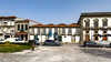
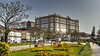
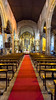
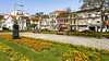

The above images may not be of the site on this page, but were taken nearby. They are loaded from Flickr so please click on them for image credits.
Click here to see more info for this site
Nearby sites
Click here to view sites on an interactive map of the areaKey: Red: member's photo, Blue: 3rd party photo, Yellow: other image, Green: no photo - please go there and take one, Grey: site destroyed
Download sites to:
KML (Google Earth)
GPX (GPS waypoints)
CSV (Garmin/Navman)
CSV (Excel)
To unlock full downloads you need to sign up as a Contributory Member. Otherwise downloads are limited to 50 sites.
Turn off the page maps and other distractions
Nearby sites listing. In the following links * = Image available
6.8km NNE 13° Cividade de Terroso* Castro or Chafurdão
7.7km ENE 64° Cividade de Bagunte* Castro or Chafurdão
11.7km ESE 120° Castro de Alvarelhos Castro or Chafurdão
17.7km ENE 76° Castro de São Miguel-o-Anjo Castro or Chafurdão
17.8km SSE 163° Castro do Monte Castelo de Guifões ou Monte Castelo Castro or Chafurdão
17.9km N 359° Outeiro dos Picotos Castro or Chafurdão
20.9km N 1° Castro do Sr. dos Desamparados Castro or Chafurdão
21.5km ENE 57° Castro do Monte das Ermidas Castro or Chafurdão
21.8km NNE 27° Museu Arqueológico Paço dos Duques Museum
22.7km N 355° Castro de São Lourenço* Castro or Chafurdão
23.6km N 358° Dolmen de Arribadas* Burial Chamber or Dolmen
24.0km N 354° Dólmen da Portelagem* Burial Chamber or Dolmen
24.5km N 353° Castro de Nossa Senhora da Paz Castro or Chafurdão
24.9km N 350° Menir de São Bartolomeu do Mar* Standing Stone (Menhir)
25.1km N 356° Mamoa 3 do Rápido* Burial Chamber or Dolmen
25.6km E 99° Castro do Monte Padrão Castro or Chafurdão
26.1km ENE 70° Castro das Eiras Castro or Chafurdão
26.9km E 79° Estação Arqueológica de Perrelos Ancient Village or Settlement
27.1km NNE 19° Castro de Monte Castro Castro or Chafurdão
27.6km N 353° Cividade de Belinho Castro or Chafurdão
27.6km N 355° Menir de São Paio de Antas* Standing Stone (Menhir)
27.7km NNE 30° Monumento Castrejo de Santa Maria de Galegos Castro or Chafurdão
27.8km ENE 61° Castro de Monte Redondo Castro or Chafurdão
28.7km ESE 112° Mamoa do Taio* Chambered Cairn
29.3km N 352° Monte do Castelo do Neiva Castro or Chafurdão
View more nearby sites and additional images


 We would like to know more about this location. Please feel free to add a brief description and any relevant information in your own language.
 Wir möchten mehr über diese Stätte erfahren. Bitte zögern Sie nicht, eine kurze Beschreibung und relevante Informationen in Deutsch hinzuzufügen.
 Nous aimerions en savoir encore un peu sur les lieux. S'il vous plaît n'hesitez pas à ajouter une courte description et tous les renseignements pertinents dans votre propre langue.
 Quisieramos informarnos un poco más de las lugares. No dude en añadir una breve descripción y otros datos relevantes en su propio idioma.