

<< Text Pages >> Castro de A Croa - Castro or Chafurdão in Spain in Galicia
Submitted by holger_rix on Friday, 11 December 2015 Page Views: 605
Iron Age and Later PrehistorySite Name: Castro de A CroaCountry: Spain
NOTE: This site is 1.771 km away from the location you searched for.
Region: Galicia Type: Castro or Chafurdão
Latitude: 42.344351N Longitude: 8.641693W
Condition:
| 5 | Perfect |
| 4 | Almost Perfect |
| 3 | Reasonable but with some damage |
| 2 | Ruined but still recognisable as an ancient site |
| 1 | Pretty much destroyed, possibly visible as crop marks |
| 0 | No data. |
| -1 | Completely destroyed |
| 5 | Superb |
| 4 | Good |
| 3 | Ordinary |
| 2 | Not Good |
| 1 | Awful |
| 0 | No data. |
| 5 | Can be driven to, probably with disabled access |
| 4 | Short walk on a footpath |
| 3 | Requiring a bit more of a walk |
| 2 | A long walk |
| 1 | In the middle of nowhere, a nightmare to find |
| 0 | No data. |
| 5 | co-ordinates taken by GPS or official recorded co-ordinates |
| 4 | co-ordinates scaled from a detailed map |
| 3 | co-ordinates scaled from a bad map |
| 2 | co-ordinates of the nearest village |
| 1 | co-ordinates of the nearest town |
| 0 | no data |
Be the first person to rate this site - see the 'Contribute!' box in the right hand menu.
Internal Links:
External Links:
Castro or Chafurdão in Galicia
You may be viewing yesterday's version of this page. To see the most up to date information please register for a free account.
Do not use the above information on other web sites or publications without permission of the contributor.
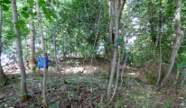
Nearby Images from Flickr

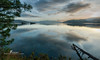
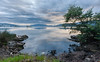
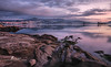

The above images may not be of the site on this page, but were taken nearby. They are loaded from Flickr so please click on them for image credits.
Click here to see more info for this site
Nearby sites
Click here to view sites on an interactive map of the areaKey: Red: member's photo, Blue: 3rd party photo, Yellow: other image, Green: no photo - please go there and take one, Grey: site destroyed
Download sites to:
KML (Google Earth)
GPX (GPS waypoints)
CSV (Garmin/Navman)
CSV (Excel)
To unlock full downloads you need to sign up as a Contributory Member. Otherwise downloads are limited to 50 sites.
Turn off the page maps and other distractions
Nearby sites listing. In the following links * = Image available
2.9km ENE 59° Castro de O Castro (As Laceiras) Castro or Chafurdão
3.0km WNW 301° Mamoa del Rey* Burial Chamber or Dolmen
3.0km WNW 302° Mámoa de Chan de Castiñeiras 2 Burial Chamber or Dolmen
3.0km NW 304° Mámoa de Chan de Castiñeiras 4* Burial Chamber or Dolmen
3.3km W 280° Mámoas de Outeiro de Ombra* Barrow Cemetery
3.4km WNW 296° Mámoa de Pedralonga* Burial Chamber or Dolmen
3.9km W 274° Chan de Armada Dolmen* Burial Chamber or Dolmen
3.9km NNE 26° Castro do Coto Loureiro Castro or Chafurdão
4.8km W 262° Mámoa de Chan de Gagán Burial Chamber or Dolmen
5.4km WSW 240° Chan de Arquiña* Burial Chamber or Dolmen
5.4km NW 325° Complexo Rupestre de Piñeiral de Caeiro Rock Art
5.4km NNW 339° Petróglifos Outeiro da Mina Rock Art
5.5km NNW 329° Petróglifo dos Sete Camiños Rock Art
5.5km SE 128° Pedra das Rodiñas Rock Art
5.9km N 353° Castro do Monte das Croas Castro or Chafurdão
5.9km NNW 326° Complexo Rupestre do Pornedo Rock Art
6.1km NNW 328° Espazo Arqueológico dos Sete Camiños Rock Art
7.0km NW 307° Castro da Subidá Castro or Chafurdão
7.0km N 357° Penedo do Vilar de Matos Rock Art
7.1km WNW 289° Castro das Pedreiras Castro or Chafurdão
7.1km SSE 163° Castro da Peneda Castro or Chafurdão
7.7km NW 307° Castro de O Monte (Mogor) Castro or Chafurdão
7.7km WNW 294° Castro da Brea Castro or Chafurdão
7.7km SW 215° Petroglifo de A Pegada de San Pedro Rock Art
7.8km NW 306° Petróglifos de Mogor* Rock Art
View more nearby sites and additional images


 We would like to know more about this location. Please feel free to add a brief description and any relevant information in your own language.
 Wir möchten mehr über diese Stätte erfahren. Bitte zögern Sie nicht, eine kurze Beschreibung und relevante Informationen in Deutsch hinzuzufügen.
 Nous aimerions en savoir encore un peu sur les lieux. S'il vous plaît n'hesitez pas à ajouter une courte description et tous les renseignements pertinents dans votre propre langue.
 Quisieramos informarnos un poco más de las lugares. No dude en añadir una breve descripción y otros datos relevantes en su propio idioma.