


<< Our Photo Pages >> Ballygibbon - Standing Stones in Ireland (Republic of) in Co. Cork
Submitted by Energyman on Sunday, 14 July 2002 Page Views: 3951
Neolithic and Bronze AgeSite Name: BallygibbonCountry: Ireland (Republic of)
NOTE: This site is 1.34 km away from the location you searched for.
County: Co. Cork Type: Standing Stones
Map Ref: W61757848
Discovery Map Number: D80
Latitude: 51.957628N Longitude: 8.55713W
Condition:
| 5 | Perfect |
| 4 | Almost Perfect |
| 3 | Reasonable but with some damage |
| 2 | Ruined but still recognisable as an ancient site |
| 1 | Pretty much destroyed, possibly visible as crop marks |
| 0 | No data. |
| -1 | Completely destroyed |
| 5 | Superb |
| 4 | Good |
| 3 | Ordinary |
| 2 | Not Good |
| 1 | Awful |
| 0 | No data. |
| 5 | Can be driven to, probably with disabled access |
| 4 | Short walk on a footpath |
| 3 | Requiring a bit more of a walk |
| 2 | A long walk |
| 1 | In the middle of nowhere, a nightmare to find |
| 0 | No data. |
| 5 | co-ordinates taken by GPS or official recorded co-ordinates |
| 4 | co-ordinates scaled from a detailed map |
| 3 | co-ordinates scaled from a bad map |
| 2 | co-ordinates of the nearest village |
| 1 | co-ordinates of the nearest town |
| 0 | no data |
Internal Links:
External Links:
I have visited· I would like to visit
GaelicLaird visited on 11th Jan 2021 - their rating: Cond: 2 Amb: 3 Access: 2 Only one stone remains of the pair. No visible trace of the second stone. Watch out for bullocks. The farmer who has the land to the west of the stones through which I gained access is a friendly fella, happy for me to cross his land, simple request of "please close the gate after you ".
")
A pair of standing stones on a low knoll, in rough pasture, on E side of Martin River valley. SW stone is fallen; it measures 1m L, 0.5m T and, if erect, over 2m H. Second stone stands 2m to NE; it is 1.07m L, 0.5m T and 1.17m H. Stones appear to have been aligned NE-SW.
Historic Environment Viewer.
After an abortive attempt to reach the stones, I thought I would record how far I got so someone else wouldn't need to try the other 6 ways I attempted! From Blarney, take Station Road leading to Rocky Road. After the turning on your right that leads to the campsite, (you ignore it and go straight on) take the next L down a narrow dead end by the green hand water pump. Follow this down to the bottom to the gate. Leave the transport there, and that's as far as I got. Another 420m to go through the gate and push through the nettles on an over grown track should get you there!
Page originally by Tom Bullock
You may be viewing yesterday's version of this page. To see the most up to date information please register for a free account.
")
Do not use the above information on other web sites or publications without permission of the contributor.
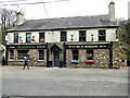
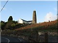
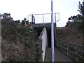
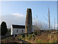
Nearby Images from Geograph Britain and Ireland:
©2023(licence)
©2008(licence)
©2012(licence)
©2008(licence)
©2019(licence)
The above images may not be of the site on this page, they are loaded from Geograph.
Please Submit an Image of this site or go out and take one for us!
Click here to see more info for this site
Nearby sites
Click here to view sites on an interactive map of the areaKey: Red: member's photo, Blue: 3rd party photo, Yellow: other image, Green: no photo - please go there and take one, Grey: site destroyed
Download sites to:
KML (Google Earth)
GPX (GPS waypoints)
CSV (Garmin/Navman)
CSV (Excel)
To unlock full downloads you need to sign up as a Contributory Member. Otherwise downloads are limited to 50 sites.
Turn off the page maps and other distractions
Nearby sites listing. In the following links * = Image available
1.7km SE 139° Curraghnalaght standing stone (north)* Standing Stone (Menhir)
1.7km SE 141° Curraghnalaght standing stone (south)* Standing Stone (Menhir)
3.1km E 82° Ballinvarrig Standing Stones (W648789)
3.2km SSW 192° Blarney Dolmen* Natural Stone / Erratic / Other Natural Feature
3.8km N 8° Dromgarriff Stone Circle (W62338222)
3.8km WSW 256° Loughane E* Standing Stones
4.6km WNW 294° Newcastle Standing Stones* Standing Stones (W5752580425)
5.0km SSE 155° Killeens North standing stone* Standing Stone (Menhir)
5.1km WSW 245° Cloghphilip Standing Stone* Standing Stone (Menhir)
5.2km W 270° Loughane West standing stone* Standing Stone (Menhir)
5.3km SSE 155° Killeens South standing stone* Standing Stone (Menhir)
5.8km ENE 68° Ballyhesty Standing Stones
6.0km WSW 253° Gortdonaghmore standing stone* Standing Stone (Menhir)
7.4km NW 319° Grenagh S Stone Circle
8.0km SW 214° Garravagh standing stone* Standing Stone (Menhir)
8.1km SSE 148° Cork Public Museum* Museum
8.1km S 184° Carrigrohane north standing stone* Standing Stone (Menhir)
8.4km SSE 148° University College Cork - Stone Corridor* Museum
8.7km W 270° Kilclogh standing stone* Standing Stone (Menhir)
9.4km WNW 303° Pluckanes North standing stone* Standing Stone (Menhir)
10.1km NW 306° Pluckanes North Stone Row / Alignment (W536845)
10.2km NW 306° Pluckanes Stone Circle (W53548457)
10.3km W 279° Ballyhennessy standing stone* Standing Stone (Menhir)
10.7km SW 227° Castleinch rock scribing* Carving
10.8km NNW 327° Knockantota North* Stone Circle (W55838758)
View more nearby sites and additional images


 We would like to know more about this location. Please feel free to add a brief description and any relevant information in your own language.
 Wir möchten mehr über diese Stätte erfahren. Bitte zögern Sie nicht, eine kurze Beschreibung und relevante Informationen in Deutsch hinzuzufügen.
 Nous aimerions en savoir encore un peu sur les lieux. S'il vous plaît n'hesitez pas à ajouter une courte description et tous les renseignements pertinents dans votre propre langue.
 Quisieramos informarnos un poco más de las lugares. No dude en añadir una breve descripción y otros datos relevantes en su propio idioma.