

<< Our Photo Pages >> Blarney Dolmen - Natural Stone / Erratic / Other Natural Feature in Ireland (Republic of) in Co. Cork
Submitted by EdwardTheHead on Saturday, 10 February 2007 Page Views: 10709
Natural PlacesSite Name: Blarney DolmenCountry: Ireland (Republic of)
NOTE: This site is 0.453 km away from the location you searched for.
County: Co. Cork Type: Natural Stone / Erratic / Other Natural Feature
Nearest Town: Blarney
Latitude: 51.929037N Longitude: 8.566952W
Condition:
| 5 | Perfect |
| 4 | Almost Perfect |
| 3 | Reasonable but with some damage |
| 2 | Ruined but still recognisable as an ancient site |
| 1 | Pretty much destroyed, possibly visible as crop marks |
| 0 | No data. |
| -1 | Completely destroyed |
| 5 | Superb |
| 4 | Good |
| 3 | Ordinary |
| 2 | Not Good |
| 1 | Awful |
| 0 | No data. |
| 5 | Can be driven to, probably with disabled access |
| 4 | Short walk on a footpath |
| 3 | Requiring a bit more of a walk |
| 2 | A long walk |
| 1 | In the middle of nowhere, a nightmare to find |
| 0 | No data. |
| 5 | co-ordinates taken by GPS or official recorded co-ordinates |
| 4 | co-ordinates scaled from a detailed map |
| 3 | co-ordinates scaled from a bad map |
| 2 | co-ordinates of the nearest village |
| 1 | co-ordinates of the nearest town |
| 0 | no data |
Internal Links:
External Links:
I have visited· I would like to visit
lichen visited on 12th Oct 2014 - their rating: Cond: 3 Amb: 4 Access: 4
")
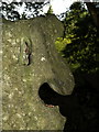
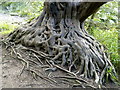
Blarney Dolmen is located on the grounds of Blarney castle in the Rock Close area. Very easy walk from the castle and the few times I have been there very few people around.
You may be viewing yesterday's version of this page. To see the most up to date information please register for a free account.
")
")
Do not use the above information on other web sites or publications without permission of the contributor.
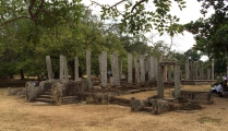
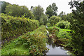
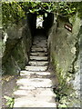
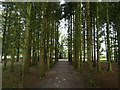
Nearby Images from Geograph Britain and Ireland:
©2016(licence)
©2007(licence)
©2007(licence)
©2007(licence)
©2007(licence)
The above images may not be of the site on this page, they are loaded from Geograph.
Please Submit an Image of this site or go out and take one for us!
Click here to see more info for this site
Nearby sites
Click here to view sites on an interactive map of the areaKey: Red: member's photo, Blue: 3rd party photo, Yellow: other image, Green: no photo - please go there and take one, Grey: site destroyed
Download sites to:
KML (Google Earth)
GPX (GPS waypoints)
CSV (Garmin/Navman)
CSV (Excel)
To unlock full downloads you need to sign up as a Contributory Member. Otherwise downloads are limited to 50 sites.
Turn off the page maps and other distractions
Nearby sites listing. In the following links * = Image available
2.5km NE 43° Curraghnalaght standing stone (south)* Standing Stone (Menhir)
2.6km NE 42° Curraghnalaght standing stone (north)* Standing Stone (Menhir)
3.1km ESE 116° Killeens North standing stone* Standing Stone (Menhir)
3.2km NNE 12° Ballygibbon* Standing Stones (W61757848)
3.3km ESE 119° Killeens South standing stone* Standing Stone (Menhir)
3.8km NW 307° Loughane E* Standing Stones
4.1km WNW 285° Cloghphilip Standing Stone* Standing Stone (Menhir)
4.9km S 179° Carrigrohane north standing stone* Standing Stone (Menhir)
5.2km SW 228° Garravagh standing stone* Standing Stone (Menhir)
5.2km NE 46° Ballinvarrig Standing Stones (W648789)
5.3km WNW 286° Gortdonaghmore standing stone* Standing Stone (Menhir)
5.5km NW 305° Loughane West standing stone* Standing Stone (Menhir)
6.2km SE 126° Cork Public Museum* Museum
6.2km NW 325° Newcastle Standing Stones* Standing Stones (W5752580425)
6.5km SE 127° University College Cork - Stone Corridor* Museum
7.0km N 10° Dromgarriff Stone Circle (W62338222)
8.1km NE 48° Ballyhesty Standing Stones
8.2km WSW 241° Castleinch rock scribing* Carving
8.7km WNW 292° Kilclogh standing stone* Standing Stone (Menhir)
9.7km NNW 334° Grenagh S Stone Circle
10.7km WNW 297° Ballyhennessy standing stone* Standing Stone (Menhir)
11.0km NW 319° Pluckanes North standing stone* Standing Stone (Menhir)
11.8km NW 321° Pluckanes North Stone Row / Alignment (W536845)
11.9km NW 321° Pluckanes Stone Circle (W53548457)
12.4km SE 137° Ballinvuskig standing stone (north)* Standing Stone (Menhir)
View more nearby sites and additional images


 We would like to know more about this location. Please feel free to add a brief description and any relevant information in your own language.
 Wir möchten mehr über diese Stätte erfahren. Bitte zögern Sie nicht, eine kurze Beschreibung und relevante Informationen in Deutsch hinzuzufügen.
 Nous aimerions en savoir encore un peu sur les lieux. S'il vous plaît n'hesitez pas à ajouter une courte description et tous les renseignements pertinents dans votre propre langue.
 Quisieramos informarnos un poco más de las lugares. No dude en añadir una breve descripción y otros datos relevantes en su propio idioma.