

<< Text Pages >> Castro das Valiñas - Castro or Chafurdão in Spain in Galicia
Submitted by holger_rix on Saturday, 19 December 2015 Page Views: 472
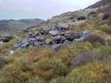
Iron Age and Later PrehistorySite Name: Castro das ValiñasCountry: Spain
NOTE: This site is 2.413 km away from the location you searched for.
Region: Galicia Type: Castro or Chafurdão
Nearest Town: Santiago de Compostella Nearest Village: Padrón
Latitude: 42.759507N Longitude: 8.559551W
Condition:
| 5 | Perfect |
| 4 | Almost Perfect |
| 3 | Reasonable but with some damage |
| 2 | Ruined but still recognisable as an ancient site |
| 1 | Pretty much destroyed, possibly visible as crop marks |
| 0 | No data. |
| -1 | Completely destroyed |
| 5 | Superb |
| 4 | Good |
| 3 | Ordinary |
| 2 | Not Good |
| 1 | Awful |
| 0 | No data. |
| 5 | Can be driven to, probably with disabled access |
| 4 | Short walk on a footpath |
| 3 | Requiring a bit more of a walk |
| 2 | A long walk |
| 1 | In the middle of nowhere, a nightmare to find |
| 0 | No data. |
| 5 | co-ordinates taken by GPS or official recorded co-ordinates |
| 4 | co-ordinates scaled from a detailed map |
| 3 | co-ordinates scaled from a bad map |
| 2 | co-ordinates of the nearest village |
| 1 | co-ordinates of the nearest town |
| 0 | no data |
Be the first person to rate this site - see the 'Contribute!' box in the right hand menu.
Internal Links:
External Links:
Castro in Galicia
You may be viewing yesterday's version of this page. To see the most up to date information please register for a free account.
Do not use the above information on other web sites or publications without permission of the contributor.
Nearby Images from Flickr
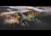
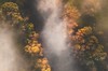
The above images may not be of the site on this page, but were taken nearby. They are loaded from Flickr so please click on them for image credits.
Click here to see more info for this site
Nearby sites
Click here to view sites on an interactive map of the areaKey: Red: member's photo, Blue: 3rd party photo, Yellow: other image, Green: no photo - please go there and take one, Grey: site destroyed
Download sites to:
KML (Google Earth)
GPX (GPS waypoints)
CSV (Garmin/Navman)
CSV (Excel)
To unlock full downloads you need to sign up as a Contributory Member. Otherwise downloads are limited to 50 sites.
Turn off the page maps and other distractions
Nearby sites listing. In the following links * = Image available
198m SSE 156° Castro de Couso Castro or Chafurdão
4.9km SW 230° Castro Valente Castro or Chafurdão
5.3km NW 322° Petróglifo de Outeiro do Corno* Rock Art
7.1km NNW 336° Castro Mouro Castro or Chafurdão
7.5km SW 215° Petróglifo dos Penoucos de Campo Redondo Rock Art
7.6km WSW 258° Castro de Padrón Castro or Chafurdão
7.8km SW 218° Petroglifos Pedra da Serpe* Rock Art
7.9km SSE 160° Castro de Matalobos Castro or Chafurdão
7.9km WSW 248° Castro do Barco Castro or Chafurdão
8.0km ENE 72° Castro de Agronovo Castro or Chafurdão
8.0km ENE 71° Castro de Illobre Castro or Chafurdão
8.0km ENE 72° Castro de Marzán Castro or Chafurdão
8.1km ENE 71° Castro do Peto Castro or Chafurdão
8.5km NW 316° Castro Lupario Castro or Chafurdão
8.9km WNW 294° Castro Lupario Castro or Chafurdão
9.2km WNW 287° Coto do Castro Castro or Chafurdão
9.3km NW 317° Petróglifo do Monte Pumariño Rock Art
9.4km SSE 166° Castroloureiro Castro or Chafurdão
9.5km SE 130° Castro de Aguións Castro or Chafurdão
10.1km SSE 148° Castro de Ouzande Castro or Chafurdão
10.3km W 275° Castro de Oín Castro or Chafurdão
10.3km ESE 117° Castro de San Miguel Castro or Chafurdão
10.8km W 261° Castro de Traxeito Castro or Chafurdão
11.0km NNE 14° Castro de Angrois Castro or Chafurdão
11.2km NNW 332° Petróglifo de A Nave* Rock Art
View more nearby sites and additional images


 We would like to know more about this location. Please feel free to add a brief description and any relevant information in your own language.
 Wir möchten mehr über diese Stätte erfahren. Bitte zögern Sie nicht, eine kurze Beschreibung und relevante Informationen in Deutsch hinzuzufügen.
 Nous aimerions en savoir encore un peu sur les lieux. S'il vous plaît n'hesitez pas à ajouter une courte description et tous les renseignements pertinents dans votre propre langue.
 Quisieramos informarnos un poco más de las lugares. No dude en añadir una breve descripción y otros datos relevantes en su propio idioma.