


<< Text Pages >> Castro de Roda do Castro - Castro or Chafurdão in Spain in Galicia
Submitted by holger_rix on Friday, 11 December 2015 Page Views: 538
Iron Age and Later PrehistorySite Name: Castro de Roda do Castro Alternative Name: Castro de VilasusoCountry: Spain
NOTE: This site is 1.339 km away from the location you searched for.
Region: Galicia Type: Castro or Chafurdão
Latitude: 42.933631N Longitude: 8.480633W
Condition:
| 5 | Perfect |
| 4 | Almost Perfect |
| 3 | Reasonable but with some damage |
| 2 | Ruined but still recognisable as an ancient site |
| 1 | Pretty much destroyed, possibly visible as crop marks |
| 0 | No data. |
| -1 | Completely destroyed |
| 5 | Superb |
| 4 | Good |
| 3 | Ordinary |
| 2 | Not Good |
| 1 | Awful |
| 0 | No data. |
| 5 | Can be driven to, probably with disabled access |
| 4 | Short walk on a footpath |
| 3 | Requiring a bit more of a walk |
| 2 | A long walk |
| 1 | In the middle of nowhere, a nightmare to find |
| 0 | No data. |
| 5 | co-ordinates taken by GPS or official recorded co-ordinates |
| 4 | co-ordinates scaled from a detailed map |
| 3 | co-ordinates scaled from a bad map |
| 2 | co-ordinates of the nearest village |
| 1 | co-ordinates of the nearest town |
| 0 | no data |
Be the first person to rate this site - see the 'Contribute!' box in the right hand menu.
Internal Links:
External Links:
Castro or Chafurdão in Galicia
You may be viewing yesterday's version of this page. To see the most up to date information please register for a free account.
Do not use the above information on other web sites or publications without permission of the contributor.
Nearby Images from Flickr
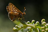
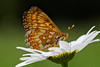
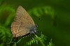
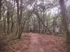
The above images may not be of the site on this page, but were taken nearby. They are loaded from Flickr so please click on them for image credits.
Click here to see more info for this site
Nearby sites
Click here to view sites on an interactive map of the areaKey: Red: member's photo, Blue: 3rd party photo, Yellow: other image, Green: no photo - please go there and take one, Grey: site destroyed
Download sites to:
KML (Google Earth)
GPX (GPS waypoints)
CSV (Garmin/Navman)
CSV (Excel)
To unlock full downloads you need to sign up as a Contributory Member. Otherwise downloads are limited to 50 sites.
Turn off the page maps and other distractions
Nearby sites listing. In the following links * = Image available
3.0km ENE 64° Castro de Monte do Castro (Santiago) Castro or Chafurdão
3.7km E 90° Castro da Devesa do Carballal Castro or Chafurdão
4.1km NE 43° Castro da Caluba Castro or Chafurdão
4.6km NNE 31° Castro da Corela Castro or Chafurdão
5.0km SSW 213° Castro de Picou Castro or Chafurdão
5.8km W 268° Castro do Bargo Castro or Chafurdão
6.2km NNE 25° Castro de Vilacide Castro or Chafurdão
6.4km SSE 162° Dolmen de Zaramacedo* Burial Chamber or Dolmen
6.5km ENE 58° Castro do Casal Castro or Chafurdão
6.8km NE 35° Castro de Oroso Pequeno Castro or Chafurdão
8.0km WSW 240° Monte Pedroso Petroglifos* Rock Art
8.1km NE 34° Castro de Vilalbarro Castro or Chafurdão
8.2km NNE 13° Castro de O Valo Castro or Chafurdão
8.8km WNW 303° Castro de Merelle Castro or Chafurdão
8.9km WSW 239° Petroglifos de Correxíns* Rock Art
9.1km W 279° Castro de Fontoade Castro or Chafurdão
9.1km WNW 291° A Pedra que Fala Rock Art
9.3km NE 45° Castro de Vilarromariz Castro or Chafurdão
9.3km WNW 287° Castromaior (Lamascal) Castro or Chafurdão
9.5km SSW 204° Castro de Angrois Castro or Chafurdão
10.0km NNE 20° Castro de Trasmonte Castro or Chafurdão
10.0km WSW 238° Castro de Marmancou Castro or Chafurdão
10.2km NNW 335° Castro de Francada Castro or Chafurdão
10.3km SW 223° Castriño de Conxo Petroglifos* Rock Art
10.3km SW 223° Castro de Conxo Castro or Chafurdão
View more nearby sites and additional images


 We would like to know more about this location. Please feel free to add a brief description and any relevant information in your own language.
 Wir möchten mehr über diese Stätte erfahren. Bitte zögern Sie nicht, eine kurze Beschreibung und relevante Informationen in Deutsch hinzuzufügen.
 Nous aimerions en savoir encore un peu sur les lieux. S'il vous plaît n'hesitez pas à ajouter une courte description et tous les renseignements pertinents dans votre propre langue.
 Quisieramos informarnos un poco más de las lugares. No dude en añadir una breve descripción y otros datos relevantes en su propio idioma.