

<< Text Pages >> Castro da Cruz do Castro - Castro or Chafurdão in Spain in Galicia
Submitted by TheCaptain on Wednesday, 08 September 2010 Page Views: 1477
Iron Age and Later PrehistorySite Name: Castro da Cruz do CastroCountry: Spain
NOTE: This site is 0.22 km away from the location you searched for.
Region: Galicia Type: Castro or Chafurdão
Nearest Town: Pontevedra Nearest Village: Cotobade
Latitude: 42.481158N Longitude: 8.476204W
Condition:
| 5 | Perfect |
| 4 | Almost Perfect |
| 3 | Reasonable but with some damage |
| 2 | Ruined but still recognisable as an ancient site |
| 1 | Pretty much destroyed, possibly visible as crop marks |
| 0 | No data. |
| -1 | Completely destroyed |
| 5 | Superb |
| 4 | Good |
| 3 | Ordinary |
| 2 | Not Good |
| 1 | Awful |
| 0 | No data. |
| 5 | Can be driven to, probably with disabled access |
| 4 | Short walk on a footpath |
| 3 | Requiring a bit more of a walk |
| 2 | A long walk |
| 1 | In the middle of nowhere, a nightmare to find |
| 0 | No data. |
| 5 | co-ordinates taken by GPS or official recorded co-ordinates |
| 4 | co-ordinates scaled from a detailed map |
| 3 | co-ordinates scaled from a bad map |
| 2 | co-ordinates of the nearest village |
| 1 | co-ordinates of the nearest town |
| 0 | no data |
Be the first person to rate this site - see the 'Contribute!' box in the right hand menu.
Internal Links:
External Links:
Castro in Galicia
Castro da Cruz do Castro is a Castro in the parish of Carballedo, community of Cotobade, Province of Pontevedra, region of Galicia
You may be viewing yesterday's version of this page. To see the most up to date information please register for a free account.
Do not use the above information on other web sites or publications without permission of the contributor.
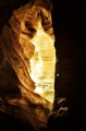
Nearby Images from Flickr
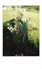
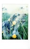

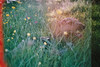
The above images may not be of the site on this page, but were taken nearby. They are loaded from Flickr so please click on them for image credits.
Click here to see more info for this site
Nearby sites
Click here to view sites on an interactive map of the areaKey: Red: member's photo, Blue: 3rd party photo, Yellow: other image, Green: no photo - please go there and take one, Grey: site destroyed
Download sites to:
KML (Google Earth)
GPX (GPS waypoints)
CSV (Garmin/Navman)
CSV (Excel)
To unlock full downloads you need to sign up as a Contributory Member. Otherwise downloads are limited to 50 sites.
Turn off the page maps and other distractions
Nearby sites listing. In the following links * = Image available
3.6km NW 320° Eira dos Mouros Castro or Chafurdão
3.9km W 274° Laxe das Coutadas Rock Art
4.0km NW 317° Castro de A Cividá Castro or Chafurdão
4.3km NNW 331° Petróglifos Laxe das Rodas Rock Art
5.4km WNW 282° Castro de O Coto do Castro (O Valiño) Castro or Chafurdão
5.7km W 281° Portela das Laxes Petrogrifo Rock Art
5.7km NNW 328° Petroglifo Laxe das Ferraduras* Rock Art
6.0km NNW 329° Laxe dos Cebros* Rock Art
6.1km NE 40° Petróglifo dos Castelos* Rock Art
6.1km WSW 256° Castro de Tenorio Castro or Chafurdão
6.2km W 270° Pedrafita do Coto da Fontiña Standing Stone (Menhir)
6.3km NNW 340° Petroglifos en Morillas Montes Rock Art
6.5km WNW 282° Castro de Outeiro do Castro Castro or Chafurdão
7.1km NNW 339° Petroglifos do Outeiro de Pantrigo* Rock Art
7.3km W 275° Castro do Coto de Rodelas Castro or Chafurdão
7.7km E 97° Porta do Alén* Rock Outcrop
7.9km WNW 294° Pedra da Boullosa Rock Art
8.1km NNW 326° Parque Arqueológico del Arte Rupestre (PAAR)* Rock Art
8.2km NNW 330° Outeiro da Pena Furada* Rock Art
8.3km NNW 328° Laxe da Forneiriña* Rock Art
8.4km NNW 329° Laxe dos Carballos* Rock Art
8.4km NNW 330° Outeiro dos Cogoludos* Rock Art
8.5km NNW 329° Outeiro das Ventaniñas* Rock Art
8.5km NW 306° Pedra de San Francisco Rock Art
9.0km SSE 155° Pedrafita de Xende 2 Standing Stone (Menhir)
View more nearby sites and additional images


 We would like to know more about this location. Please feel free to add a brief description and any relevant information in your own language.
 Wir möchten mehr über diese Stätte erfahren. Bitte zögern Sie nicht, eine kurze Beschreibung und relevante Informationen in Deutsch hinzuzufügen.
 Nous aimerions en savoir encore un peu sur les lieux. S'il vous plaît n'hesitez pas à ajouter une courte description et tous les renseignements pertinents dans votre propre langue.
 Quisieramos informarnos un poco más de las lugares. No dude en añadir una breve descripción y otros datos relevantes en su propio idioma.