


<< Text Pages >> Marco da Anta - Standing Stone (Menhir) in Spain in Galicia
Submitted by holger_rix on Wednesday, 16 December 2015 Page Views: 883
Neolithic and Bronze AgeSite Name: Marco da Anta Alternative Name: Pedra da Anta, Pedra do Marco, Pedra do Ghicho, Pedrafita dos montes de Santa LeocadiaCountry: Spain
NOTE: This site is 4.094 km away from the location you searched for.
Region: Galicia Type: Standing Stone (Menhir)
Latitude: 43.266685N Longitude: 8.501685W
Condition:
| 5 | Perfect |
| 4 | Almost Perfect |
| 3 | Reasonable but with some damage |
| 2 | Ruined but still recognisable as an ancient site |
| 1 | Pretty much destroyed, possibly visible as crop marks |
| 0 | No data. |
| -1 | Completely destroyed |
| 5 | Superb |
| 4 | Good |
| 3 | Ordinary |
| 2 | Not Good |
| 1 | Awful |
| 0 | No data. |
| 5 | Can be driven to, probably with disabled access |
| 4 | Short walk on a footpath |
| 3 | Requiring a bit more of a walk |
| 2 | A long walk |
| 1 | In the middle of nowhere, a nightmare to find |
| 0 | No data. |
| 5 | co-ordinates taken by GPS or official recorded co-ordinates |
| 4 | co-ordinates scaled from a detailed map |
| 3 | co-ordinates scaled from a bad map |
| 2 | co-ordinates of the nearest village |
| 1 | co-ordinates of the nearest town |
| 0 | no data |
Be the first person to rate this site - see the 'Contribute!' box in the right hand menu.
Internal Links:
External Links:
Standing Stone (Menhir) in Galicia
You may be viewing yesterday's version of this page. To see the most up to date information please register for a free account.
Do not use the above information on other web sites or publications without permission of the contributor.
Nearby Images from Flickr
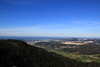

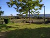
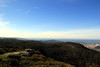
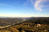
The above images may not be of the site on this page, but were taken nearby. They are loaded from Flickr so please click on them for image credits.
Click here to see more info for this site
Nearby sites
Click here to view sites on an interactive map of the areaKey: Red: member's photo, Blue: 3rd party photo, Yellow: other image, Green: no photo - please go there and take one, Grey: site destroyed
Download sites to:
KML (Google Earth)
GPX (GPS waypoints)
CSV (Garmin/Navman)
CSV (Excel)
To unlock full downloads you need to sign up as a Contributory Member. Otherwise downloads are limited to 50 sites.
Turn off the page maps and other distractions
Nearby sites listing. In the following links * = Image available
913m NE 50° Castro do Coto de Santa Locaia Castro or Chafurdão
2.9km W 263° Castro de Mirón Castro or Chafurdão
3.7km NE 48° Castro de Canzobre Castro or Chafurdão
4.1km N 2° Castro da Penouqueira Castro or Chafurdão
4.2km N 350° Castro de Castelo Castro or Chafurdão
4.4km W 260° Castro de Vigo Castro or Chafurdão
4.6km NW 316° Castro do Petón Castro or Chafurdão
5.1km NE 49° Castro de Freón Castro or Chafurdão
5.2km NNW 347° Castro de Figueiroa Castro or Chafurdão
5.2km N 9° Castro de Laxobre Castro or Chafurdão
5.5km NNW 344° Castro de Castelo Castro or Chafurdão
5.9km NNE 15° Castro de Rañobre Castro or Chafurdão
6.8km NNE 20° Castro de Galán Castro or Chafurdão
6.9km WSW 253° Castro de Santa Baia Castro or Chafurdão
7.2km WNW 303° Castro de O Castro (A Lagoa) Castro or Chafurdão
8.4km N 10° Castro do Puntido Castro or Chafurdão
8.4km N 10° Castro do Cociñadoiro Castro or Chafurdão
9.1km E 85° Castro de Sésamo Castro or Chafurdão
9.7km E 89° Castro de Sueiro Castro or Chafurdão
9.9km NE 45° Castro de Elviña Castro or Chafurdão
10.1km NNE 21° Castro de Nostián Castro or Chafurdão
10.8km WNW 287° Castro de Costenla Castro or Chafurdão
11.3km ENE 70° Castro de Alvedro Castro or Chafurdão
11.4km E 80° Castro de Sigrás Castro or Chafurdão
11.9km W 272° Castro de Vilela (Carballo) Castro or Chafurdão
View more nearby sites and additional images


 We would like to know more about this location. Please feel free to add a brief description and any relevant information in your own language.
 Wir möchten mehr über diese Stätte erfahren. Bitte zögern Sie nicht, eine kurze Beschreibung und relevante Informationen in Deutsch hinzuzufügen.
 Nous aimerions en savoir encore un peu sur les lieux. S'il vous plaît n'hesitez pas à ajouter une courte description et tous les renseignements pertinents dans votre propre langue.
 Quisieramos informarnos un poco más de las lugares. No dude en añadir una breve descripción y otros datos relevantes en su propio idioma.