

<< Text Pages >> Anta do Padrão - Burial Chamber or Dolmen in Portugal in Porto
Submitted by AlexHunger on Monday, 29 May 2006 Page Views: 4068
Neolithic and Bronze AgeSite Name: Anta do PadrãoCountry: Portugal
NOTE: This site is 7.357 km away from the location you searched for.
Distrito: Porto Type: Burial Chamber or Dolmen
Nearest Town: Porto Nearest Village: Paredes
Latitude: 41.184759N Longitude: 8.40296W
Condition:
| 5 | Perfect |
| 4 | Almost Perfect |
| 3 | Reasonable but with some damage |
| 2 | Ruined but still recognisable as an ancient site |
| 1 | Pretty much destroyed, possibly visible as crop marks |
| 0 | No data. |
| -1 | Completely destroyed |
| 5 | Superb |
| 4 | Good |
| 3 | Ordinary |
| 2 | Not Good |
| 1 | Awful |
| 0 | No data. |
| 5 | Can be driven to, probably with disabled access |
| 4 | Short walk on a footpath |
| 3 | Requiring a bit more of a walk |
| 2 | A long walk |
| 1 | In the middle of nowhere, a nightmare to find |
| 0 | No data. |
| 5 | co-ordinates taken by GPS or official recorded co-ordinates |
| 4 | co-ordinates scaled from a detailed map |
| 3 | co-ordinates scaled from a bad map |
| 2 | co-ordinates of the nearest village |
| 1 | co-ordinates of the nearest town |
| 0 | no data |
Be the first person to rate this site - see the 'Contribute!' box in the right hand menu.
Internal Links:
External Links:
I have visited· I would like to visit
annikacunha would like to visit
Distrito do Porto, Area of Baltar
More information at IGESPAR
You may be viewing yesterday's version of this page. To see the most up to date information please register for a free account.
Do not use the above information on other web sites or publications without permission of the contributor.
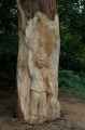
Nearby Images from Flickr


The above images may not be of the site on this page, but were taken nearby. They are loaded from Flickr so please click on them for image credits.
Click here to see more info for this site
Nearby sites
Click here to view sites on an interactive map of the areaKey: Red: member's photo, Blue: 3rd party photo, Yellow: other image, Green: no photo - please go there and take one, Grey: site destroyed
Download sites to:
KML (Google Earth)
GPX (GPS waypoints)
CSV (Garmin/Navman)
CSV (Excel)
To unlock full downloads you need to sign up as a Contributory Member. Otherwise downloads are limited to 50 sites.
Turn off the page maps and other distractions
Nearby sites listing. In the following links * = Image available
1.8km SE 126° Mamoa de Ramos Artificial Mound
1.9km NNE 33° Castro da Serra do Muro de Vandoma Castro or Chafurdão
8.0km N 349° Mamoa do Taio* Chambered Cairn
8.8km ESE 119° Castro de Monte Mozinho Castro or Chafurdão
12.6km ESE 111° Sepulturas medievais de Quintã* Rock Cut Tomb
12.6km E 79° Sepulturas rupestres da Portela* Rock Cut Tomb
12.7km E 79° Anta de Santa Marta* Burial Chamber or Dolmen
13.1km ESE 110° Gravuras de Lomar* Rock Art
13.1km ESE 110° Menir de Luzim* Standing Stone (Menhir)
13.5km NE 41° Castro de São Domingos Castro or Chafurdão
15.0km N 349° Castro do Monte Padrão Castro or Chafurdão
15.3km NNE 17° Anta da Leira Longa Burial Chamber or Dolmen
15.4km N 5° Citânia de Sanfins* Castro or Chafurdão
15.4km N 10° Museu Sanfins de Ferreira* Museum
16.1km WSW 239° Castro do Guedes Castro or Chafurdão
17.6km ESE 123° Castro dos Arados Castro or Chafurdão
18.9km NNE 14° Castro de Santa Margarida Castro or Chafurdão
19.6km SE 146° Anta do Vale da Rua Burial Chamber or Dolmen
21.5km E 97° Tongobriga Ancient Village or Settlement
22.2km NW 306° Castro de Alvarelhos Castro or Chafurdão
23.1km W 274° Castro do Monte Castelo de Guifões ou Monte Castelo Castro or Chafurdão
23.7km N 356° Estação Arqueológica de Perrelos Ancient Village or Settlement
23.9km SSW 204° Castro de Fiães Castro or Chafurdão
25.5km NNW 335° Castro de São Miguel-o-Anjo Castro or Chafurdão
27.0km S 190° Castro de Romariz* Castro or Chafurdão
View more nearby sites and additional images


 We would like to know more about this location. Please feel free to add a brief description and any relevant information in your own language.
 Wir möchten mehr über diese Stätte erfahren. Bitte zögern Sie nicht, eine kurze Beschreibung und relevante Informationen in Deutsch hinzuzufügen.
 Nous aimerions en savoir encore un peu sur les lieux. S'il vous plaît n'hesitez pas à ajouter une courte description et tous les renseignements pertinents dans votre propre langue.
 Quisieramos informarnos un poco más de las lugares. No dude en añadir una breve descripción y otros datos relevantes en su propio idioma.