 with our Megalithic Portal iPhone app")


<< Text Pages >> Castro do Monte da Consolação - Castro or Chafurdão in Portugal in Braga
Submitted by TheCaptain on Wednesday, 08 September 2010 Page Views: 2256
Iron Age and Later PrehistorySite Name: Castro do Monte da ConsolaçãoCountry: Portugal
NOTE: This site is 2.125 km away from the location you searched for.
Distrito: Braga Type: Castro or Chafurdão
Nearest Town: Braga Nearest Village: Nogueiró
Latitude: 41.545000N Longitude: 8.379W
Condition:
| 5 | Perfect |
| 4 | Almost Perfect |
| 3 | Reasonable but with some damage |
| 2 | Ruined but still recognisable as an ancient site |
| 1 | Pretty much destroyed, possibly visible as crop marks |
| 0 | No data. |
| -1 | Completely destroyed |
| 5 | Superb |
| 4 | Good |
| 3 | Ordinary |
| 2 | Not Good |
| 1 | Awful |
| 0 | No data. |
| 5 | Can be driven to, probably with disabled access |
| 4 | Short walk on a footpath |
| 3 | Requiring a bit more of a walk |
| 2 | A long walk |
| 1 | In the middle of nowhere, a nightmare to find |
| 0 | No data. |
| 5 | co-ordinates taken by GPS or official recorded co-ordinates |
| 4 | co-ordinates scaled from a detailed map |
| 3 | co-ordinates scaled from a bad map |
| 2 | co-ordinates of the nearest village |
| 1 | co-ordinates of the nearest town |
| 0 | no data |
Be the first person to rate this site - see the 'Contribute!' box in the right hand menu.
Internal Links:
External Links:
Castro in North Portugal
Castro do Monte da Consolação is a Castro in the community of Nogueiró near the town of Braga, District of Braga
You may be viewing yesterday's version of this page. To see the most up to date information please register for a free account.
Do not use the above information on other web sites or publications without permission of the contributor.
Nearby Images from Flickr


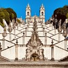
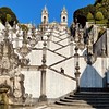

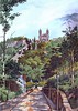
The above images may not be of the site on this page, but were taken nearby. They are loaded from Flickr so please click on them for image credits.
Click here to see more info for this site
Nearby sites
Click here to view sites on an interactive map of the areaKey: Red: member's photo, Blue: 3rd party photo, Yellow: other image, Green: no photo - please go there and take one, Grey: site destroyed
Download sites to:
KML (Google Earth)
GPX (GPS waypoints)
CSV (Garmin/Navman)
CSV (Excel)
To unlock full downloads you need to sign up as a Contributory Member. Otherwise downloads are limited to 50 sites.
Turn off the page maps and other distractions
Nearby sites listing. In the following links * = Image available
3.6km SSW 202° Castro Santa Marta das Cortiças Castro or Chafurdão
4.5km WNW 294° Castro Máximo Castro or Chafurdão
4.8km SE 140° Citânia de Sabroso* Castro or Chafurdão
5.1km ESE 121° Museu da cultura castreja* Museum
5.6km ESE 110° Citânia de Briteiros* Castro or Chafurdão
6.4km SW 223° Mamoa de Lamas* Burial Chamber or Dolmen
9.4km ENE 62° Estação Lusitano-Romana de Póvoa do Lanhoso Castro or Chafurdão
9.7km SW 216° Castro de Monte Redondo Castro or Chafurdão
13.2km SSE 149° Museu Martins Sarmento* Museum
13.5km SSW 204° Castro das Eiras Castro or Chafurdão
14.2km NNW 328° Castro de Barbudo Castro or Chafurdão
15.3km SW 232° Castro do Monte das Ermidas Castro or Chafurdão
16.1km N 356° Citânia de São Julião de Caldelas Castro or Chafurdão
16.1km W 279° Monumento Castrejo de Santa Maria de Galegos Castro or Chafurdão
16.8km SSW 192° Estação Arqueológica de Perrelos Ancient Village or Settlement
19.0km ESE 121° Castro de Santo Ovídio Castro or Chafurdão
20.3km W 265° Museu Arqueológico Paço dos Duques Museum
21.3km SW 217° Castro de São Miguel-o-Anjo Castro or Chafurdão
21.6km WNW 282° Castro de Monte Castro Castro or Chafurdão
21.8km S 173° Castro de Santa Margarida Castro or Chafurdão
23.6km ENE 64° Monte do Castelo Castro or Chafurdão
23.9km E 79° Monte do Castelo Castro or Chafurdão
24.0km NE 34° Ruínas da Calcedónia Castro or Chafurdão
24.7km S 181° Citânia de Sanfins* Castro or Chafurdão
24.9km S 178° Museu Sanfins de Ferreira* Museum
View more nearby sites and additional images


 We would like to know more about this location. Please feel free to add a brief description and any relevant information in your own language.
 Wir möchten mehr über diese Stätte erfahren. Bitte zögern Sie nicht, eine kurze Beschreibung und relevante Informationen in Deutsch hinzuzufügen.
 Nous aimerions en savoir encore un peu sur les lieux. S'il vous plaît n'hesitez pas à ajouter une courte description et tous les renseignements pertinents dans votre propre langue.
 Quisieramos informarnos un poco más de las lugares. No dude en añadir una breve descripción y otros datos relevantes en su propio idioma.