


<< Other Photo Pages >> Hermit's Cave and Holy Well - Burren National Park - Holy Well or Sacred Spring in Ireland (Republic of) in Co. Clare
Submitted by damian120 on Tuesday, 18 September 2018 Page Views: 1819
Springs and Holy WellsSite Name: Hermit's Cave and Holy Well - Burren National ParkCountry: Ireland (Republic of) County: Co. Clare Type: Holy Well or Sacred Spring
Nearest Town: Ballyvaughan Nearest Village: Carran
Latitude: 54.088100N Longitude: 8.375136W
Condition:
| 5 | Perfect |
| 4 | Almost Perfect |
| 3 | Reasonable but with some damage |
| 2 | Ruined but still recognisable as an ancient site |
| 1 | Pretty much destroyed, possibly visible as crop marks |
| 0 | No data. |
| -1 | Completely destroyed |
| 5 | Superb |
| 4 | Good |
| 3 | Ordinary |
| 2 | Not Good |
| 1 | Awful |
| 0 | No data. |
| 5 | Can be driven to, probably with disabled access |
| 4 | Short walk on a footpath |
| 3 | Requiring a bit more of a walk |
| 2 | A long walk |
| 1 | In the middle of nowhere, a nightmare to find |
| 0 | No data. |
| 5 | co-ordinates taken by GPS or official recorded co-ordinates |
| 4 | co-ordinates scaled from a detailed map |
| 3 | co-ordinates scaled from a bad map |
| 2 | co-ordinates of the nearest village |
| 1 | co-ordinates of the nearest town |
| 0 | no data |
Internal Links:
External Links:
")
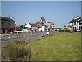
For years this one-man monastic settlement was difficult to locate and it's great to know, that it's now marked on the Brown Walking Trail at the Burren National Park, and is easily accessible on foot. Sheltered by the Burren hills and Eagle's Rock above, this historic site commands a wonderful panoramic view of the surrounding landscape, while at the same time remains endlessly wrapped in an envelope of infinite solitude and tranquillity.
You may be viewing yesterday's version of this page. To see the most up to date information please register for a free account.
")
")
")
Do not use the above information on other web sites or publications without permission of the contributor.
Nearby Images from Geograph Britain and Ireland:
©2009(licence)
©2008(licence)
©2022(licence)
©2022(licence)
©2009(licence)
The above images may not be of the site on this page, they are loaded from Geograph.
Please Submit an Image of this site or go out and take one for us!
Click here to see more info for this site
Nearby sites
Click here to view sites on an interactive map of the areaKey: Red: member's photo, Blue: 3rd party photo, Yellow: other image, Green: no photo - please go there and take one, Grey: site destroyed
Download sites to:
KML (Google Earth)
GPX (GPS waypoints)
CSV (Garmin/Navman)
CSV (Excel)
To unlock full downloads you need to sign up as a Contributory Member. Otherwise downloads are limited to 50 sites.
Turn off the page maps and other distractions
Nearby sites listing. In the following links * = Image available
1.9km ENE 66° Heapstown Cairn* Chambered Cairn (G77251626)
3.4km S 184° Carrowkeel* Passage Grave (G75231206)
3.5km SSW 191° Carrowkeel Cairn C Passage Grave (G748121)
3.5km SSW 191° Carrowkeel D Passage Grave (G748121)
3.5km S 184° Carrowkeel Cairn X* Cairn (G75251196)
3.6km S 183° Carrowkeel Cairn G* Chambered Cairn (G7531111933)
3.6km S 183° Carrowkeel H* Passage Grave (G7530211863)
3.7km E 95° Cromleach Lodge* Chambered Tomb (G79181517)
3.8km S 182° Carrowkeel Cairn K* Chambered Cairn (G7533511726)
3.8km S 183° Carrowkeel L* Passage Grave (G753117)
3.8km S 174° Carrowkeel O Passage Grave (G759117)
3.9km S 172° Carrowkeel P Passage Grave (G760116)
3.9km S 188° Carrowkeel Cairn E* Court Tomb (G7492711606)
4.0km SSW 194° Carrowkeel B* Passage Grave (G7446711598)
4.1km E 87° Carrickglass* Portal Tomb (G796157)
4.1km S 180° Carrowkeel M Passage Grave (G755114)
4.1km S 188° Carrowkeel F* Passage Grave (G749114)
4.2km S 178° Carrowkeel N Passage Grave (G756113)
5.1km SW 235° Kesh Corran Chambered Cairn (G7127812622)
6.4km ESE 119° Shee Lugh* Chambered Cairn
12.9km SSW 207° Ballynakill (LoughRea) Stone Circle* Stone Circle (G696040)
13.2km S 174° Ballynanultagh* Portal Tomb (G76800237)
19.8km ENE 65° Turlough Stone Row* Standing Stones (G935238)
19.8km NW 317° Tanrego Bay Stone Circle (G6230)
19.9km NNW 333° Carrowmore 27* Passage Grave
View more nearby sites and additional images


 We would like to know more about this location. Please feel free to add a brief description and any relevant information in your own language.
 Wir möchten mehr über diese Stätte erfahren. Bitte zögern Sie nicht, eine kurze Beschreibung und relevante Informationen in Deutsch hinzuzufügen.
 Nous aimerions en savoir encore un peu sur les lieux. S'il vous plaît n'hesitez pas à ajouter une courte description et tous les renseignements pertinents dans votre propre langue.
 Quisieramos informarnos un poco más de las lugares. No dude en añadir una breve descripción y otros datos relevantes en su propio idioma.