


<< Text Pages >> Castro de Loureiro (Forcarei) - Castro or Chafurdão in Spain in Galicia
Submitted by holger_rix on Saturday, 19 December 2015 Page Views: 587
Iron Age and Later PrehistorySite Name: Castro de Loureiro (Forcarei)Country: Spain
NOTE: This site is 1.342 km away from the location you searched for.
Region: Galicia Type: Castro or Chafurdão
Nearest Town: Santiago de Compostella Nearest Village: Estrada
Latitude: 42.594070N Longitude: 8.333795W
Condition:
| 5 | Perfect |
| 4 | Almost Perfect |
| 3 | Reasonable but with some damage |
| 2 | Ruined but still recognisable as an ancient site |
| 1 | Pretty much destroyed, possibly visible as crop marks |
| 0 | No data. |
| -1 | Completely destroyed |
| 5 | Superb |
| 4 | Good |
| 3 | Ordinary |
| 2 | Not Good |
| 1 | Awful |
| 0 | No data. |
| 5 | Can be driven to, probably with disabled access |
| 4 | Short walk on a footpath |
| 3 | Requiring a bit more of a walk |
| 2 | A long walk |
| 1 | In the middle of nowhere, a nightmare to find |
| 0 | No data. |
| 5 | co-ordinates taken by GPS or official recorded co-ordinates |
| 4 | co-ordinates scaled from a detailed map |
| 3 | co-ordinates scaled from a bad map |
| 2 | co-ordinates of the nearest village |
| 1 | co-ordinates of the nearest town |
| 0 | no data |
Be the first person to rate this site - see the 'Contribute!' box in the right hand menu.
Internal Links:
External Links:
Castro in Galicia
You may be viewing yesterday's version of this page. To see the most up to date information please register for a free account.
Do not use the above information on other web sites or publications without permission of the contributor.
Nearby Images from Flickr
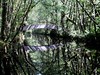
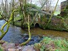
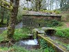
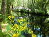
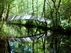
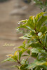
The above images may not be of the site on this page, but were taken nearby. They are loaded from Flickr so please click on them for image credits.
Click here to see more info for this site
Nearby sites
Click here to view sites on an interactive map of the areaKey: Red: member's photo, Blue: 3rd party photo, Yellow: other image, Green: no photo - please go there and take one, Grey: site destroyed
Download sites to:
KML (Google Earth)
GPX (GPS waypoints)
CSV (Garmin/Navman)
CSV (Excel)
To unlock full downloads you need to sign up as a Contributory Member. Otherwise downloads are limited to 50 sites.
Turn off the page maps and other distractions
Nearby sites listing. In the following links * = Image available
2.7km SSW 193° Pedrafita do Cachafeiro Standing Stone (Menhir)
4.4km SSE 159° Castro das Rodeiras Castro or Chafurdão
6.1km WSW 247° Castro de Vilalén Castro or Chafurdão
8.9km W 281° Castro das Quintas Castro or Chafurdão
9.4km WNW 297° Castro de Marcenlos Castro or Chafurdão
9.6km WNW 303° Castro de Ribela Castro or Chafurdão
11.1km SW 225° Petróglifo dos Castelos* Rock Art
13.2km NNE 30° Castro de Toiriz (Silleda)* Castro or Chafurdão
13.5km E 83° Castro de Vilatuxe Castro or Chafurdão
14.0km SSW 197° Porta do Alén* Rock Outcrop
14.9km NW 309° Castro de Guimarei Castro or Chafurdão
15.3km WSW 244° Petroglifos en Morillas Montes Rock Art
15.4km WSW 247° Petroglifos do Outeiro de Pantrigo* Rock Art
15.5km NNE 27° Copa do Castro* Castro or Chafurdão
15.7km NNW 336° Castro de San Tomé de Ancorados Castro or Chafurdão
16.0km W 270° Petróglifo dos Campiños* Rock Art
16.3km WSW 237° Petróglifos Laxe das Rodas Rock Art
16.4km NW 307° Castro de Ouzande Castro or Chafurdão
16.5km WSW 243° Laxe dos Cebros* Rock Art
16.6km NW 326° Castro de San Miguel Castro or Chafurdão
16.6km WSW 242° Petroglifo Laxe das Ferraduras* Rock Art
16.7km NW 318° Castro de Aguións Castro or Chafurdão
16.7km SSE 154° Castro de Magros Castro or Chafurdão
16.7km WSW 251° Outeiro da Pena Furada* Rock Art
16.8km WSW 252° Outeiro dos Cogoludos* Rock Art
View more nearby sites and additional images


 We would like to know more about this location. Please feel free to add a brief description and any relevant information in your own language.
 Wir möchten mehr über diese Stätte erfahren. Bitte zögern Sie nicht, eine kurze Beschreibung und relevante Informationen in Deutsch hinzuzufügen.
 Nous aimerions en savoir encore un peu sur les lieux. S'il vous plaît n'hesitez pas à ajouter une courte description et tous les renseignements pertinents dans votre propre langue.
 Quisieramos informarnos un poco más de las lugares. No dude en añadir una breve descripción y otros datos relevantes en su propio idioma.