 with our Megalithic Portal iPhone app")

<< Text Pages >> Castro de San Migueliño - Castro or Chafurdão in Spain in Galicia
Submitted by holger_rix on Saturday, 12 December 2015 Page Views: 524
Iron Age and Later PrehistorySite Name: Castro de San MigueliñoCountry: Spain
NOTE: This site is 5.139 km away from the location you searched for.
Region: Galicia Type: Castro or Chafurdão
Latitude: 42.950711N Longitude: 8.355467W
Condition:
| 5 | Perfect |
| 4 | Almost Perfect |
| 3 | Reasonable but with some damage |
| 2 | Ruined but still recognisable as an ancient site |
| 1 | Pretty much destroyed, possibly visible as crop marks |
| 0 | No data. |
| -1 | Completely destroyed |
| 5 | Superb |
| 4 | Good |
| 3 | Ordinary |
| 2 | Not Good |
| 1 | Awful |
| 0 | No data. |
| 5 | Can be driven to, probably with disabled access |
| 4 | Short walk on a footpath |
| 3 | Requiring a bit more of a walk |
| 2 | A long walk |
| 1 | In the middle of nowhere, a nightmare to find |
| 0 | No data. |
| 5 | co-ordinates taken by GPS or official recorded co-ordinates |
| 4 | co-ordinates scaled from a detailed map |
| 3 | co-ordinates scaled from a bad map |
| 2 | co-ordinates of the nearest village |
| 1 | co-ordinates of the nearest town |
| 0 | no data |
Be the first person to rate this site - see the 'Contribute!' box in the right hand menu.
Internal Links:
External Links:
Castro or Chafurdão in Galicia
You may be viewing yesterday's version of this page. To see the most up to date information please register for a free account.
Do not use the above information on other web sites or publications without permission of the contributor.
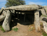
Nearby Images from Flickr
The above images may not be of the site on this page, but were taken nearby. They are loaded from Flickr so please click on them for image credits.
Click here to see more info for this site
Nearby sites
Click here to view sites on an interactive map of the areaKey: Red: member's photo, Blue: 3rd party photo, Yellow: other image, Green: no photo - please go there and take one, Grey: site destroyed
Download sites to:
KML (Google Earth)
GPX (GPS waypoints)
CSV (Garmin/Navman)
CSV (Excel)
To unlock full downloads you need to sign up as a Contributory Member. Otherwise downloads are limited to 50 sites.
Turn off the page maps and other distractions
Nearby sites listing. In the following links * = Image available
4.7km NNE 20° Castro de Sar Castro or Chafurdão
5.0km WNW 288° Castro do Casal Castro or Chafurdão
5.8km NW 322° Castro de Vilarromariz Castro or Chafurdão
6.5km NNE 18° Castro da Grabanxa Castro or Chafurdão
6.8km WSW 254° Castro da Devesa do Carballal Castro or Chafurdão
7.0km NNE 32° Castro de San Román Castro or Chafurdão
7.3km WNW 301° Castro de Oroso Pequeno Castro or Chafurdão
7.4km W 279° Castro da Caluba Castro or Chafurdão
7.5km NW 310° Castro de Vilalbarro Castro or Chafurdão
7.5km W 266° Castro de Monte do Castro (Santiago) Castro or Chafurdão
8.1km WNW 285° Castro da Corela Castro or Chafurdão
8.4km WNW 296° Castro de Vilacide Castro or Chafurdão
8.8km N 6° Castro de Marzoa Castro or Chafurdão
8.8km NE 35° Peneda de Guntín Dolmen Burial Chamber or Dolmen
9.0km NNW 332° Castro de Bouzalonga Castro or Chafurdão
9.9km N 353° Castro do Recouso Castro or Chafurdão
10.1km NW 318° Castro de Trasmonte Castro or Chafurdão
10.3km NW 306° Castro de O Valo Castro or Chafurdão
10.4km W 259° Castro de Roda do Castro Castro or Chafurdão
10.6km NNE 29° Castro de Cimadevila Castro or Chafurdão
11.4km SW 226° Dolmen de Zaramacedo* Burial Chamber or Dolmen
12.1km SSE 155° Croa do Castro Castro or Chafurdão
12.6km ESE 119° Castro de Couto Cornado Castro or Chafurdão
14.3km WSW 245° Castro de Picou Castro or Chafurdão
14.3km NE 52° Castro de Céltigos (Igrexa) Castro or Chafurdão
View more nearby sites and additional images


 We would like to know more about this location. Please feel free to add a brief description and any relevant information in your own language.
 Wir möchten mehr über diese Stätte erfahren. Bitte zögern Sie nicht, eine kurze Beschreibung und relevante Informationen in Deutsch hinzuzufügen.
 Nous aimerions en savoir encore un peu sur les lieux. S'il vous plaît n'hesitez pas à ajouter une courte description et tous les renseignements pertinents dans votre propre langue.
 Quisieramos informarnos un poco más de las lugares. No dude en añadir una breve descripción y otros datos relevantes en su propio idioma.