


<< Our Photo Pages >> Chousa Nova Dolmen - Burial Chamber or Dolmen in Spain in Galicia
Submitted by holger_rix on Thursday, 03 December 2015 Page Views: 819
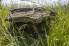
Neolithic and Bronze AgeSite Name: Chousa Nova Dolmen Alternative Name: Anta da Chousa NovaCountry: Spain
NOTE: This site is 1.525 km away from the location you searched for.
Region: Galicia Type: Burial Chamber or Dolmen
Nearest Village: Bandeira
Latitude: 42.756788N Longitude: 8.292722W
Condition:
| 5 | Perfect |
| 4 | Almost Perfect |
| 3 | Reasonable but with some damage |
| 2 | Ruined but still recognisable as an ancient site |
| 1 | Pretty much destroyed, possibly visible as crop marks |
| 0 | No data. |
| -1 | Completely destroyed |
| 5 | Superb |
| 4 | Good |
| 3 | Ordinary |
| 2 | Not Good |
| 1 | Awful |
| 0 | No data. |
| 5 | Can be driven to, probably with disabled access |
| 4 | Short walk on a footpath |
| 3 | Requiring a bit more of a walk |
| 2 | A long walk |
| 1 | In the middle of nowhere, a nightmare to find |
| 0 | No data. |
| 5 | co-ordinates taken by GPS or official recorded co-ordinates |
| 4 | co-ordinates scaled from a detailed map |
| 3 | co-ordinates scaled from a bad map |
| 2 | co-ordinates of the nearest village |
| 1 | co-ordinates of the nearest town |
| 0 | no data |
Internal Links:
External Links:
")
You may be viewing yesterday's version of this page. To see the most up to date information please register for a free account.
")
")
")
Do not use the above information on other web sites or publications without permission of the contributor.
Nearby Images from Flickr
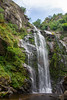
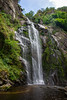
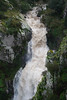
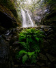

The above images may not be of the site on this page, but were taken nearby. They are loaded from Flickr so please click on them for image credits.
Click here to see more info for this site
Nearby sites
Click here to view sites on an interactive map of the areaKey: Red: member's photo, Blue: 3rd party photo, Yellow: other image, Green: no photo - please go there and take one, Grey: site destroyed
Download sites to:
KML (Google Earth)
GPX (GPS waypoints)
CSV (Garmin/Navman)
CSV (Excel)
To unlock full downloads you need to sign up as a Contributory Member. Otherwise downloads are limited to 50 sites.
Turn off the page maps and other distractions
Nearby sites listing. In the following links * = Image available
4.0km NW 304° Castro do Monte do Castelo Castro or Chafurdão
5.5km SE 139° Copa do Castro* Castro or Chafurdão
7.4km SSE 154° Castro de Toiriz (Silleda)* Castro or Chafurdão
7.9km W 267° Círculo Lítico de Castrotión Standing Stones
8.2km W 274° Castro de Moimenta Castro or Chafurdão
10.4km E 89° Necrópole Megalítica do Marco do Camballón* Barrow Cemetery
10.5km WSW 249° Castro de San Tomé de Ancorados Castro or Chafurdão
10.5km N 0° Croa do Castro Castro or Chafurdão
13.3km WSW 251° Castro de San Miguel Castro or Chafurdão
14.4km WNW 281° Castro de Marzán Castro or Chafurdão
14.4km WNW 282° Castro do Peto Castro or Chafurdão
14.5km W 281° Castro de Agronovo Castro or Chafurdão
14.5km WNW 282° Castro de Illobre Castro or Chafurdão
15.7km WSW 248° Castro de Aguións Castro or Chafurdão
16.5km NNE 21° Castro de Couto Cornado Castro or Chafurdão
17.2km SW 222° Castro de Ribela Castro or Chafurdão
17.4km WSW 240° Castro de Guimarei Castro or Chafurdão
18.1km SW 220° Castro de Marcenlos Castro or Chafurdão
18.2km SE 129° Castro de Donramiro Castro or Chafurdão
18.4km S 191° Castro de Loureiro (Forcarei) Castro or Chafurdão
18.5km WSW 243° Castro de Ouzande Castro or Chafurdão
18.6km SE 130° Castriño de Bendoiro Castro or Chafurdão
19.0km NW 316° Dolmen de Zaramacedo* Burial Chamber or Dolmen
19.2km SSE 148° Castro de Vilatuxe Castro or Chafurdão
20.3km SW 216° Castro das Quintas Castro or Chafurdão
View more nearby sites and additional images


 We would like to know more about this location. Please feel free to add a brief description and any relevant information in your own language.
 Wir möchten mehr über diese Stätte erfahren. Bitte zögern Sie nicht, eine kurze Beschreibung und relevante Informationen in Deutsch hinzuzufügen.
 Nous aimerions en savoir encore un peu sur les lieux. S'il vous plaît n'hesitez pas à ajouter une courte description et tous les renseignements pertinents dans votre propre langue.
 Quisieramos informarnos un poco más de las lugares. No dude en añadir una breve descripción y otros datos relevantes en su propio idioma.