


<< Text Pages >> Tory Island - Ancient Cross in Ireland (Republic of) in Co. Donegal
Submitted by Sunny100 on Thursday, 01 December 2011 Page Views: 4168
Early Medieval (Dark Age)Site Name: Tory Island Alternative Name: Oilean Thoraigh, Oilean Thur RiCountry: Ireland (Republic of)
NOTE: This site is 0.883 km away from the location you searched for.
County: Co. Donegal Type: Ancient Cross
Nearest Town: Dunglow Nearest Village: Derrybeg
Map Ref: B854464
Latitude: 55.264340N Longitude: 8.230405W
Condition:
| 5 | Perfect |
| 4 | Almost Perfect |
| 3 | Reasonable but with some damage |
| 2 | Ruined but still recognisable as an ancient site |
| 1 | Pretty much destroyed, possibly visible as crop marks |
| 0 | No data. |
| -1 | Completely destroyed |
| 5 | Superb |
| 4 | Good |
| 3 | Ordinary |
| 2 | Not Good |
| 1 | Awful |
| 0 | No data. |
| 5 | Can be driven to, probably with disabled access |
| 4 | Short walk on a footpath |
| 3 | Requiring a bit more of a walk |
| 2 | A long walk |
| 1 | In the middle of nowhere, a nightmare to find |
| 0 | No data. |
| 5 | co-ordinates taken by GPS or official recorded co-ordinates |
| 4 | co-ordinates scaled from a detailed map |
| 3 | co-ordinates scaled from a bad map |
| 2 | co-ordinates of the nearest village |
| 1 | co-ordinates of the nearest town |
| 0 | no data |
Internal Links:
External Links:
Ancient Cross in Co. Donegal
Tory Island is located about 9 miles off the north-western coast of Co Donegal. Near West Town are the ruins of St Columba's church, the famous Tau Cross, round tower and an ancient burial site. On the north side of the island is the legendary Wishing Stone, while on the eastern side is the ancient fort of Dun Bhalair. [You can catch a ferry boat from Magheroarty on the mainland].
There are the ruins of a church that stands on the site of a 6th century monastery associated with St Columba and St Earnan. The famous Tau Cross stands upon a pile of stones, probably one of two oratories on the island. This is in the shape of a "T" resembling the Greek letter - otherwise it is fairly crude, but it is rare because there are only two in the whole of Ireland. The age of the cross is uncertain but it probably dates from between the 6th-12th century ? There are also the remains of a high cross and a medieval round tower that was originally the monks bell tower.
The Grave Of The Seven is an ancient tomb, don't know how old, where six men and one woman were buried. Local legend says that clay from the woman's grave keeps vermin away. Below the rocks at the northern side of Tory Island is a flat-topped rock. A wish is granted to anybody who might want to step onto the rock or manage to throw three stones onto it. At the east side of the island is Dun Bhalair or 'The Fort of Balor' the one-eyed Celtic god of darkness.
You may be viewing yesterday's version of this page. To see the most up to date information please register for a free account.
Do not use the above information on other web sites or publications without permission of the contributor.
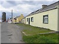
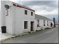
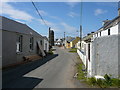
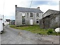
Nearby Images from Geograph Britain and Ireland:
©2011(licence)
©2011(licence)
©2008(licence)
©2011(licence)
©2011(licence)
The above images may not be of the site on this page, they are loaded from Geograph.
Please Submit an Image of this site or go out and take one for us!
Click here to see more info for this site
Nearby sites
Click here to view sites on an interactive map of the areaKey: Red: member's photo, Blue: 3rd party photo, Yellow: other image, Green: no photo - please go there and take one, Grey: site destroyed
Download sites to:
KML (Google Earth)
GPX (GPS waypoints)
CSV (Garmin/Navman)
CSV (Excel)
To unlock full downloads you need to sign up as a Contributory Member. Otherwise downloads are limited to 50 sites.
Turn off the page maps and other distractions
Nearby sites listing. In the following links * = Image available
18.0km ESE 115° Muntermellan* Portal Tomb (C0180138771)
19.0km SE 127° Greenhill Donegal * Chambered Tomb (C005348)
21.9km ESE 123° Ballymore Lower* Chambered Tomb (C039345)
22.0km ESE 123° Knocknafaugher Stone Row / Alignment (C039344)
24.7km S 189° Cnoc a' Stolaire 1* Standing Stone (Menhir)
27.4km ESE 104° Mevagh Rock Art* Rock Art (C121397)
29.5km ESE 124° Carlan Upper Stone Row / Alignment (C100300)
31.4km E 96° Cashel Glebe unclassified tomb* Burial Chamber or Dolmen (C16744274)
32.9km E 95° Ballyhiernan standing stone* Standing Stone (Menhir) (C18254350)
33.4km SE 127° Barnes Lower NE Row Stone Row / Alignment (C122263)
33.5km SE 131° Barnes Lower Standing Stones* Standing Stones (C1077024449)
34.8km SE 145° St. Colmcille's Stone* Wedge Tomb (C0535617857)
34.9km ESE 115° Carmoney* Chambered Tomb (C172318)
36.6km E 89° O'Donnell's stones* Marker Stone (C22084687)
36.9km SE 124° Drumard* Chambered Tomb (C159255)
39.2km SE 126° Portleon Stone Row / Alignment (C172233)
39.6km ESE 114° Gortnavern* Portal Tomb (C218304)
44.6km ESE 107° Killycolman Stone Row / Alignment (C282334)
46.0km ESE 119° Ballykenny Stone Circle (C257240)
48.4km SSW 197° St Connell's Churchyard (Inishkeel)* Ancient Cross (B711001)
49.7km SSE 156° Moonbeg* Chambered Tomb (C059010)
50.7km SSW 197° Doon Fort* Stone Fort or Dun (G700980)
51.3km SSW 195° Kilclooney More II* Portal Tomb (G7220796721)
51.5km SSW 195° Kilclooney Court Tomb* Court Tomb (G717967)
51.7km ESE 116° Carnaghan Portal Tomb (C320237)
View more nearby sites and additional images


 We would like to know more about this location. Please feel free to add a brief description and any relevant information in your own language.
 Wir möchten mehr über diese Stätte erfahren. Bitte zögern Sie nicht, eine kurze Beschreibung und relevante Informationen in Deutsch hinzuzufügen.
 Nous aimerions en savoir encore un peu sur les lieux. S'il vous plaît n'hesitez pas à ajouter une courte description et tous les renseignements pertinents dans votre propre langue.
 Quisieramos informarnos un poco más de las lugares. No dude en añadir una breve descripción y otros datos relevantes en su propio idioma.