


<< Text Pages >> Castro de O Adro - Castro or Chafurdão in Spain in Galicia
Submitted by holger_rix on Saturday, 12 December 2015 Page Views: 559
Iron Age and Later PrehistorySite Name: Castro de O AdroCountry: Spain
NOTE: This site is 3.998 km away from the location you searched for.
Region: Galicia Type: Castro or Chafurdão
Latitude: 43.310955N Longitude: 8.164624W
Condition:
| 5 | Perfect |
| 4 | Almost Perfect |
| 3 | Reasonable but with some damage |
| 2 | Ruined but still recognisable as an ancient site |
| 1 | Pretty much destroyed, possibly visible as crop marks |
| 0 | No data. |
| -1 | Completely destroyed |
| 5 | Superb |
| 4 | Good |
| 3 | Ordinary |
| 2 | Not Good |
| 1 | Awful |
| 0 | No data. |
| 5 | Can be driven to, probably with disabled access |
| 4 | Short walk on a footpath |
| 3 | Requiring a bit more of a walk |
| 2 | A long walk |
| 1 | In the middle of nowhere, a nightmare to find |
| 0 | No data. |
| 5 | co-ordinates taken by GPS or official recorded co-ordinates |
| 4 | co-ordinates scaled from a detailed map |
| 3 | co-ordinates scaled from a bad map |
| 2 | co-ordinates of the nearest village |
| 1 | co-ordinates of the nearest town |
| 0 | no data |
Be the first person to rate this site - see the 'Contribute!' box in the right hand menu.
Internal Links:
External Links:
Castro or Chafurdão in Galicia
You may be viewing yesterday's version of this page. To see the most up to date information please register for a free account.
Do not use the above information on other web sites or publications without permission of the contributor.
Nearby Images from Flickr
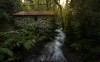
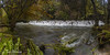
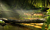

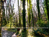
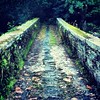
The above images may not be of the site on this page, but were taken nearby. They are loaded from Flickr so please click on them for image credits.
Click here to see more info for this site
Nearby sites
Click here to view sites on an interactive map of the areaKey: Red: member's photo, Blue: 3rd party photo, Yellow: other image, Green: no photo - please go there and take one, Grey: site destroyed
Download sites to:
KML (Google Earth)
GPX (GPS waypoints)
CSV (Garmin/Navman)
CSV (Excel)
To unlock full downloads you need to sign up as a Contributory Member. Otherwise downloads are limited to 50 sites.
Turn off the page maps and other distractions
Nearby sites listing. In the following links * = Image available
2.6km SE 127° Castro de Adragonte Castro or Chafurdão
2.9km ENE 65° Castro de Goimil Castro or Chafurdão
3.4km ESE 103° Castro do Monte das Casas Vellas Castro or Chafurdão
3.7km SW 222° Castro de O Monte da Croa Castro or Chafurdão
3.9km SE 137° Castro de Monte do Castro (San Mamede) Castro or Chafurdão
4.0km NE 42° Petróglifos do Monte Calvela Rock Art
5.6km WSW 248° Castro da Croa (Illobre) Castro or Chafurdão
5.7km ESE 117° Menhir de Mántaras Standing Stone (Menhir)
6.3km ESE 123° Castro do Monte do Castelo (Irixoa) Castro or Chafurdão
6.8km ESE 109° Castro do Bispo Castro or Chafurdão
6.8km N 358° Castro de A Chousa de Andrade Castro or Chafurdão
7.2km SSW 212° Castro de Santa Cruz (A Graña) Castro or Chafurdão
7.3km WSW 249° Castro de Vixoi Castro or Chafurdão
7.5km NNW 345° Mámoas da Fraga Barrow Cemetery
8.3km SW 218° Castro de As Croas (Betanzos) Castro or Chafurdão
9.0km WNW 302° Castro de Sada Castro or Chafurdão
9.0km SE 130° Tumbas antropomórficas de San Martiño de Churío Barrow Cemetery
9.1km WNW 284° Castro de Samoedo Castro or Chafurdão
9.2km ENE 59° Castro de A Louseira Castro or Chafurdão
9.2km SSE 149° Petroglifo e Mámoa das Lombas Rock Art
9.6km NE 41° Castro de As Croas Castro or Chafurdão
9.6km SSW 212° Castro de Callobre Castro or Chafurdão
9.9km NW 308° Castro de Loureiro Castro or Chafurdão
10.5km WNW 294° Castro de Meirás Castro or Chafurdão
10.6km WSW 245° Castro de Orto Castro or Chafurdão
View more nearby sites and additional images


 We would like to know more about this location. Please feel free to add a brief description and any relevant information in your own language.
 Wir möchten mehr über diese Stätte erfahren. Bitte zögern Sie nicht, eine kurze Beschreibung und relevante Informationen in Deutsch hinzuzufügen.
 Nous aimerions en savoir encore un peu sur les lieux. S'il vous plaît n'hesitez pas à ajouter une courte description et tous les renseignements pertinents dans votre propre langue.
 Quisieramos informarnos un poco más de las lugares. No dude en añadir una breve descripción y otros datos relevantes en su propio idioma.