


<< Our Photo Pages >> Creevery Upper - Chambered Tomb in Ireland (Republic of) in Co. Donegal
Submitted by TwentyTrees on Wednesday, 02 September 2009 Page Views: 4904
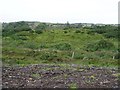
Neolithic and Bronze AgeSite Name: Creevery Upper Alternative Name: Dermot and Grania's BedCountry: Ireland (Republic of)
NOTE: This site is 1.684 km away from the location you searched for.
County: Co. Donegal Type: Chambered Tomb
Nearest Town: Rathmullen Nearest Village: Ballyboe
Map Ref: G92766277
Latitude: 54.513284N Longitude: 8.11253W
Condition:
| 5 | Perfect |
| 4 | Almost Perfect |
| 3 | Reasonable but with some damage |
| 2 | Ruined but still recognisable as an ancient site |
| 1 | Pretty much destroyed, possibly visible as crop marks |
| 0 | No data. |
| -1 | Completely destroyed |
| 5 | Superb |
| 4 | Good |
| 3 | Ordinary |
| 2 | Not Good |
| 1 | Awful |
| 0 | No data. |
| 5 | Can be driven to, probably with disabled access |
| 4 | Short walk on a footpath |
| 3 | Requiring a bit more of a walk |
| 2 | A long walk |
| 1 | In the middle of nowhere, a nightmare to find |
| 0 | No data. |
| 5 | co-ordinates taken by GPS or official recorded co-ordinates |
| 4 | co-ordinates scaled from a detailed map |
| 3 | co-ordinates scaled from a bad map |
| 2 | co-ordinates of the nearest village |
| 1 | co-ordinates of the nearest town |
| 0 | no data |
Internal Links:
External Links:
")
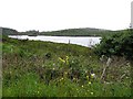
Heading south from Rathmullen along the coast road turn (R247) right at Ballyboe and head along the road for around half a mile, keeping left where the road forks. The tomb is clearly visible in the field, with the road passing about 20m away. Fine views across Loch Swilly.
You may be viewing yesterday's version of this page. To see the most up to date information please register for a free account.
")
")
Do not use the above information on other web sites or publications without permission of the contributor.
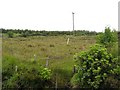
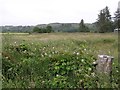
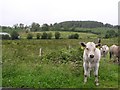
Nearby Images from Geograph Britain and Ireland:
©2008(licence)
©2008(licence)
©2008(licence)
©2008(licence)
©2008(licence)
The above images may not be of the site on this page, they are loaded from Geograph.
Please Submit an Image of this site or go out and take one for us!
Click here to see more info for this site
Nearby sites
Click here to view sites on an interactive map of the areaKey: Red: member's photo, Blue: 3rd party photo, Yellow: other image, Green: no photo - please go there and take one, Grey: site destroyed
Download sites to:
KML (Google Earth)
GPX (GPS waypoints)
CSV (Garmin/Navman)
CSV (Excel)
To unlock full downloads you need to sign up as a Contributory Member. Otherwise downloads are limited to 50 sites.
Turn off the page maps and other distractions
Nearby sites listing. In the following links * = Image available
4.3km WNW 298° Twomilestone Standing Stone (Menhir) (G890648)
12.8km SSW 194° Shasgar* Court Tomb (G896504)
15.2km SE 143° Skaghlea Cairn Court Tomb (H01985070)
15.7km E 93° Boa Island* Sculptured Stone (H08516198)
16.3km SSE 165° Kilcoo Stone Circle (G970470)
18.3km SE 129° Doagh Glebe Promontory Fort / Cliff Castle (H0709051350)
18.7km SE 131° Rossinure Beg Court Tomb (H06915053)
19.4km SE 130° Rossinure More Court Tomb (H07715039)
19.4km E 91° Cruninish Island Ring Barrow Round Barrow(s) (H12256239)
20.3km SW 231° Tievebaun Burial Chamber or Dolmen
21.1km SSE 161° Corracloona* Court Tomb (G997428)
22.1km SW 215° Dartry* Wedge Tomb (G799447)
22.3km WSW 248° Creevykeel* Court Tomb (G7192054549)
23.1km SSE 154° Corraderrybrock Stone Circle (H030420)
23.5km ENE 78° Formil Multiple Stone Rows / Avenue (H159675)
23.5km NNW 338° Lettermore Stone Circle (G841847)
23.6km ENE 78° Formil Stone Row / Alignment (H159676)
23.6km ENE 78° Formil Stone Circle (H159676)
24.8km E 96° White Island (Lower Lough Erne) Sculptured Stone (H175600)
24.9km SSE 148° Cloghastuckane Stone Circle (H059416)
25.0km SSE 148° Toppan Stone Circle (H060415)
25.5km SE 139° Aghanaglack Court Tomb (H096435)
26.4km SSE 150° Kilrooskagh Portal Tomb (H06143998)
26.5km NW 311° Carricknamoghil* Court Tomb
26.8km SE 127° Ross Lough Crannog (H14294677)
View more nearby sites and additional images


 We would like to know more about this location. Please feel free to add a brief description and any relevant information in your own language.
 Wir möchten mehr über diese Stätte erfahren. Bitte zögern Sie nicht, eine kurze Beschreibung und relevante Informationen in Deutsch hinzuzufügen.
 Nous aimerions en savoir encore un peu sur les lieux. S'il vous plaît n'hesitez pas à ajouter une courte description et tous les renseignements pertinents dans votre propre langue.
 Quisieramos informarnos un poco más de las lugares. No dude en añadir una breve descripción y otros datos relevantes en su propio idioma.