


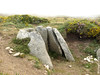
<< Our Photo Pages >> Dolmen de Penagache - Burial Chamber or Dolmen in Spain in Galicia
Submitted by yackoff on Tuesday, 18 October 2011 Page Views: 5902
Neolithic and Bronze AgeSite Name: Dolmen de Penagache Alternative Name: Mamoa da Portela do Pau M2Country: Spain
NOTE: This site is 4.349 km away from the location you searched for.
Region: Galicia Type: Burial Chamber or Dolmen
Nearest Town: Bangueses Nearest Village: Verea
Latitude: 42.071894N Longitude: 8.099386W
Condition:
| 5 | Perfect |
| 4 | Almost Perfect |
| 3 | Reasonable but with some damage |
| 2 | Ruined but still recognisable as an ancient site |
| 1 | Pretty much destroyed, possibly visible as crop marks |
| 0 | No data. |
| -1 | Completely destroyed |
| 5 | Superb |
| 4 | Good |
| 3 | Ordinary |
| 2 | Not Good |
| 1 | Awful |
| 0 | No data. |
| 5 | Can be driven to, probably with disabled access |
| 4 | Short walk on a footpath |
| 3 | Requiring a bit more of a walk |
| 2 | A long walk |
| 1 | In the middle of nowhere, a nightmare to find |
| 0 | No data. |
| 5 | co-ordinates taken by GPS or official recorded co-ordinates |
| 4 | co-ordinates scaled from a detailed map |
| 3 | co-ordinates scaled from a bad map |
| 2 | co-ordinates of the nearest village |
| 1 | co-ordinates of the nearest town |
| 0 | no data |
Internal Links:
External Links:
I have visited· I would like to visit
DrewParsons would like to visit
")
You may be viewing yesterday's version of this page. To see the most up to date information please register for a free account.
")
")
Do not use the above information on other web sites or publications without permission of the contributor.
Nearby Images from Flickr
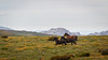
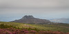
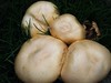
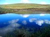
The above images may not be of the site on this page, but were taken nearby. They are loaded from Flickr so please click on them for image credits.
Click here to see more info for this site
Nearby sites
Click here to view sites on an interactive map of the areaKey: Red: member's photo, Blue: 3rd party photo, Yellow: other image, Green: no photo - please go there and take one, Grey: site destroyed
Download sites to:
KML (Google Earth)
GPX (GPS waypoints)
CSV (Garmin/Navman)
CSV (Excel)
To unlock full downloads you need to sign up as a Contributory Member. Otherwise downloads are limited to 50 sites.
Turn off the page maps and other distractions
Nearby sites listing. In the following links * = Image available
5.2km E 87° Pedrafita das Catro Cruces Standing Stone (Menhir)
8.7km WSW 245° Porta de Lamas de Mouro* Museum
9.2km S 190° Casa da Moura Dolmen (A Gurita)* Burial Chamber or Dolmen
12.8km N 5° Pía de Poulo Castro or Chafurdão
14.2km NE 45° Castro de Castromao* Castro or Chafurdão
14.4km NNW 340° Petróglifos do Monte Picoñas (Valongo) Rock Art
14.6km SE 140° Pedrafita en Aquis Querquernis Standing Stone (Menhir)
14.6km SE 138° Aquis Querquennis Campamento Romano* Ancient Village or Settlement
14.8km W 276° Castro de Melgaço ou Castro da Cividade de Paderne Castro or Chafurdão
16.0km NNW 335° Castro de Coto Furado Castro or Chafurdão
16.6km WSW 237° Mamoa do Batateiro* Burial Chamber or Dolmen
16.6km WNW 295° Petroglifo da Moura Rock Art
18.2km NE 40° Petróglifo do Freixo Rock Art
19.8km N 350° Castro de Lapela Castro or Chafurdão
20.6km SE 141° Casiña da Moura* Burial Chamber or Dolmen
21.2km SE 144° Casola do Foxo* Burial Chamber or Dolmen
21.8km ENE 66° San Cibrao Dolmen 1 Burial Chamber or Dolmen
21.8km ENE 66° San Cibrao Dolmen 2 Burial Chamber or Dolmen
22.2km SE 138° Necrópole de Outeiro de Cavaladre* Burial Chamber or Dolmen
24.0km S 182° Aquis Originis Ancient Village or Settlement
24.2km SSW 200° Porta do Lindoso Museum
25.0km NNE 29° Castro de Trelle Castro or Chafurdão
26.0km N 358° Castro de Ventosela Castro or Chafurdão
26.5km WNW 292° Castro da Cividá Castro or Chafurdão
27.3km SW 220° Porta do Mezio* Museum
View more nearby sites and additional images


 We would like to know more about this location. Please feel free to add a brief description and any relevant information in your own language.
 Wir möchten mehr über diese Stätte erfahren. Bitte zögern Sie nicht, eine kurze Beschreibung und relevante Informationen in Deutsch hinzuzufügen.
 Nous aimerions en savoir encore un peu sur les lieux. S'il vous plaît n'hesitez pas à ajouter une courte description et tous les renseignements pertinents dans votre propre langue.
 Quisieramos informarnos un poco más de las lugares. No dude en añadir una breve descripción y otros datos relevantes en su propio idioma.