


<< Text Pages >> Huanchaquito-Las Llamas - Misc. Earthwork in Peru
Submitted by davidmorgan on Sunday, 29 April 2018 Page Views: 1003
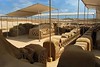
Multi-periodSite Name: Huanchaquito-Las LlamasCountry: Peru
NOTE: This site is 2.351 km away from the location you searched for.
Type: Misc. Earthwork
Nearest Town: Trujillo
Latitude: 8.1021S Longitude: 79.1043W
Condition:
| 5 | Perfect |
| 4 | Almost Perfect |
| 3 | Reasonable but with some damage |
| 2 | Ruined but still recognisable as an ancient site |
| 1 | Pretty much destroyed, possibly visible as crop marks |
| 0 | No data. |
| -1 | Completely destroyed |
| 5 | Superb |
| 4 | Good |
| 3 | Ordinary |
| 2 | Not Good |
| 1 | Awful |
| 0 | No data. |
| 5 | Can be driven to, probably with disabled access |
| 4 | Short walk on a footpath |
| 3 | Requiring a bit more of a walk |
| 2 | A long walk |
| 1 | In the middle of nowhere, a nightmare to find |
| 0 | No data. |
| 5 | co-ordinates taken by GPS or official recorded co-ordinates |
| 4 | co-ordinates scaled from a detailed map |
| 3 | co-ordinates scaled from a bad map |
| 2 | co-ordinates of the nearest village |
| 1 | co-ordinates of the nearest town |
| 0 | no data |
Internal Links:
External Links:
Burial Site in La Libertad Region, Peru
The site of the sacrificial killing of more than 140 children and over 200 llamas by the people of the Chimú culture on the coast of Peru around 1450 CE.
You may be viewing yesterday's version of this page. To see the most up to date information please register for a free account.
Do not use the above information on other web sites or publications without permission of the contributor.
Nearby Images from Flickr
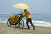
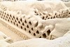
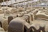

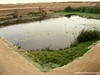
The above images may not be of the site on this page, but were taken nearby. They are loaded from Flickr so please click on them for image credits.
Click here to see more info for this site
Nearby sites
Click here to view sites on an interactive map of the areaKey: Red: member's photo, Blue: 3rd party photo, Yellow: other image, Green: no photo - please go there and take one, Grey: site destroyed
Download sites to:
KML (Google Earth)
GPX (GPS waypoints)
CSV (Garmin/Navman)
CSV (Excel)
To unlock full downloads you need to sign up as a Contributory Member. Otherwise downloads are limited to 50 sites.
Turn off the page maps and other distractions
Nearby sites listing. In the following links * = Image available
3.3km ESE 103° Chan Chan* Ancient Village or Settlement
6.5km E 93° Huaca Esmeralda* Pyramid / Mastaba
12.5km ESE 105° Huaca del Sol* Pyramid / Mastaba
13.0km ESE 106° Huaca de la Luna* Ancient Temple
13.1km ESE 110° Museo Huacas de Moche Museum
13.1km N 359° Cerro Campana* Sculptured Stone
21.8km E 80° Caballo Muerto Ancient Village or Settlement
30.4km NW 313° El Brujo* Ancient Village or Settlement
36.8km NNW 344° Mocollope Ancient Village or Settlement
111.9km NNE 15° Kuntur Wasi* Ancient Temple
112.2km ESE 112° La Galgada Pyramid / Mastaba
116.6km NNE 30° Cumbemayo Rock Art
118.4km ENE 73° Marcahuamachuco* Ancient Village or Settlement
127.9km N 353° Nanchoc Ancient Village or Settlement
129.9km NNE 33° Ventanillas de Otuzco Rock Cut Tomb
136.5km NNW 335° Huaca el Pueblo Pyramid / Mastaba
149.9km SSE 150° Huambacho Ancient Village or Settlement
151.8km SE 138° Siete Huaca* Ancient Village or Settlement
154.7km NNW 339° Huaca Rajada Pyramid / Mastaba
161.3km NNW 333° Ventarron - Temple of the Captured Deer Ancient Temple
164.1km NNW 333° Collud Ancient Temple
164.5km NNW 339° Cerro Pátapo Ancient Village or Settlement
174.2km SE 144° Huerequeque Ancient Village or Settlement
175.9km SE 126° Tumshukayko* Ancient Village or Settlement
177.4km SSE 148° Taukachi-Konkan Ancient Village or Settlement
View more nearby sites and additional images


 We would like to know more about this location. Please feel free to add a brief description and any relevant information in your own language.
 Wir möchten mehr über diese Stätte erfahren. Bitte zögern Sie nicht, eine kurze Beschreibung und relevante Informationen in Deutsch hinzuzufügen.
 Nous aimerions en savoir encore un peu sur les lieux. S'il vous plaît n'hesitez pas à ajouter une courte description et tous les renseignements pertinents dans votre propre langue.
 Quisieramos informarnos un poco más de las lugares. No dude en añadir una breve descripción y otros datos relevantes en su propio idioma.